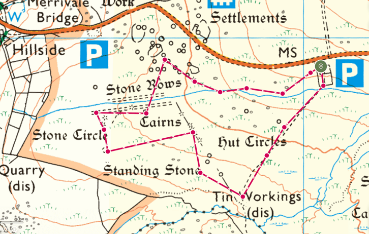
This is a short, flat route. What it lacks in distance and lung busting adventure though, it more than makes up for the history and intrigue that it takes you through. This walk shows off, in just a couple a of KMs, the incredible history of Dartmoor. It takes us to prehistoric settlements, stone circles and burial cairns, brings us thorough the monastic past of the moors and takes us up to the industrial heritage that lays the modern foundation of the area.
Four Winds Car Park
The walk starts from the Four Winds Car Park, found on the B3357 road just along from Merrivale Quarry. This site, which is commonly used as it offers great access to the moorland, is favoured by the tor bagging hiker, night navigating Mountain Training trainee and Duke of Edinburgh expedition completer alike and as such, the car park fills quickly and early. The Four Winds car park is not only interesting because of the access it offers however, the car park itself is part of the attraction of this walk. The Four Winds car park is not only a lovely tree lined enclosure but is the site of the old Foggintor School.
Walkhampton Foggintor School was opened in 1914, with the purpose of serving the children of the local quarry men from the nearby Foggintor, Rundlestone and Merrivale. The school stood on the road, with separate entrances for boys and girls, and behind it were the separate boys’ and girls’ playgrounds. Behind this was the schoolhouse in which Mr Stoyle, the only headmaster of the school lived with his family. Following the decline of the quarrying industry, the school was closed in 1936 being demolished in 1964 when no use could be found for the site (having been used as a residential dwelling in the intervening period).
All that remains of the school now is a few low walls around the Four Winds car park. The parking places sit on the site of the old playgrounds and serve as the starting point for this walk. Heading southwest, you first pass through a Squeeze Stile (and when you the size I am it is indeed a squeeze) at the back of the boys’ playground, entering into a large courtyard which is dominated by a Fir Tree. This space is where the old schoolhouse stood, and the Fir Tree was planted there by Ivan Stoyle (the son of the headmaster) in 1924 after it had served its purpose as the schools Christmas tree. Heading out the back of this courtyard, through a second Squeeze Stile, brings you out on the open moorland.


The Way Marker
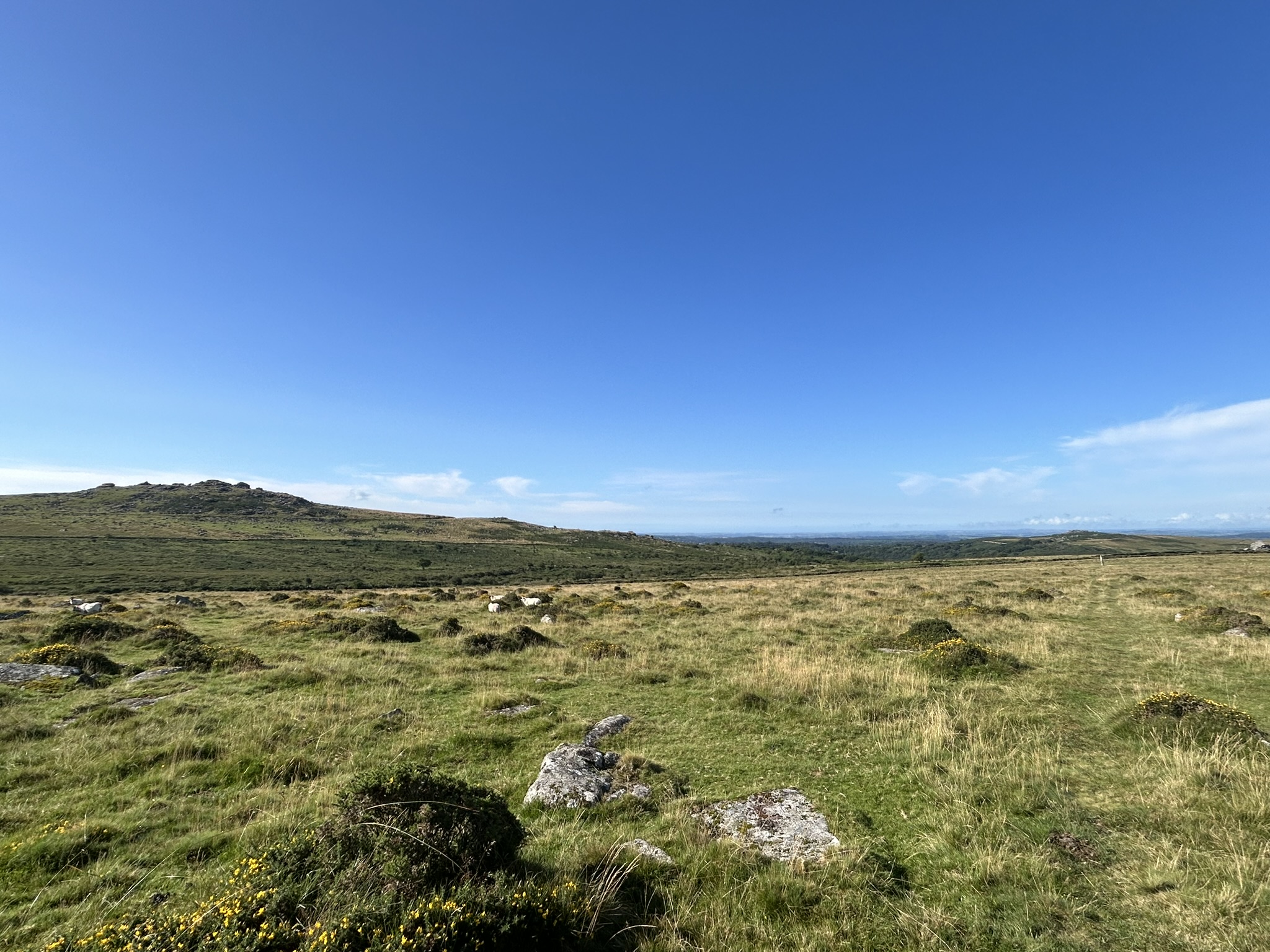
This area is dominated by high rising tors on all sides, with Foggintor Quarry and the dump sites sitting in the distance (see my walk of Foggintor Quarry here). A gentle boot worn track leads me in a south-westerly direction, gently bringing me downhill to the site of our next point of interest. After just a few hundred metres, we come to a standing stone. On one side of the weather-beaten rock is an A and on the other a T. These markings give a clue to the stones purpose, which was to act as a way marker for any traveller making their way along the Abott’s Way, between the Tavistock and Ashburton parishes.

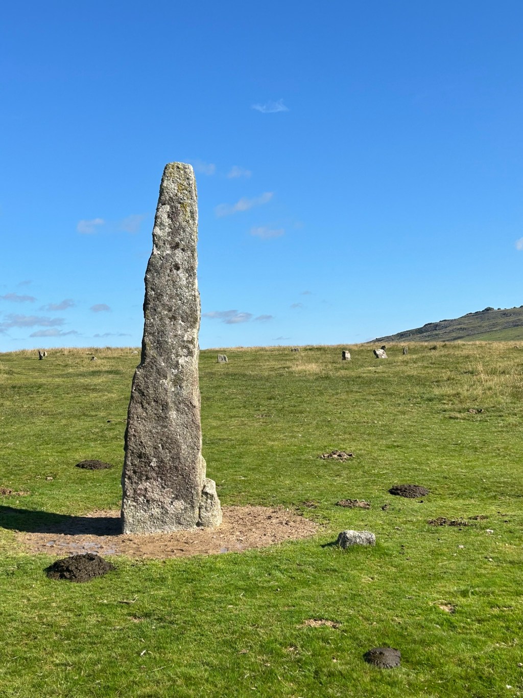
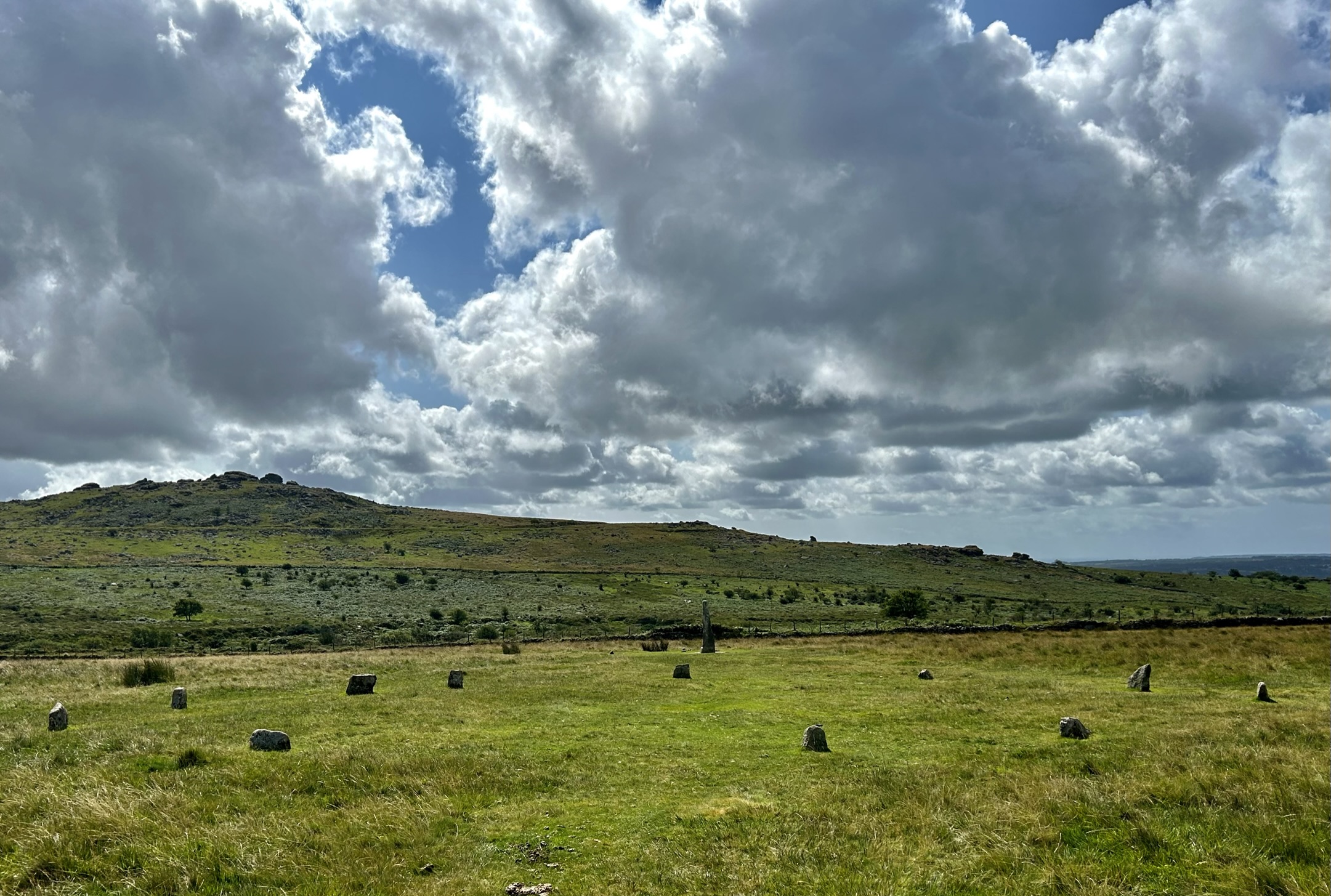
Merrivale Prehistoric Monuments
Having wondered at the utility of these way markers in what could be considered “typical” Dartmoor weather (i.e. heavy rain and mist) I continued along the path, following the direction of the way marker towards Tavistock and passing by some more of the two-metre-high direction aides. The day of this walk was sunny and clear, and as I continued along this path, a tall standing stone becomes clear in the distance. This was my next destination and so I took a beeline to it.
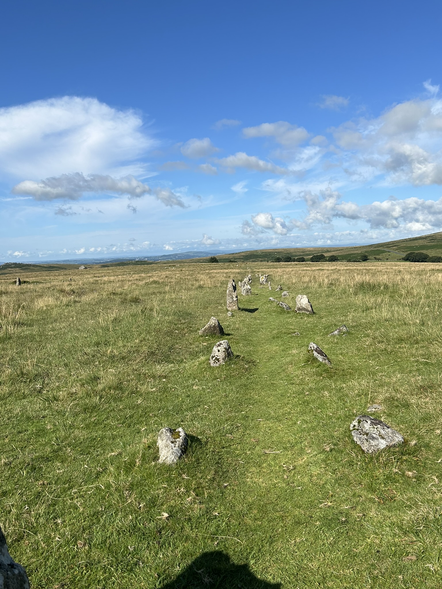
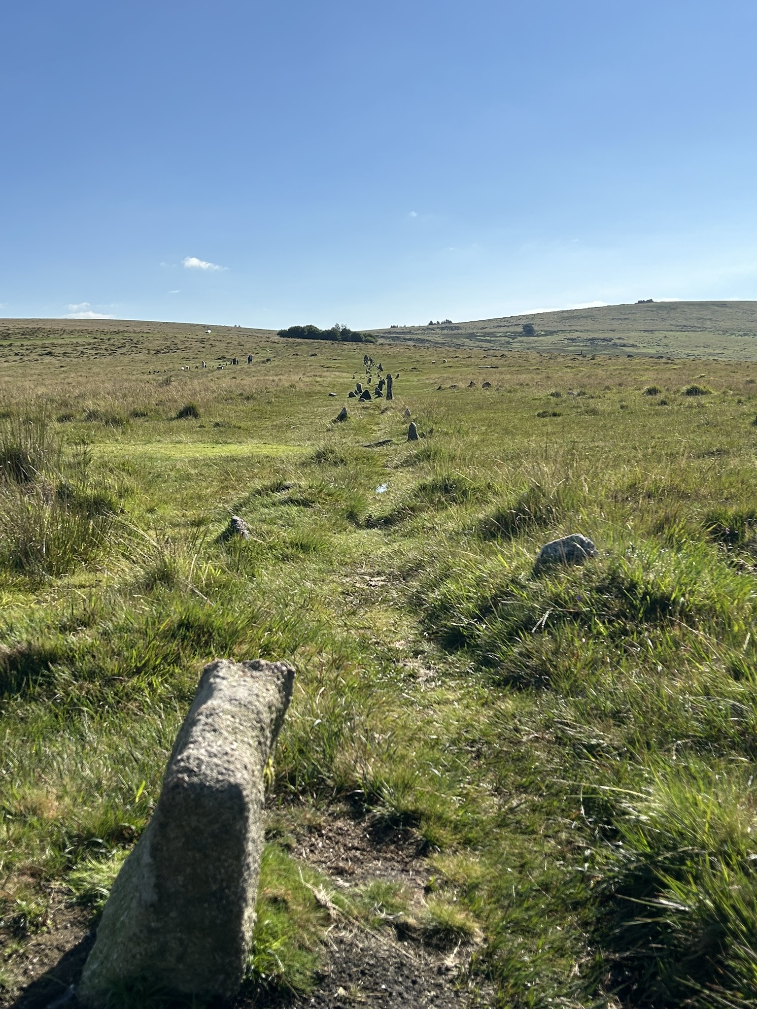
Similarly to the way markers, this is a tall, standing stone. Unlike the way markers however, this stone was a Menhir, a large, upright stone that was placed in the ground by the prehistoric peoples of Dartmoor. Sitting in the shadows of King’s Tor, this 3-metre-high Menhir dates from the late Neolithic period (about 3000 BC) and stands alongside a fine example of a stone circle and next to x2 parallel stone rows, running from east to west. The stone circle, menhir stone and stone rows are spectacular enough as they are, and conjure up imaginings of our prehistoric ancestors, the lives they led and the ceremonies that presumably happened here. An understanding of the equinoxes and solstices and the arcs of the sun however, brings even more wonder to this site, as the two double stone rows are aligned with the setting sun at the solstices.
Depending on the time of year, and depending on where you stand, the sun will set above one of the “blocking stones” that are set through both stone rows. For example, if you are stood at the blocking stone at the eastern end of the southern stone row at the spring equinox, the setting sun will appear directly above the blocking stone at the western end of the Northern stone row. Similarly, when standing at the blocking stone on the northern stone row during the autumn equinox, the setting sun now appears at the end of the southern stone row.
The theories as to why the ancient peoples took the time to build monuments such as this is debated. For some, these serve ceremonial purposes and the number of cairns found around the site would attest to that. Others however theorise that the stone rows could be used as a calendar of sorts. As mentioned above, depending on where you stand and the time of year, will alter where you view the setting sun. A knowledge of the time of year would help a farming community to plan crops and livestock cycles. The final theory, which always crops up whenever ancient monuments and churches are found, is that they are built on “ley lines”. For me, I have always liked the theory that these sites are ceremonial, built around the importance of the sun, but I will admit that the idea of a “stone calendar” does have a nice ring to it.
The exact purpose of the prehistoric monuments at Merrivale is a matter of conjecture and so too is the peoples from which they came. It may be that the site comes form a single period, it is more likely that it comes from several. What is certain however is that with so many carefully considered monuments, this site was of great importance to the people who lived in and around the surrounding area. Whatever the purpose of the monuments, the amount of planning, motivation and organisation that went into creating such a complex of sites, combined with the engineering, understanding of the movements of the sun and precision of building really is astonishing and truly something to marvel at.


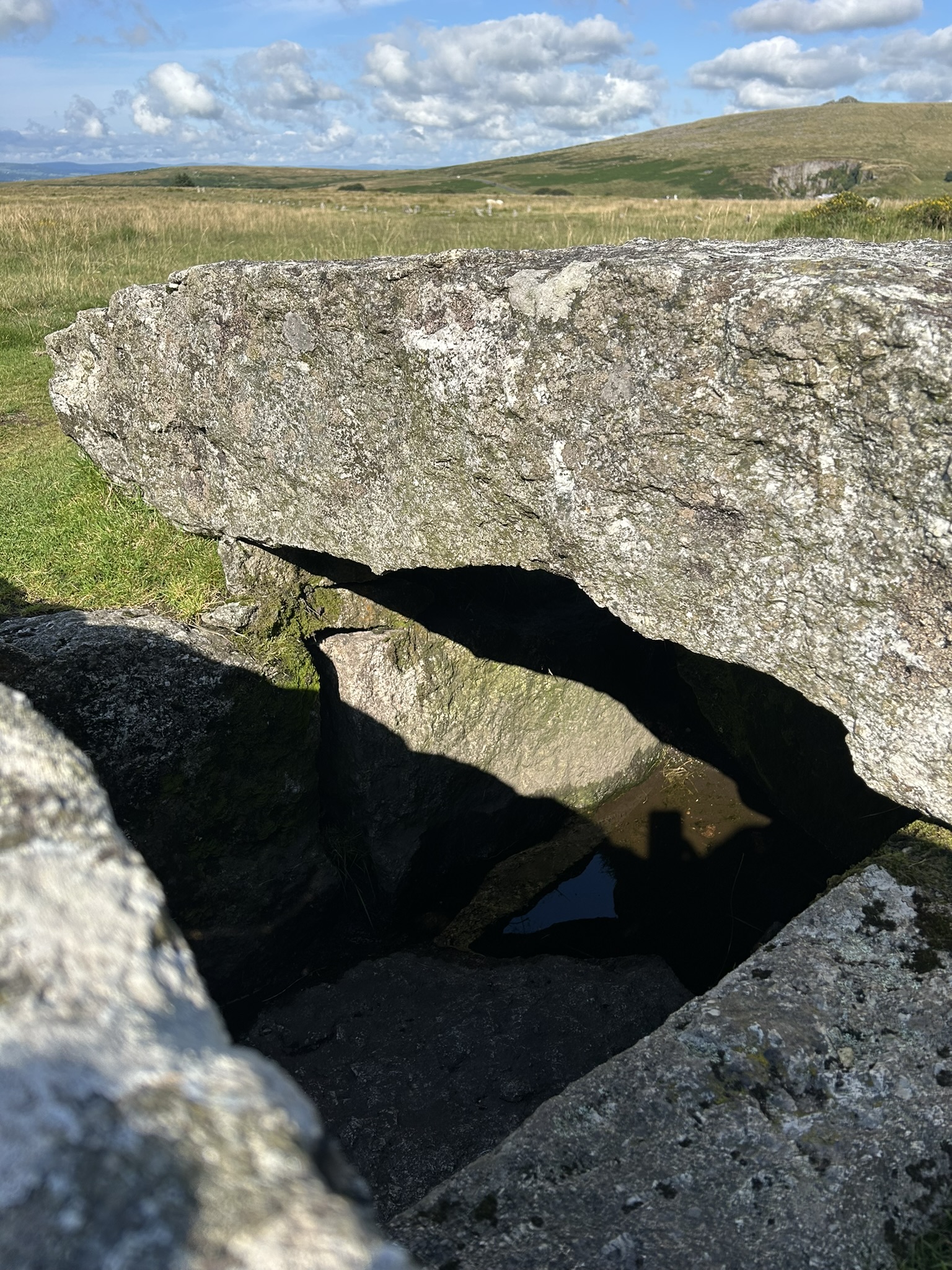
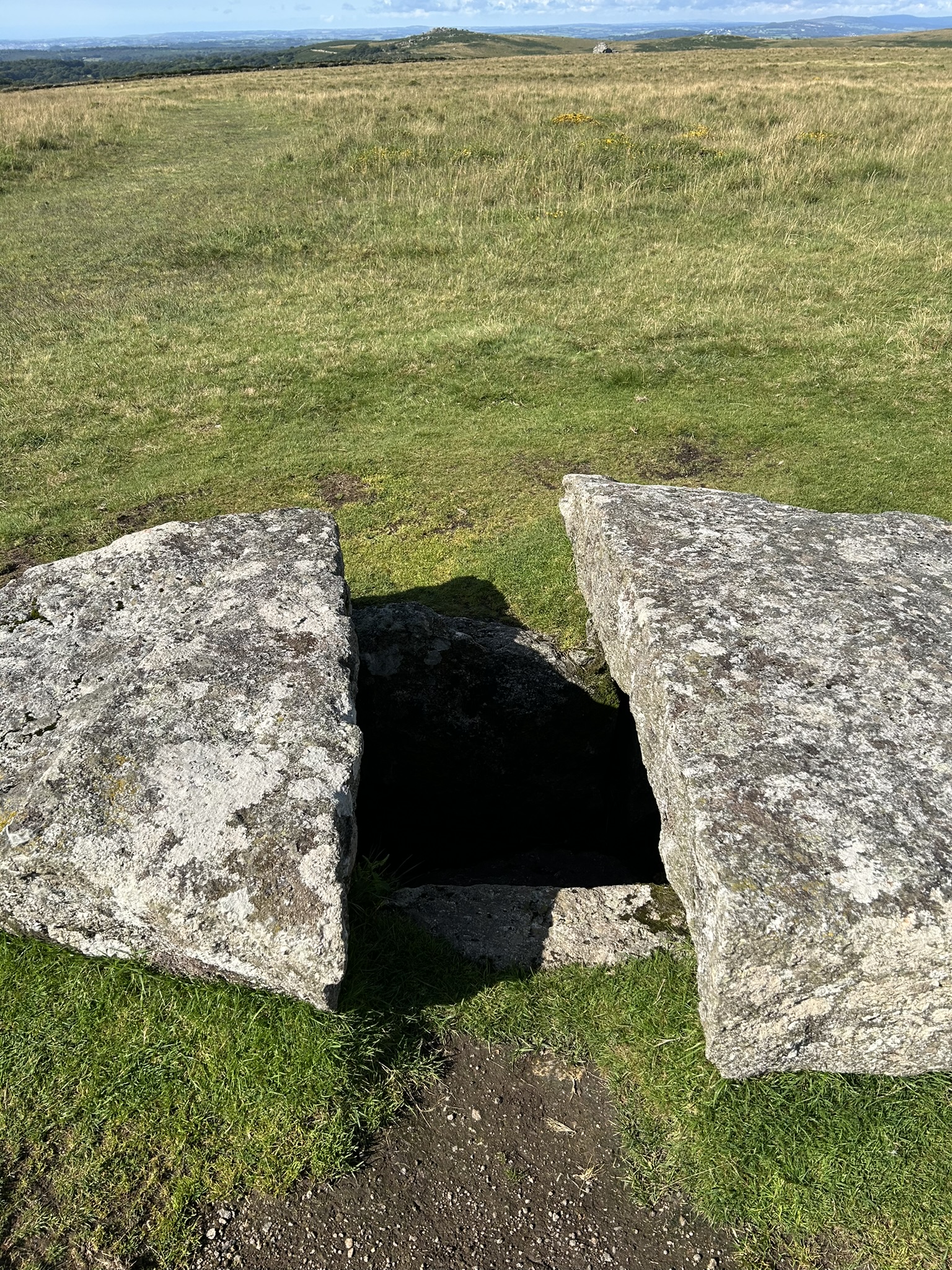
The Bronze Age Cist
Around halfway up the southern edge of the southern stone row, moves us from the neolithic into the bronze age. Here, we see the Merrivale Cist, which is one of the finest examples of a bronze-aged cist on Dartmoor.
Measuring about 2 metres long and 1 metre wide, the stone lined walls of the cist are clear. The capstone topping of the burial site has had a large section of granite removed from it. This section was taken by a local farmer, to be used as a gate post, the remaining granite showing signs of the burr holes used to cleave the stone apart. The acidic soil of the moors ensured that any remains had long since disappeared (and doubtless any grave goods that were there were likely taken when the grave was opened), but we can be certain, given the size and location of this site, that the interred was someone of high status and of great importance.

The Bronze Age Settlement
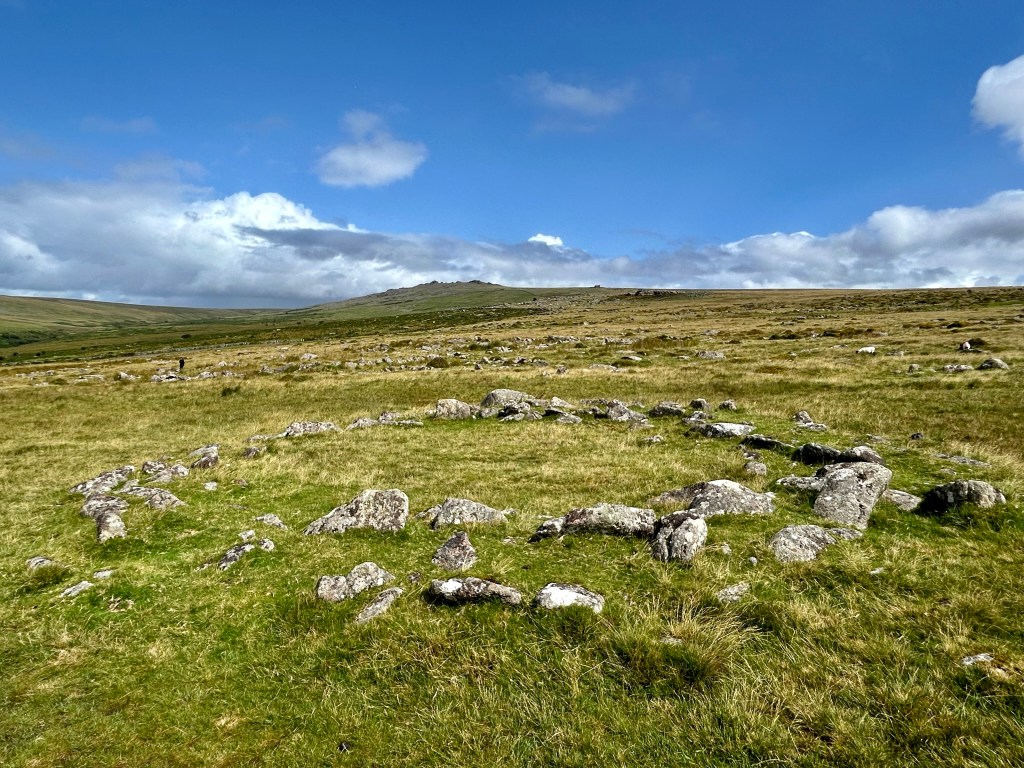
From the cist, I head north for a couple of hundred metres, crossing the stone row and leat. On the northern side of the site, but still to the south of the road, is a large Bronze Aged settlement. With over 50 roundhouses spread across the hillside, this is a large site, which was lived in and farmed around 3000 years ago. My first thought on entering into the site, is what the inhabitants made of the neolithic stone rows and circle. At the time this site was inhabited, those monuments would have already been thousands of years old. I wonder on why this area was settled and speculate (aside from the fact that it is near a water source and on farmable land) that the ceremonial monuments of the neolithic ancestors likely played a part, and potentially were used by the bronze age settlers.
The site itself has numerous examples of the circular foundations to the structures that would have provided shelter to farmer and animal alike. The houses here vary in size but as I pass through the site, I can’t help imaging what life was like for these individuals. A harsh life, centred on the rearing of their animals (likely sheep and cattle), the inhabitants farmed this area until its abandonment (likely due to over farming leading to the boggy moorland it is today) in the late Bronze Age (around 800 BC).
Returning Home
Having travelled from the recent past, passed through the medieval times all the way back to the Neolithic and returning via the Bronze Age, I follow the leat gently uphill, back to car park (entering the car park through the northern edge, where the school once stood, to avoid the Squeeze Stiles this time.
Whilst I have set a route out below, this walk doesn’t need one. In fact, I think this walk is even more special for the opportunity to just bimble around the relatively contained area to the southwest of the car park, which is steeped in history, wonder and spiritual importance.
| Difficulty | Distance | Navigation Required? |
| Easy | 2.5km | No |
| Grid Reference | Safety | Footwear |
| Start/Finish SX 560 749 | General Dartmoor Consideration | B1 |


Leave a reply to John Bainbridge Cancel reply