It’s 21 degrees as I head out of my house at 0800. The first signs of summer have finally arrived in Devon, towards the end of June and with it, I remember how uncomfortable it can be running in this heat, and more so the humidity. As such, I quickly shut my front door turn around and swap my running shorts for hiking shorts, with the intention of doing a walk I have been thinking about for a few weeks. Feeling happy with my decision, I head to the car.
Shapley Tor
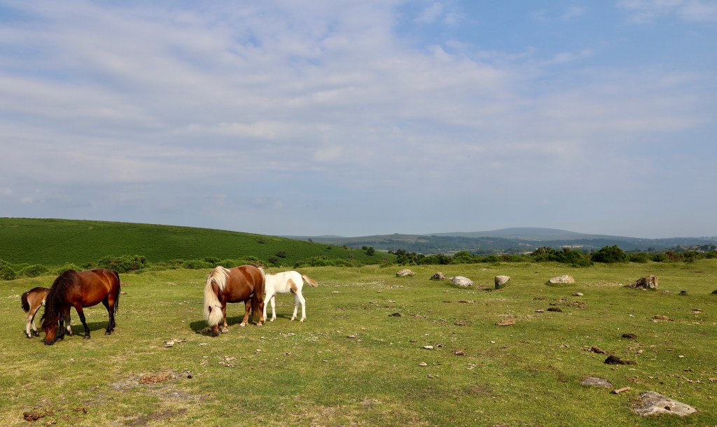
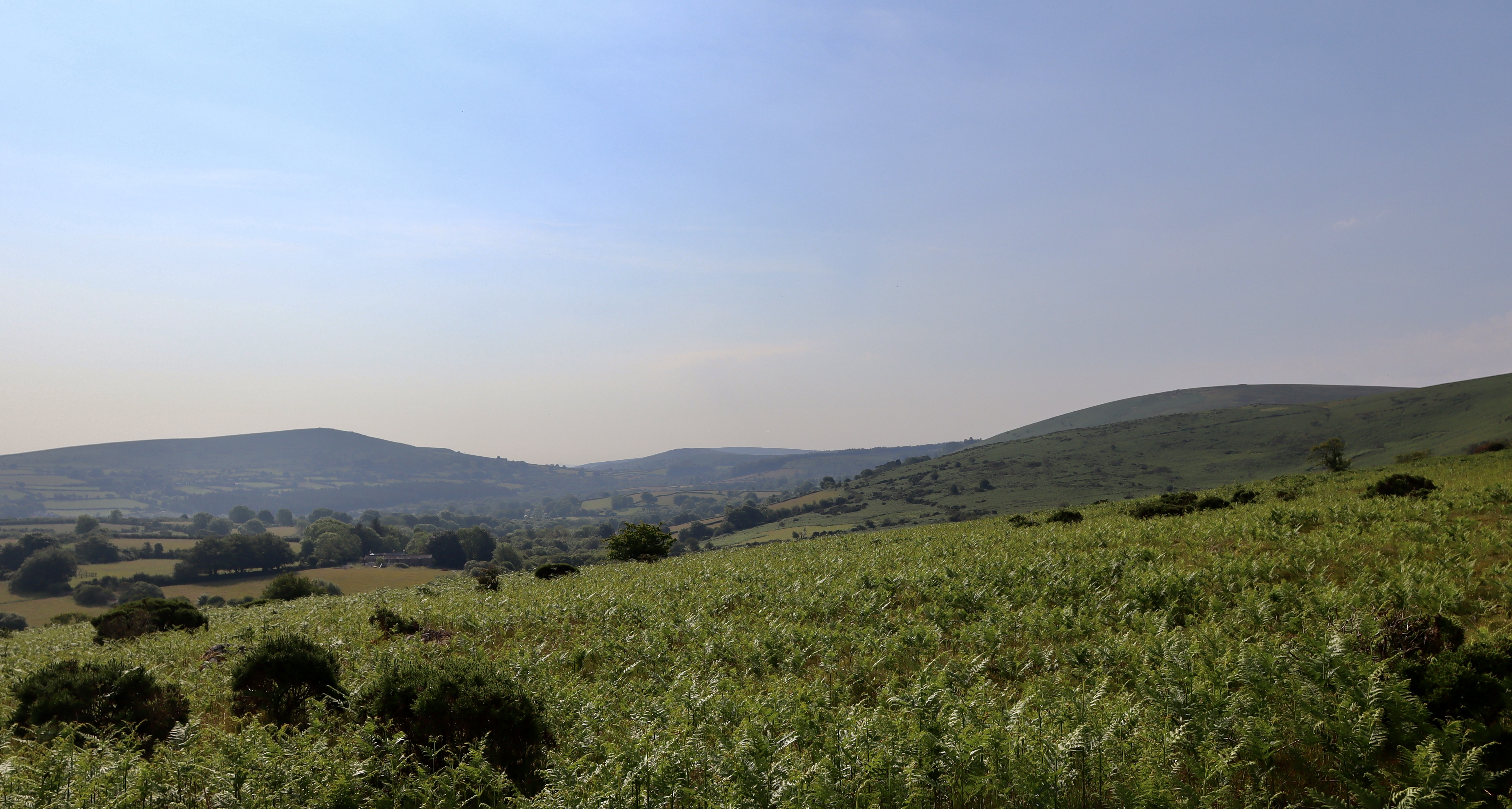
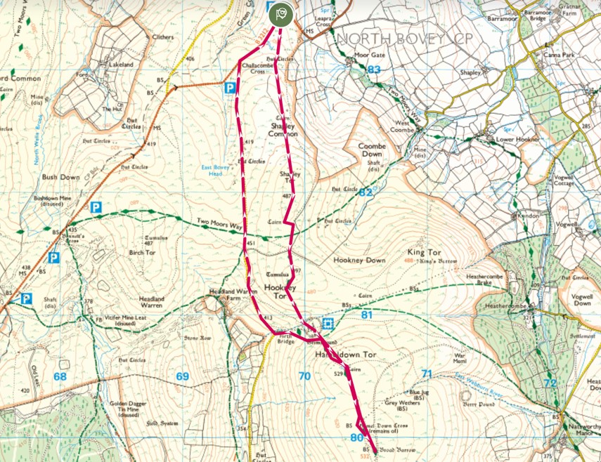
The walk starts and finishes at the Shapley Common North car park. OS maps shows this carpark as having a viewpoint, and on arrival it is easy to see why. Any walk that starts with views straight off the bat is a winner in itself, but this is enhanced with a pair of newborn foals, who are nuzzling their mothers whilst overlooking the fields that wend their way to Chagford Common.
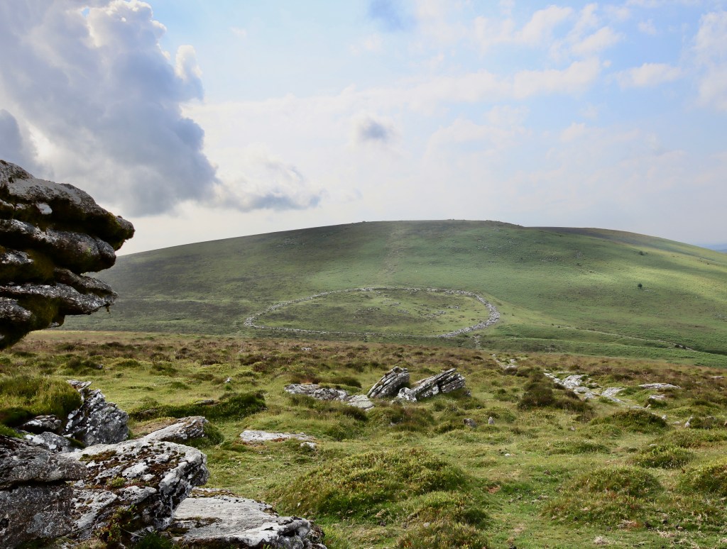
Crossing the road and heading south, a foot worn path leads the way through the bracken and gorse uphill. Following this for about 250m, making sure to avoid the large patches of bog cotton and the soaking boots they symbolise, you come to the first feature of this walk. There are x3 large circles of stone which the OS maps list as Hut Circles. These amazing examples of hut circles clearly demarcate old dwellings, likely used (at least in my head) by the hill farmers as a refuge for the harsh conditions this hill can bring (as I well know). Whilst the intention and location of the shelters was clearly one of practicality, you can’t help but marvel at the view they preside over, especially on a hot clear day like today with the skylarks singing their distraction song, apparently in competition with the nearby stonechat.
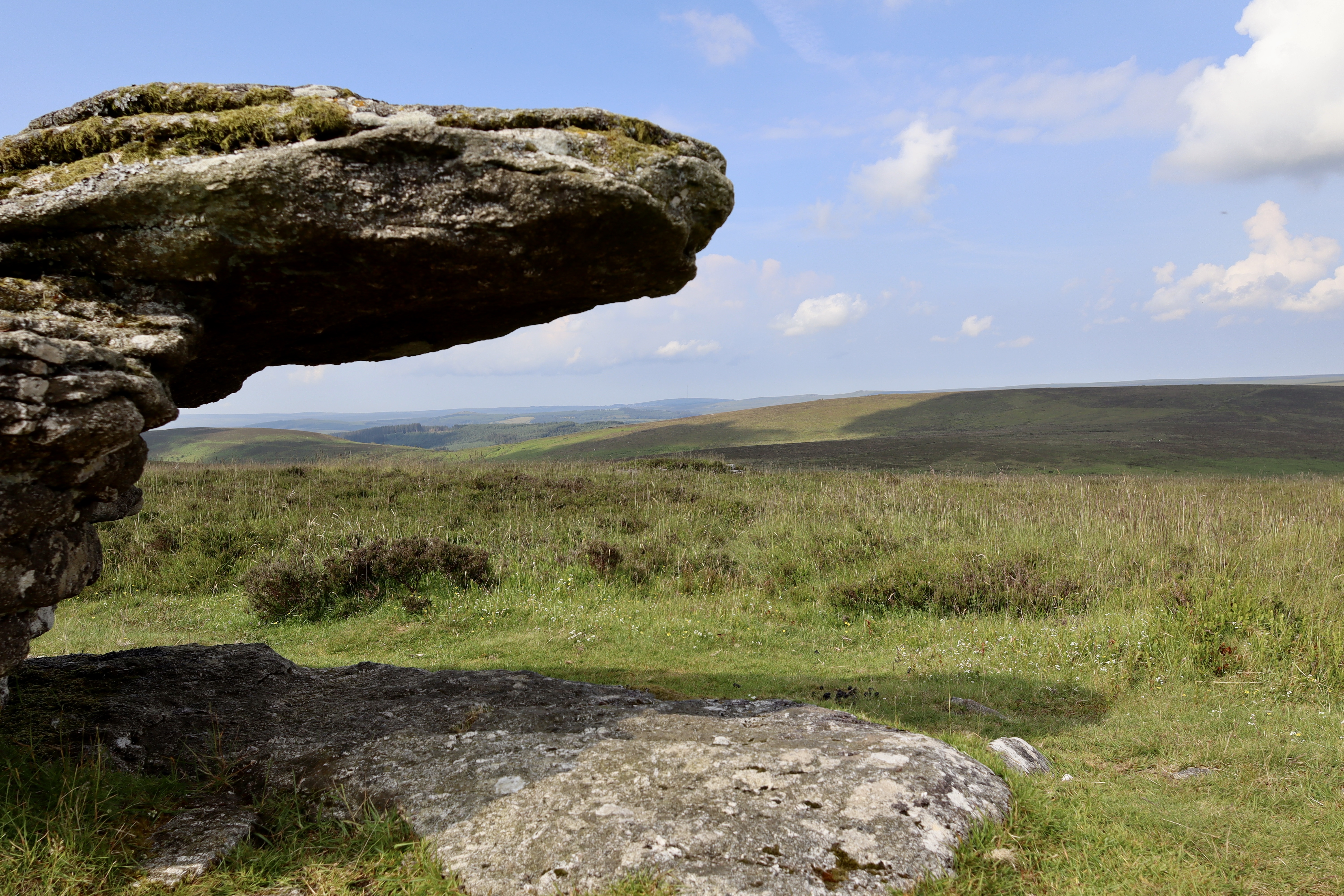
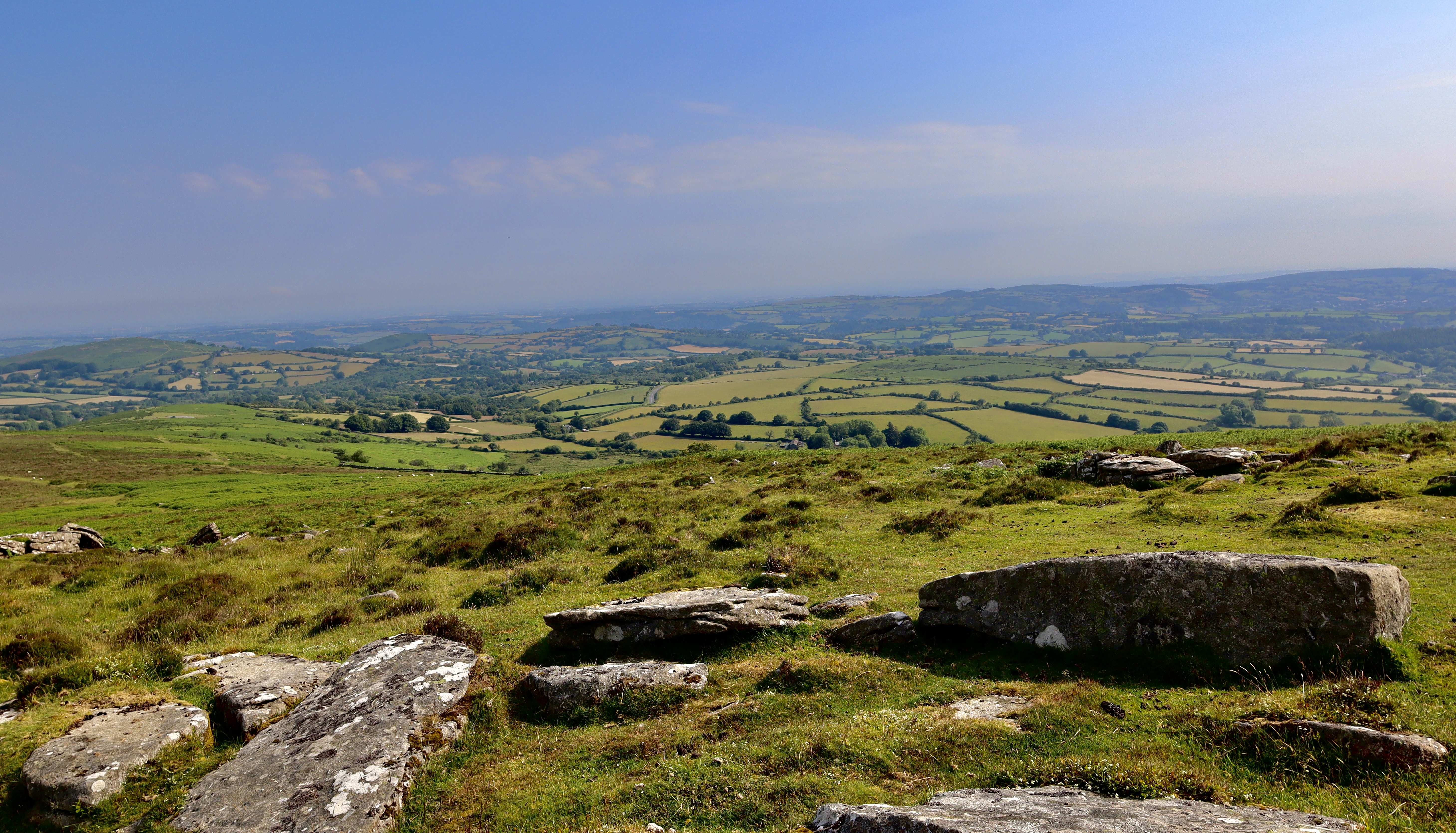
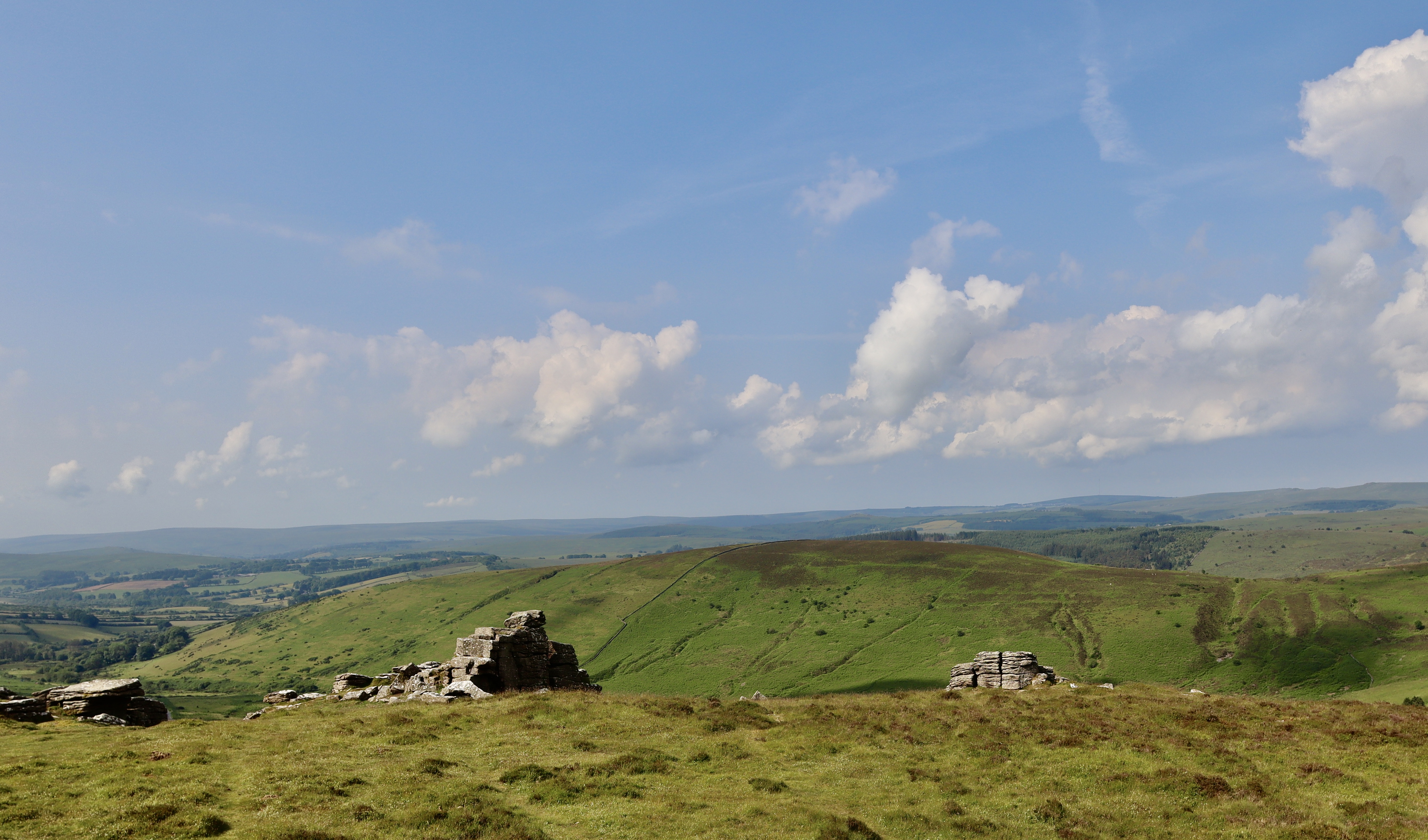
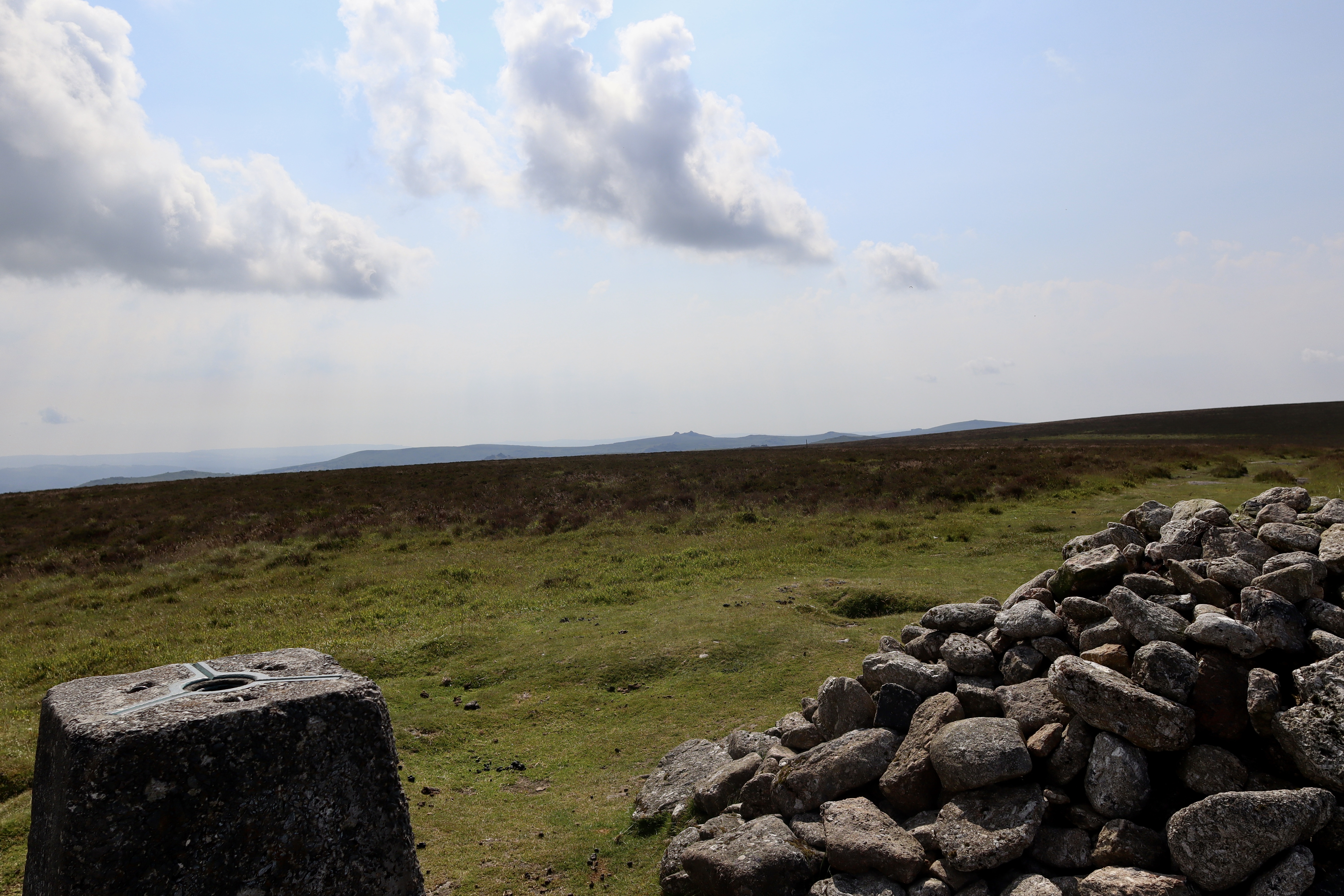
Leaving the Hut Circles behind, the path continues up Shapley Common for a few hundred meters more before it begins to level off. As it does, it will take you gently towards the left where you will see the first stop point of the walk, Shapley Tor. From this viewpoint, Shapley Tor looks like nothing more than a few rocks on a hill side. Following the path that leads to Shapley Tor, and you will see that the initial impression is in fact bang on. In the words of Shania Twain, Shapley Tor itself “don’t impress me much”.
This is a view shared by notable Dartmoor explorers of the past, with William Crossing saying of the Tor “Shapley Tor (1,599 feet), is so scattered on its gentle slope that its only notable features exist at the lowest (rather than highest) elevation. On the low, north-west shoulder of [Shapley Tor] is a large, tilted boulder and, nearby, the major pile of the [Shapley Tor], consisting of large block and slab-granite.” Whilst Shapley Tor does offer up a certain banality and fails to impress, what does impress is the view you get sat atop it. Sweating profusely now (as the weather is dry, humid and 25 degrees at 0915) I sit upon Shapley Tor, to drink in some air, drink in some water and drink in the view.
Hookney Tor
Water on board, photos taken and looking very slightly less sweaty and dishevelled, I head off Shapley Tor towards the south. Whilst trying to find something interesting to say about Shapley Tor for this write up, I did find this comment, credited to Brian Carter (1986) “Shapley Tor wasn’t as impressive as many unnamed granite outcrops I’ve encountered on moorland expeditions, so we pushed on to Hookney Tor”. I wholeheartedly agree with Mr Carter, and so continue South towards Hookney Tor.
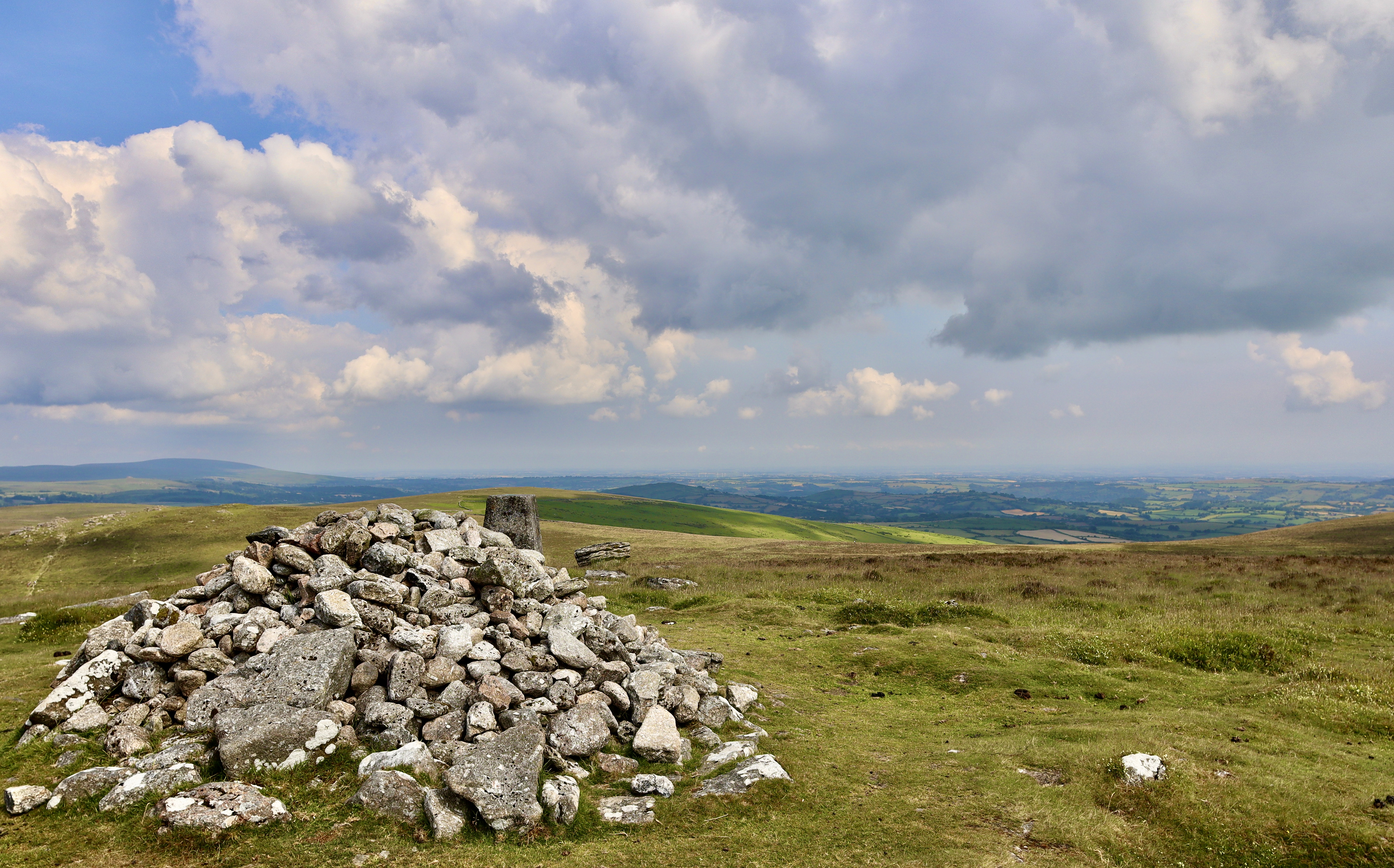
I stick to flat(ish) level and follow animal trails (so as not to disturb any nest hidden amongst the unflowered heather and moorland grasses) with the intention of visiting a cairn that is clearly marked on the OS map. The cairn as noted on the map isn’t massively obvious when you get there, so getting to it accurately will require a bit of navigation. What is clear from the zenith of Shapley Common is a rock feature, possibly part of the long-collapsed Shapley Tor, that as you get closer emerges as a contender for Dartmoor’s very own (and very mini) pride rock (see – I found something interesting about Shapley Tor that isn’t just the view). The cairn is on the same line from the summit of Shapley Common as this rock and appears as a slight mound in the moorland. Whilst this isn’t the best example of a cairn the Moor has to offer, it does serve as a gentle reminder of the historic landscape in which I’m walking, linking the present to the past seamlessly. From the cairn, our next feature, Hookney Tor is clear and so I head back onto the animal trails and straight to it.
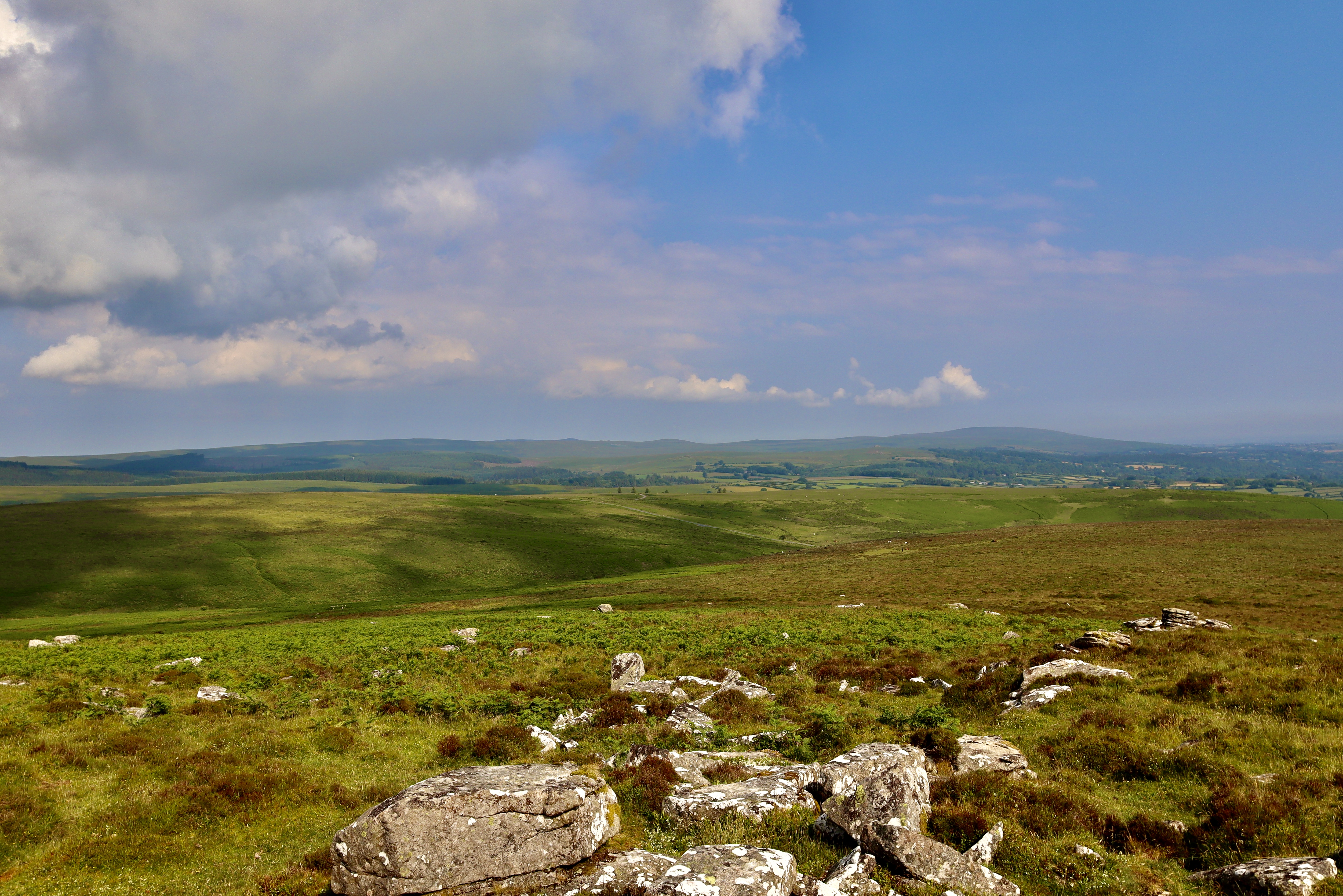
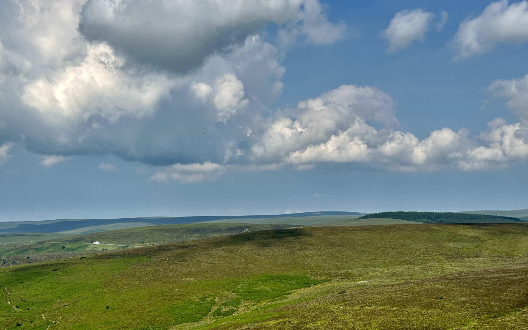
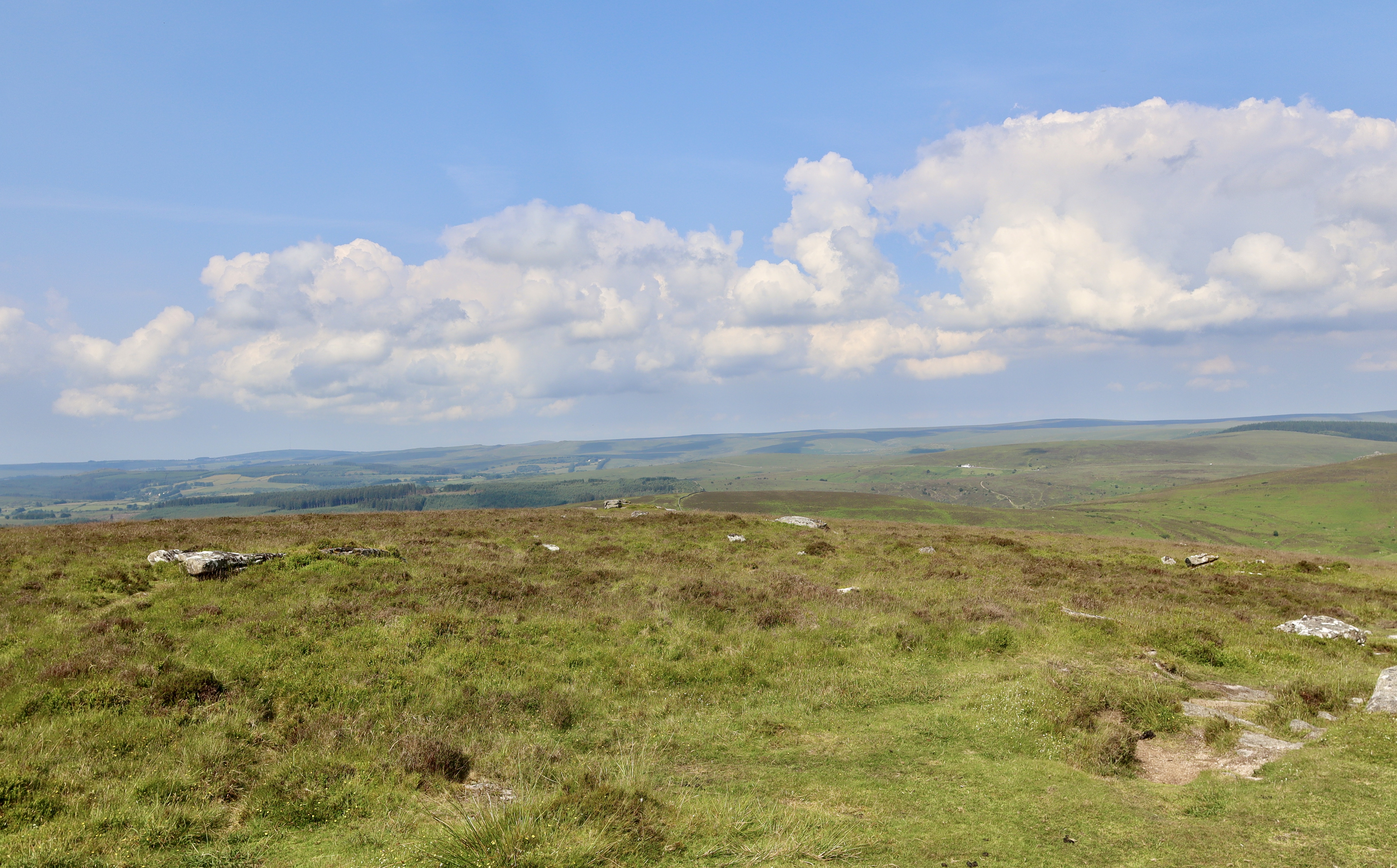
Heading toward Hookney Tor and looking to the left (east), over the top of a dry stone wall, the views of Coombs Down and North Bovey are stunning, with the surrounding hills casting shadows and introducing differing shades of green, all being overseen by King Tor, which I will not visit today but instead use as an excuse to come out this way again (not that any excuse is needed).
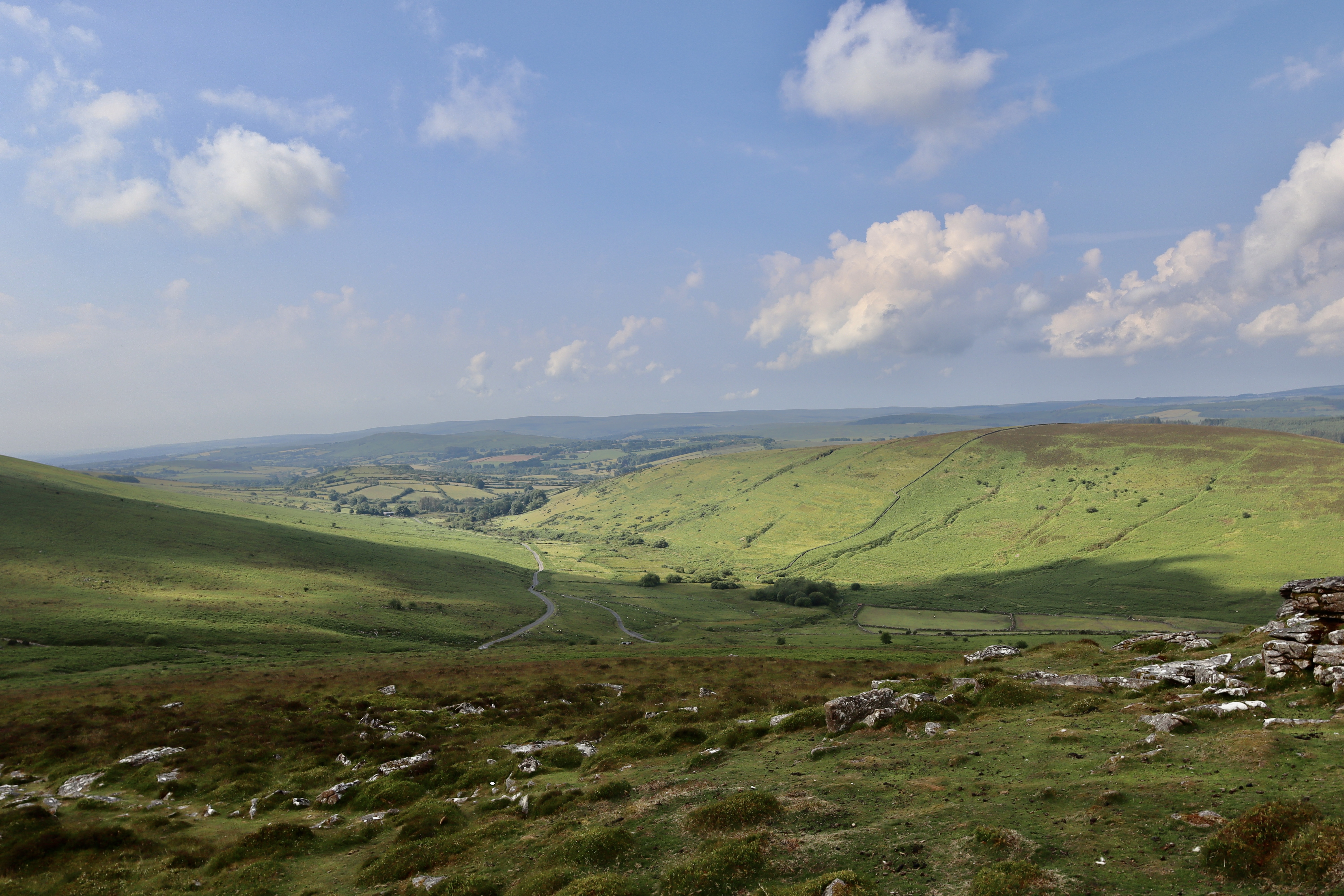
Having re-met the path, I pass through the dry stone wall, long since fallen, and begin a gentle climb up hill to Hookney Tor. Where Shapley Tor was little more than a fallen, slightly defeated and uninspiring tumble of rocks, Hookney Tor manages to combine spectacular views overlooking Fernworthy forest, the Warren House Inn and the site of the Hairy Hands to the west, with Grimspound and Hameldown Tor to the south and the valley majestically created by the burgeoning River Bovey to the east, with the commanding layered majesty that you come to expect with the granite tors of Dartmoor.
Hookney Tor, boasts a dominant position overlooking Grimspound and the Headland Warren Farm. Hookney Tor cast its shadow over one of the most heavily mined areas of Dartmoor, and from it’s top, you are able to see the gullies left by the Vitifer, Birch Tor and Golden Dagger tin mines, leaving their mark on the landscape like a scar on the skin. The Two-Moors way runs through the middle of the stacks of Hookney Tor and there is easy access to the site by the nearby road, which runs south from Challacombe Cross. The ease of access, spectacular views and combination of prehistoric and industrial history makes Hookney Tor well worth a visit, even if not part of a longer walk.

Grimspound
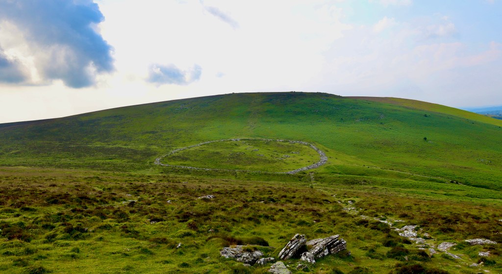
The next feature of the route, and the most spectacular, is clearly visible from Hookney Tor and even if not, is nestled at the bottom of the valley to the southeast, that Hookney Tor forms part of. Nestled in the shadows of the valley overseen by Hookney Tor and Hameldown Tor, is Grimspound.
Whilst there is a clear path down from Hookney Tor to Grimspound, it is steep and strewn with rocks so care should be taken (not easy when you just want to look at what’s ahead, whether Grimspound or the valley views) and attention paid to where your placing your feet.


Grimspound History
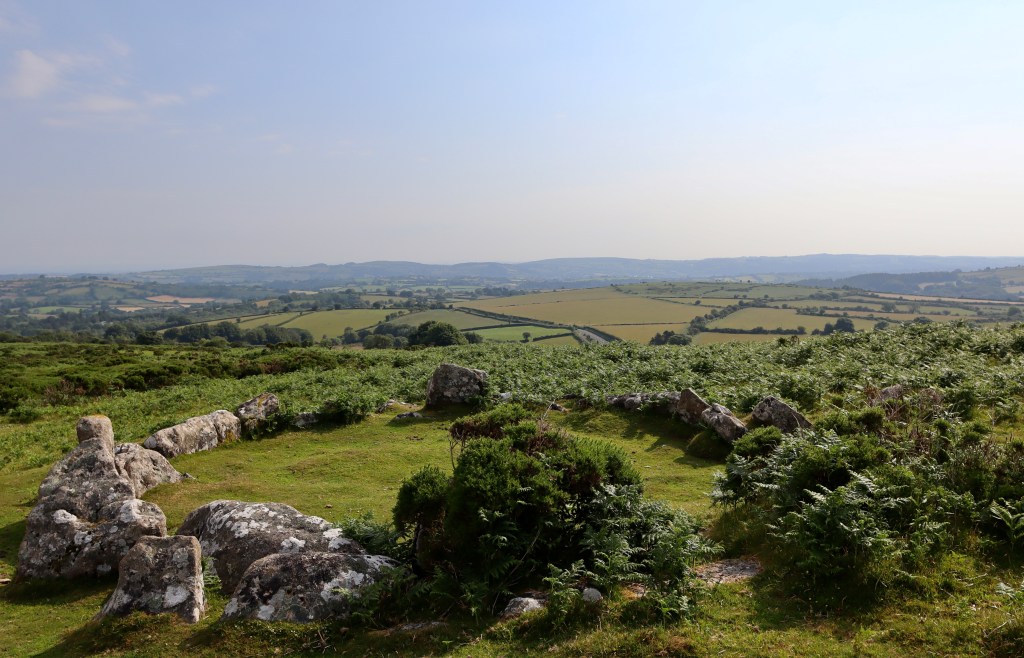
Grimspound is most probably the best-known prehistoric settlement on Dartmoor, in part due to its size, in part due to its accessibility and in part due to the views that can been taken in from its site. The name Grimspound was first recorded by the Reverend Richard Polwhele in 1797, derived from the Anglo-Saxon God of War, Grim (AKA Woden or Odin).
Grimspound consists of 24 houses (which have been officially recorded, it is likely there are more that within the enclosure that have not been disturbed) enclosed within a circular stone wall, dating from the late bronze age (1500 – 800BC). The wall has an obvious entrance, pointing towards Hameldown Tor and at points, is over 3m thick. However, nestled at the bottom of the valley, its defensive attributes are minimal and it is therefore thought that the wall were designed to keep animal in, as opposed to keeping marauding invaders out.
There has been much speculation as to the purpose of the Grimspound site. Theories include It being:
- A Viking settlement used to store mined Tin
- A temple for the Druids
- An Iron Age Fort
- A Roman Town
- A temple for the Sun
- A Phoenician settlement
- A pound for stray cattle and a
- 7th Century monastic hermitage
In order to settle the debate as to its purpose, an excavation of Grimspound was carried out by the Dartmoor Exploration Committee in 1894-96. Along with the excavation, the team also “restored” some of the huts they found in Grimspound although the accuracy of these restorations is debatable and as such, much of internal features of the Grimspound site are based on our modern interpretations of what a bronze age hut may look like.
The early excavation identified 24 huts, but of these only 11 showed signs of human inhabitation, with the remaining 13 being thought of as storage units or animal pens. This, combined with a poor defensive position, good cattle grazing, and the Grim Stream running through it providing an abundance of water, points towards Grimspound being a settlement for cattle herding community, either as a static site or one used as part of a nomadic lifestyle, to my mind at least. I think this theory is further supported, as during the time Grimspound was thought to have been established, early farmers were moving into upland areas, and settled farms and field systems were becoming commonplace, with evidence of this across Dartmoor (although none as clear as Grimspound).
More information can be found by visiting the english heritage site about Grimspound through: https://www.english-heritage.org.uk/visit/places/grimspound/
Grimspound Folklore
For me, the range of theories as to the purpose of Grimspound, demonstrates the magic that Dartmoor can have on a person. The history, the surrounding beauty and the inaccessibility (at the time) of the site combine to fire up the imagination. Add in the natural human instinct to apply order and understanding and it leaves us with multiple theories and musings. On top of this, the mystery that abounds as a mist rolls in and the isolation of the moor, especially during the night leaves a person needing to find comfort and understanding in the otherwise unknown. Grimspound, given all the above, should have numerous folklore tales told of it then, but having searched through numerous books, scoured multiple websites, listened through a several podcasts and even after asking locals, I can find no tales that include Grimspound. Opportunity lies here therefore for anyone creative enough to create their own story.
Hameldown Tor
Having wandered around Grimspound, imagining the lives of those that called it home, I head for Hameldown Tor which again, is along a clear path. Mercifully, the sun has hidden behind the clouds at this point, as the walk from Grimspound to Hameldown Tor is nothing if not steep (but is relatively short).
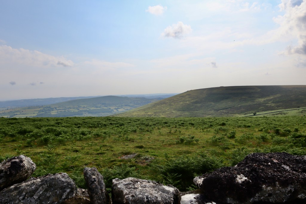
Marked by a trig point sat alongside a cairn, Hameldown Tor, again lacking in stature offers out views across the moors that are hard to compete with, most striking of which are the humps of Saddle Tor and Haytor Rock, and the mound that is Broad Barrow, just on from Hamel Down Cross. These views also offer a good excuse to rest and catch your breath having climbed the steep bank of the valley from Grimspound.
Hameldown Tor had marked the point at which I had planned to return for home. However, as so often happens, the lure of the walk, combined with the fine weather and fun time had already made meant that I pushed on just a bit further, selfishly taking just a little bit more from the journey and experience that Dartmoor had so happily given. I decided to head over to Hameldown Cross.
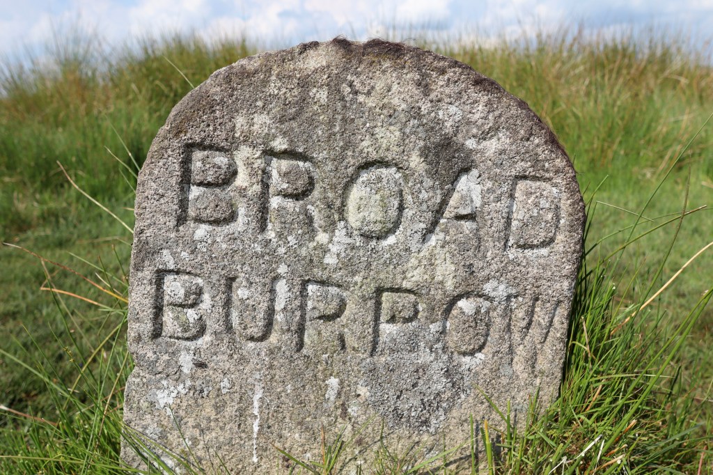
Broad Barrow
The path Southwest from Hameldown Tor is part of the Two-Moors way and is clear and easy to follow. The path runs along to Broad Barrow, but as you move along it, after about 400m to the west is a cross. This is Hameldown cross. Standing isolated in the surrounding landscape acting as a boundary marker amongst the moorland for the Duke of Somerset and takes a short diversion from the path to reach. As I reach the cross, the striking red of a rescue helicopter passes over my head, reminding of the dangers a walk across this landscape can bring (see my post Hill Walking Essentials: Routes, Weather Equipment Tips).
Re diverting back onto the path, the Broad Barrow is a few hundred metres ahead. This amazing feature, which rises slowly and unobtrusively from the ground is one of a number of Barrows that run along the spine of Hamel Down Ridge. Given the number of barrows and cairns on Hamel Down and the nearby settlement of Grimspound, Broad Barrow is clearly part of a once important and revered section of the National Park. The Two-Moors way connects Broad Barrow with nearby Single Barrow, Two Barrows and Hameldown Beacon and whilst it doesn’t take long to explore each of these, I have a route planned to visit these another day.
Having already overextended my planned walk, I use Broad Barrow as my turning point and from here head to home. At this point, there are three choices. Head across to King Tor (which I’ve mentioned will be the focus of a separate walk), head back to Hameldown Tor, descend towards Grimspound and take the track to the road or head back the way you’ve just come. I choose the road, because as mentioned, I’m training for a fitness test in a few months and as I initially planned a run, I thought the run back along the road would be good and having not run over the hills in a while, I wanted the undulating tarmac as a safety blanket. However, in what was by now 27 degrees, still and humid heat, set in a cloudless sky, on reflection I can say this was a truly terrible idea and wouldn’t recommend it. Still it got me back to the car and offered up a slightly different route back and the newborn foals were still in the carpark when I got back so overall, no harm done.
This is great route, which is easily accessible, along paths and offers steady inclines. Along with this, you get amazing views and sights of Dartmoor’s prehistoric and industrial history. It is really worth a go.
| Difficulty | Distance | Navigation Required? |
| Easy (moderate in places with steep climbs) | 8km | No |
| Grid Reference | Safety | Footwear |
| SX 698 834 | General Dartmoor Considerations Some uneven terrain Road crossing | B0 upwards |


Leave a reply to Moorland Ramblings Cancel reply