This is a great walk that will get you off the well-trodden paths (mostly), away from the (majority) of crowds and into the open moorland, with its heather, gorse and bracken, that Dartmoor is all about. It is a walk where challenging sections are interspersed with gentle bimbles, where climbs uphill are short and steep and the long, gentle downhill slopes work to take you inexorably from feature to feature. This walk takes in tors, leats, prehistoric remains and ancient woodlands. By the end, I am tired and left with a sense of hard work, without ever quite realising I was working hard.
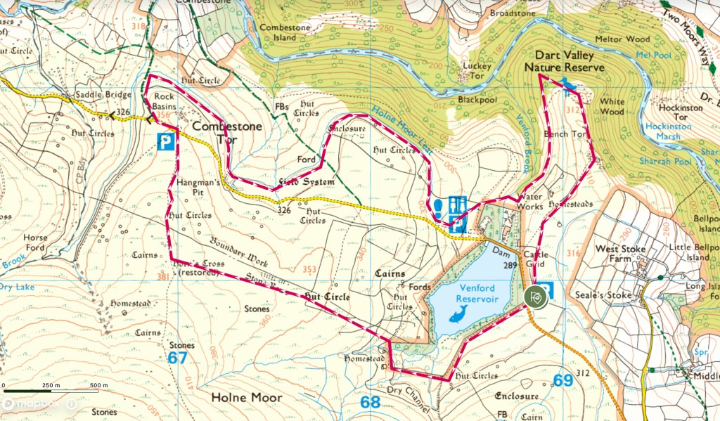
Around Venford Reservoir
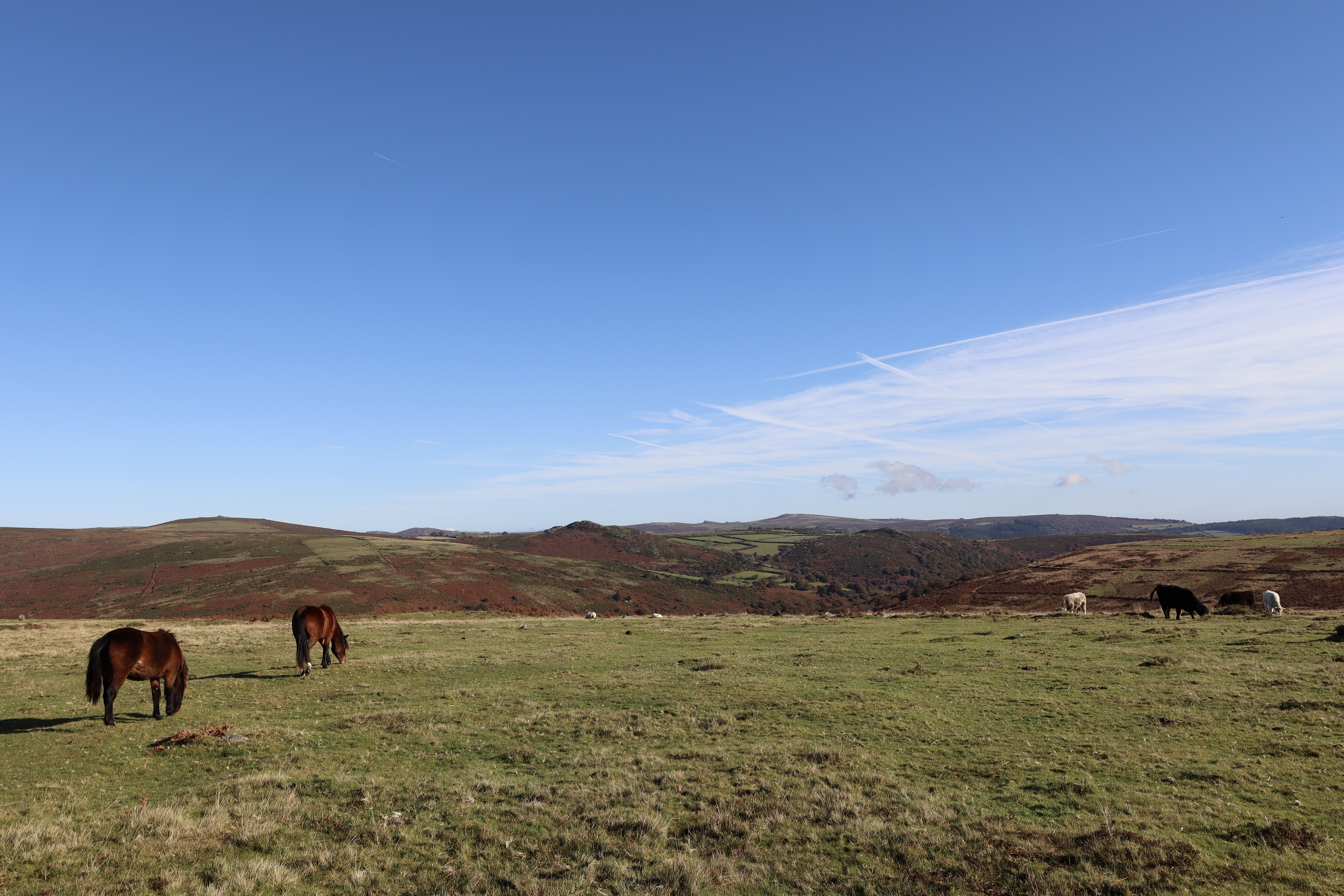
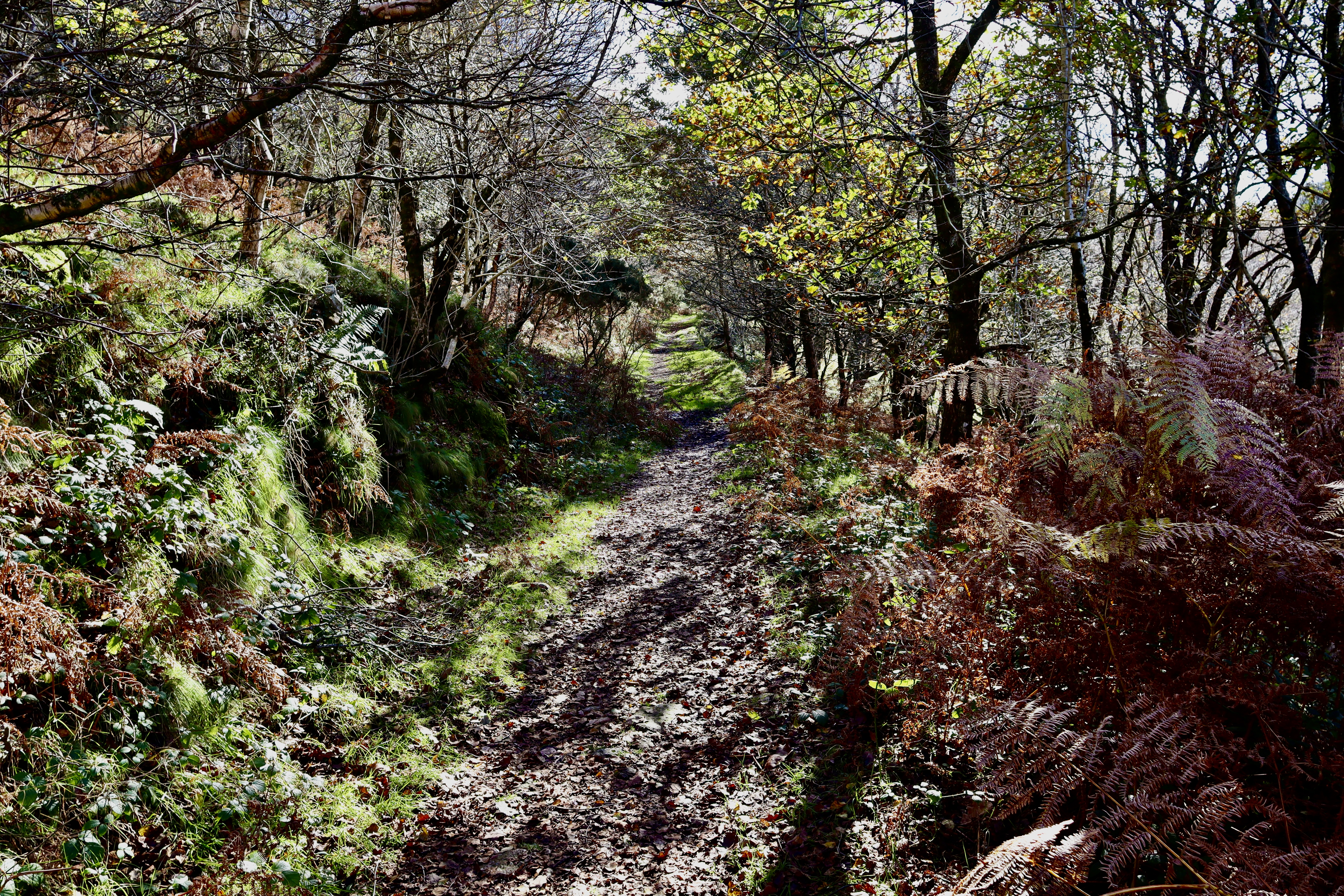
The walk starts at the Michelcombe Lane Car Park, on the eastern banks of Venford Reservoir. This car park, and indeed the location in general gets busy when the sun is shining, so getting there early is recommended. The location may be busy, but the walking route isn’t. From the car park, cross the road and head southwest, ensuring the fence that surround the reservoir remains to your right. As you make your way swerving through the bracken, gorse and overhanging branches, Holne Moor rising gently all around you.
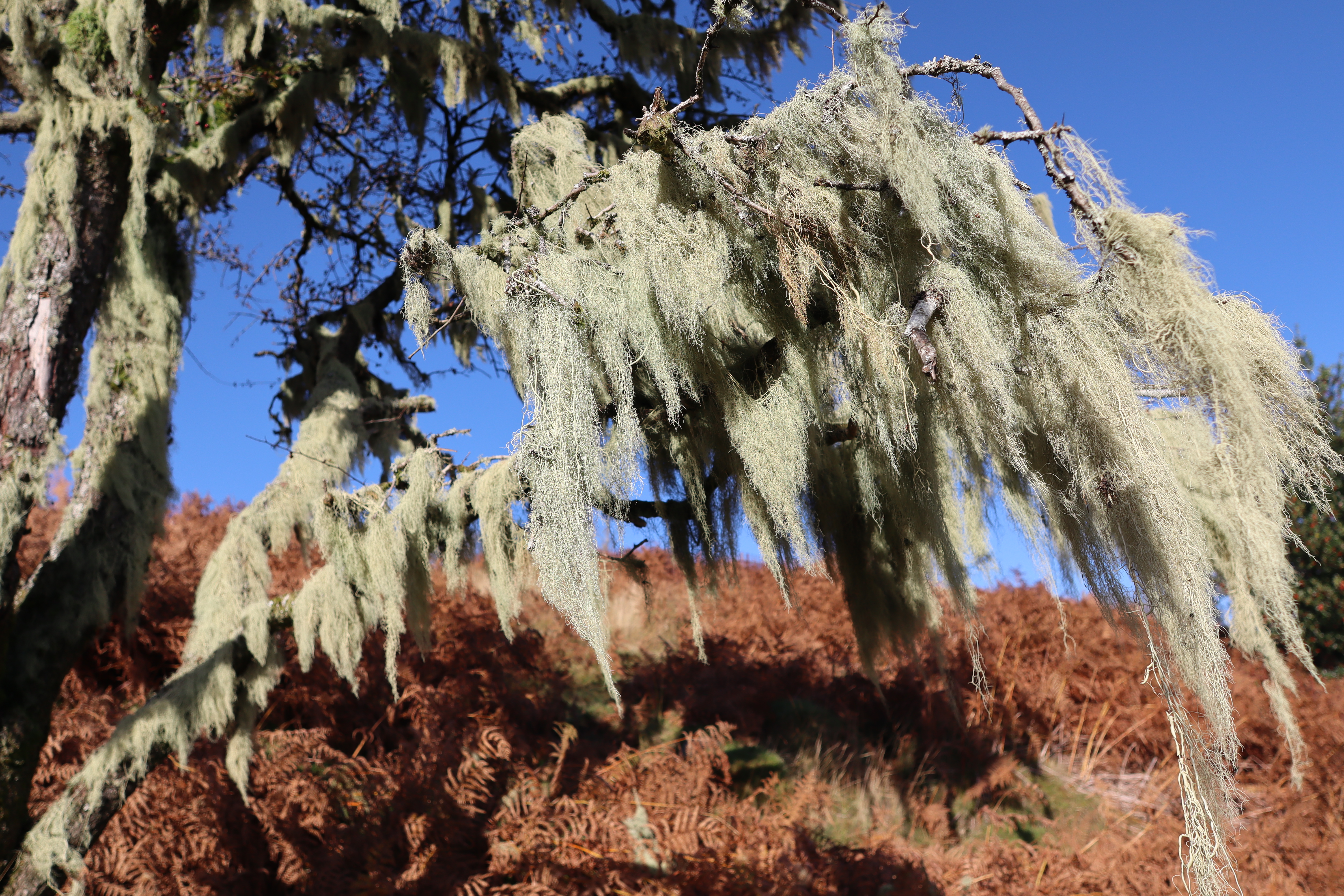
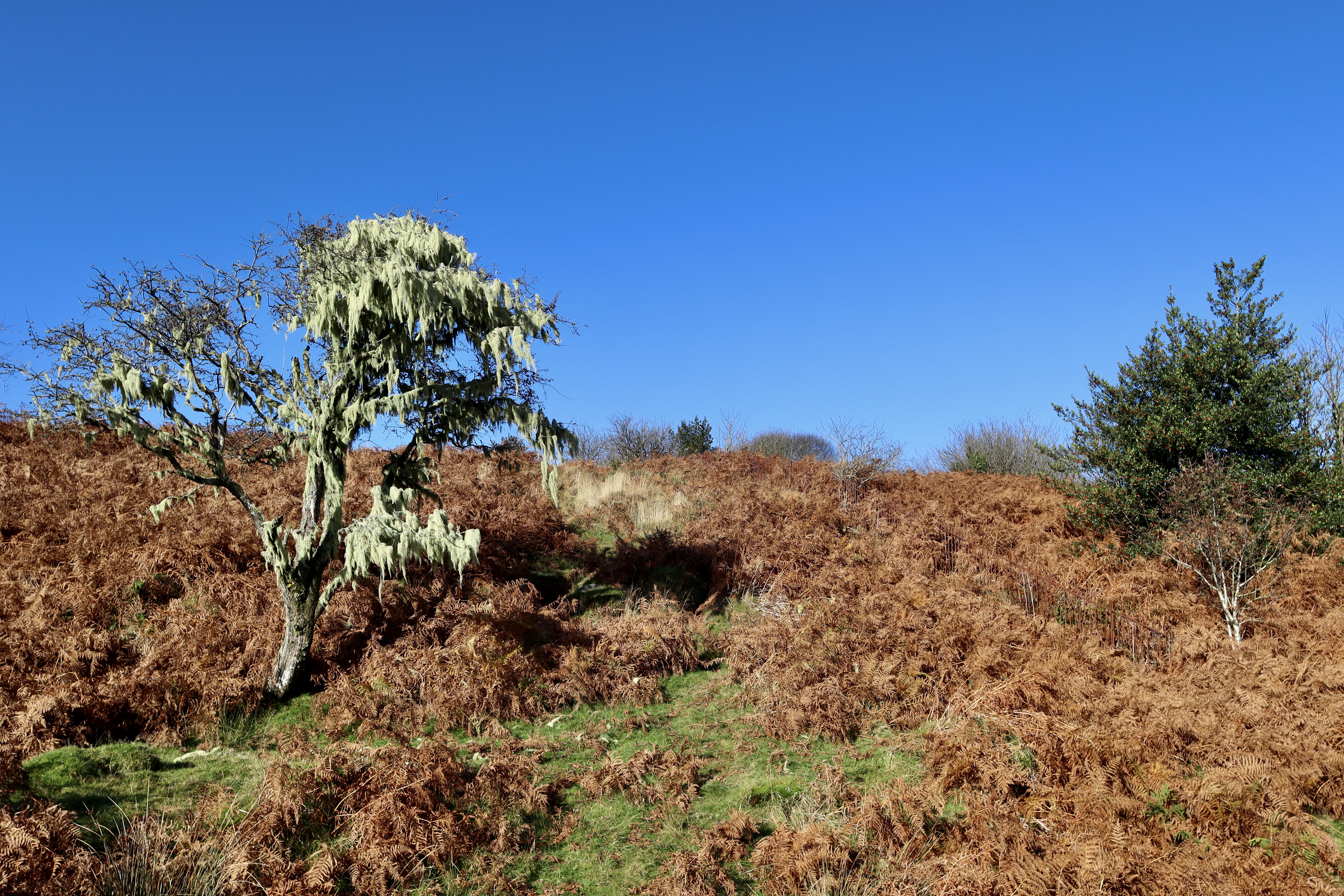
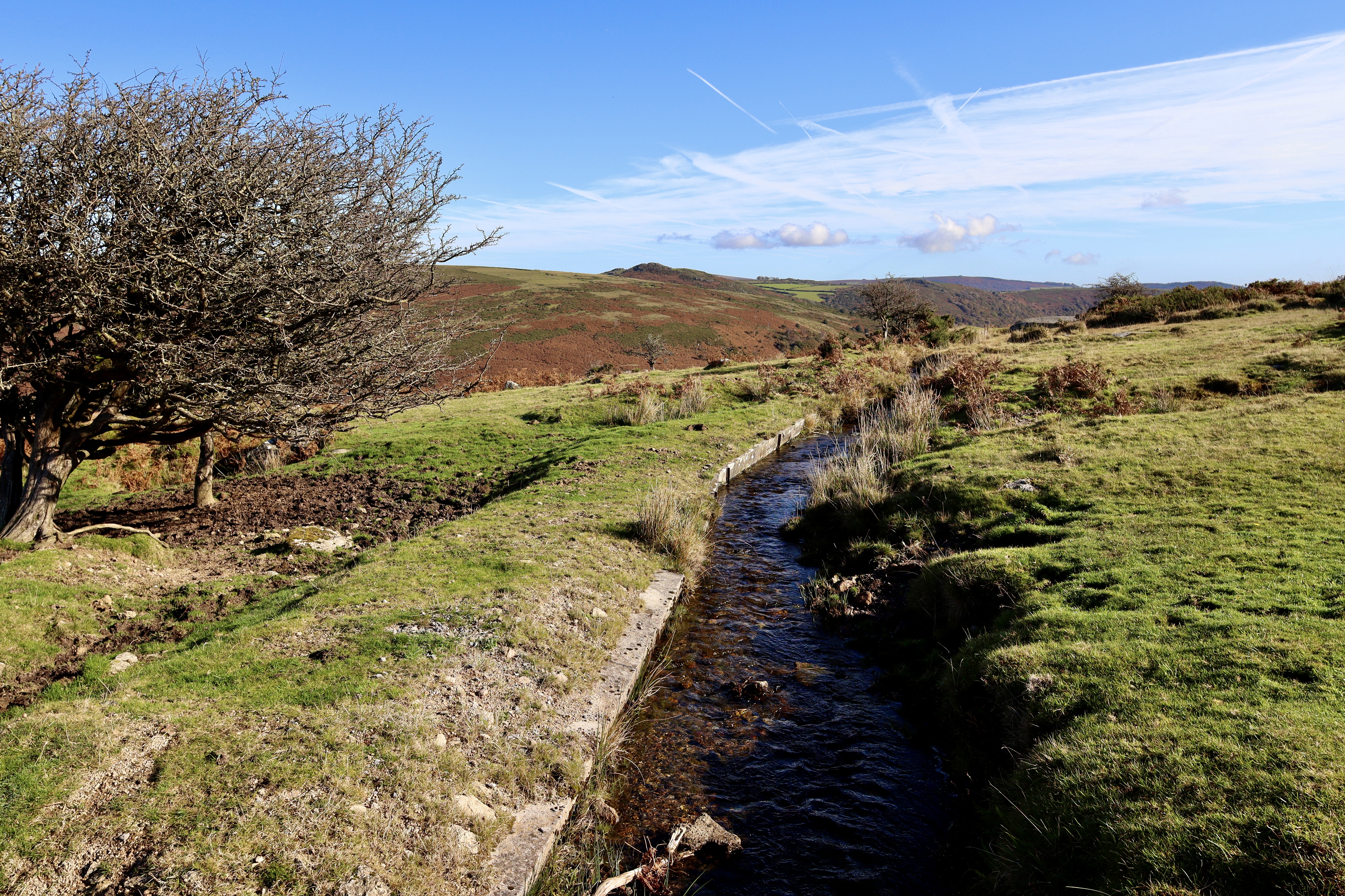
After around three quarters of a kilometre, the first challenge of the walk comes into play, with a gentle river feeding into the reservoir. Sticking close to the fencing is key here – it offers a safe route across (albeit a bit of a squeeze if you’re on the bigger end of the scale). Just across the river crossing, one of the most magnificent examples of a tree covered in Old Man’s Beard comes into view. It is one of those moments, which happens on the moor, where you have to stand in wonder at what nature has manged to conjure up. Standing proudly alone, the twisting, squat form of a hawthorn provides start contrast to the browning bracken. Hanging from its branches, in clumps of yellow that resemble cobwebs hanging as decoration (apt as Halloween is around the corner), the long tendrils of Old Man’s Beard sway gently in the breeze that provides a cooling relief from the unexpected Autumn sun.
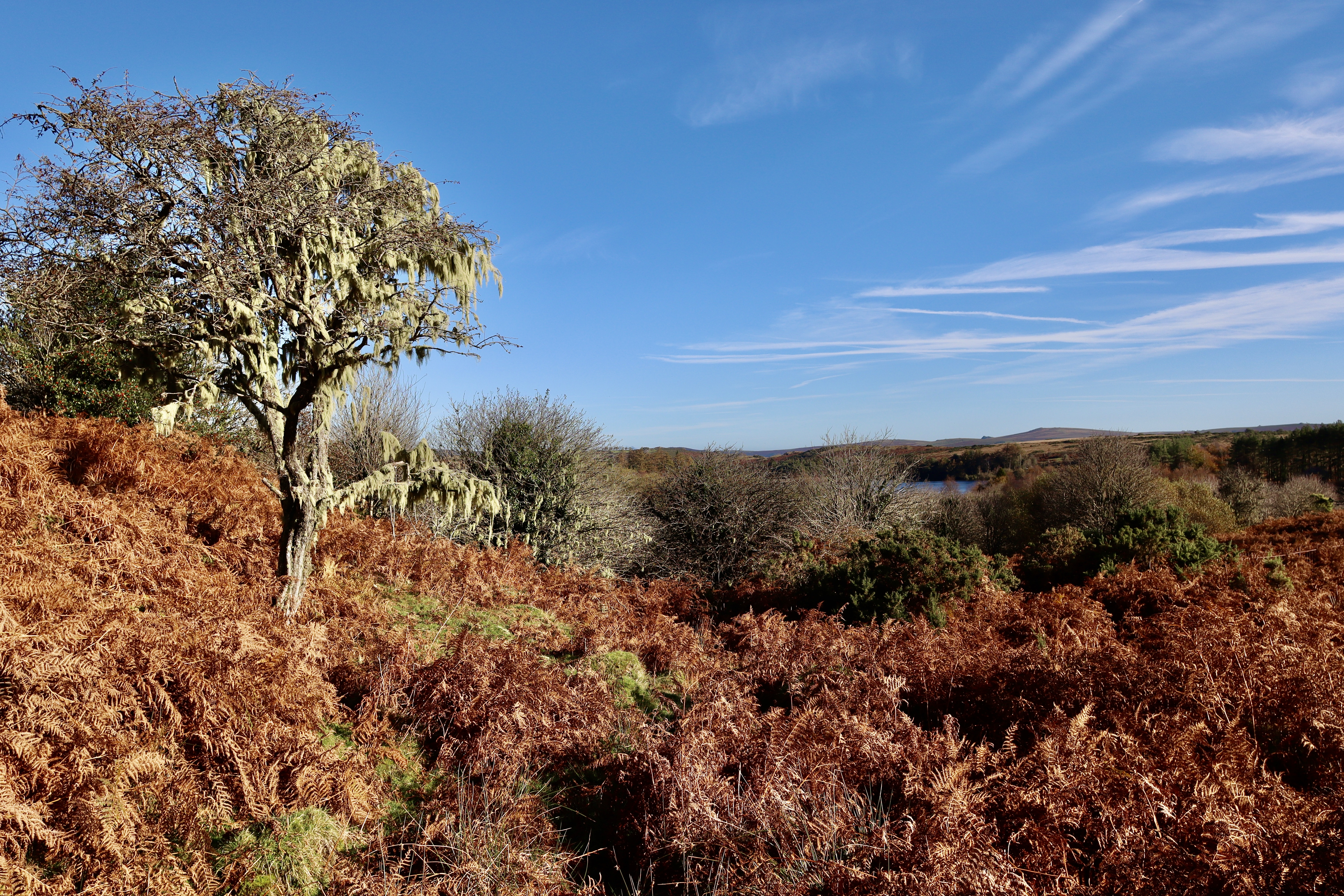
Turning to the north, just after the lichen clad tree, still handrailing the fence, about 250 meters after the first river crossing, comes a second. This one proves more of a challenge and the safety of the fencing is not available on this occasion. Having paced up and down the southern bank for a few minutes, I found myself balancing on my left foot, with a small, wobbling stepping stone beneath me. Taking a leap of faith, feeling like Indiana Jones, I made the death-defying jump (all of about two feet), onto the muddy northern shore. My roaring, tumbling and free flowing foe vanquished, I continued north, uphill through the gorse and overgrown grasses, until I came to what could reasonably be described as a path. From this (more of a grassy clearing but it served the purpose all the same) I could see my next feature. At first thinking it to be a fellow hiker, I soon put this idea out of my head (primarily because they remained stock still for a good few minutes), as I realised that what I was looking at was in fact Horn’s Cross, about 1km to the northwest.
Horn’s Cross
Standing over six feet high, Horn’s Cross can be forgiven for its weather beaten, raggedy appearance as the cross is unforgivingly exposed to the inclement weather and no doubt provides an excellent scratching post for the cows, sheep and horses that call Holne Moor their home. Standing as a way marker along the ancient Maltern Way (dating as far back as the 11th century, the Maltern Way runs from near Holne Moorgate in the west to Cockle’s Gate in the east helped connect the two great Abbeys of Dartmoor, at Buckfast and Tavistock), the ancient cross is thought to date back to the 14th century and was restored in the early twentieth century.

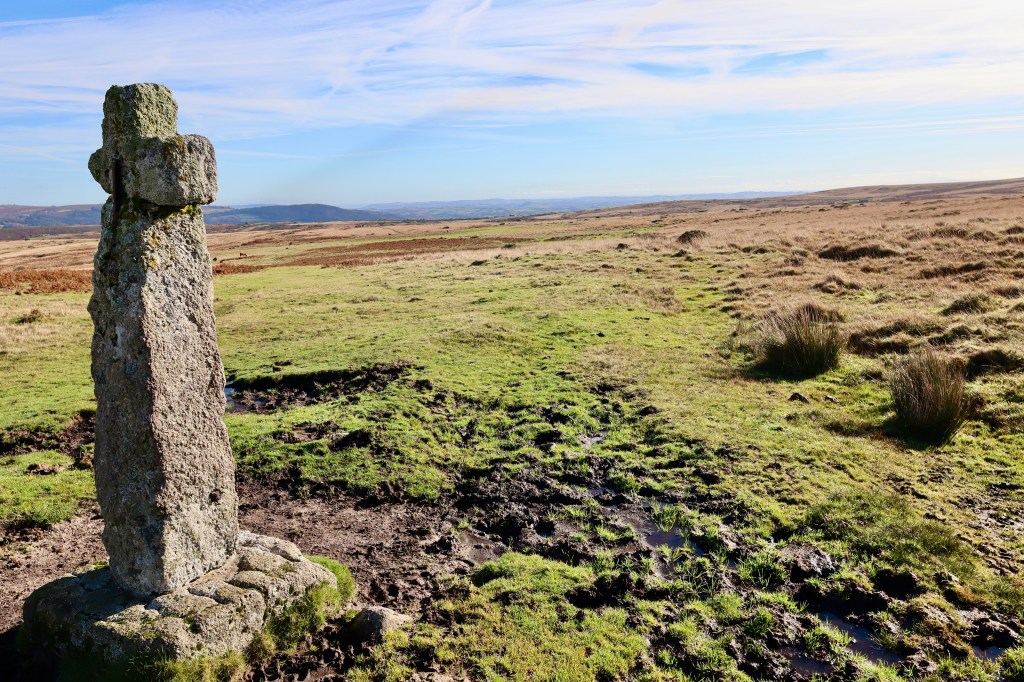
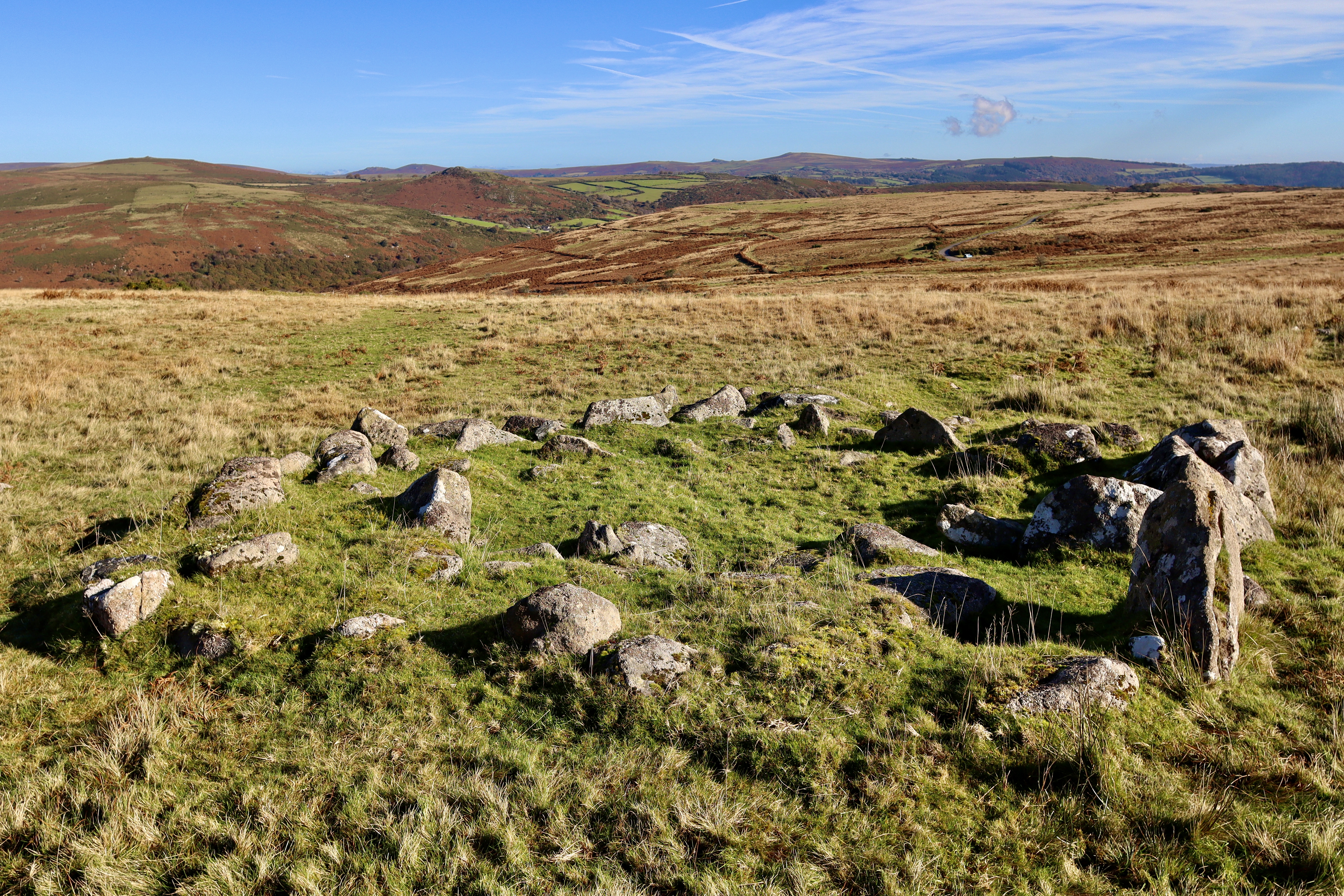
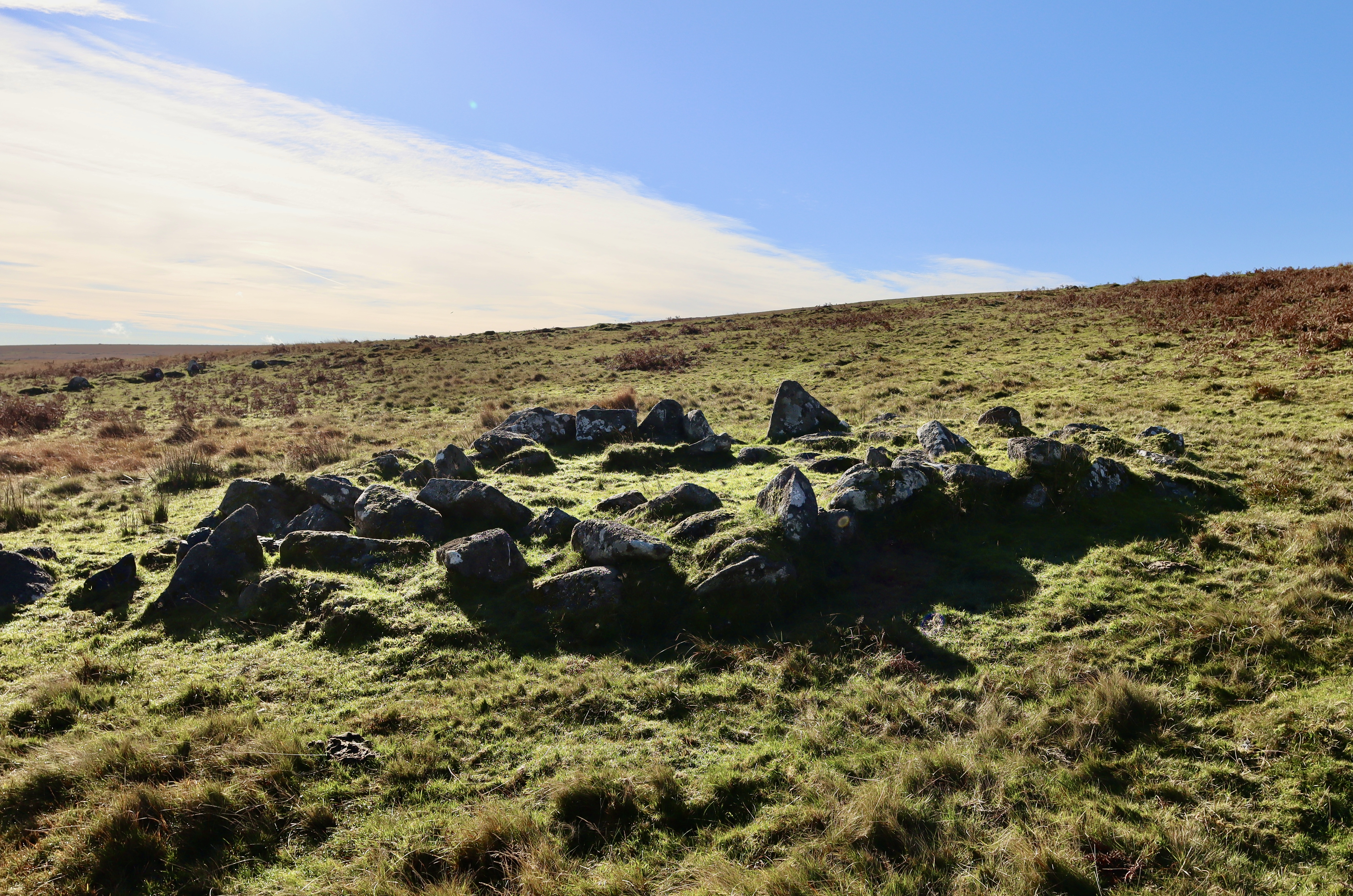
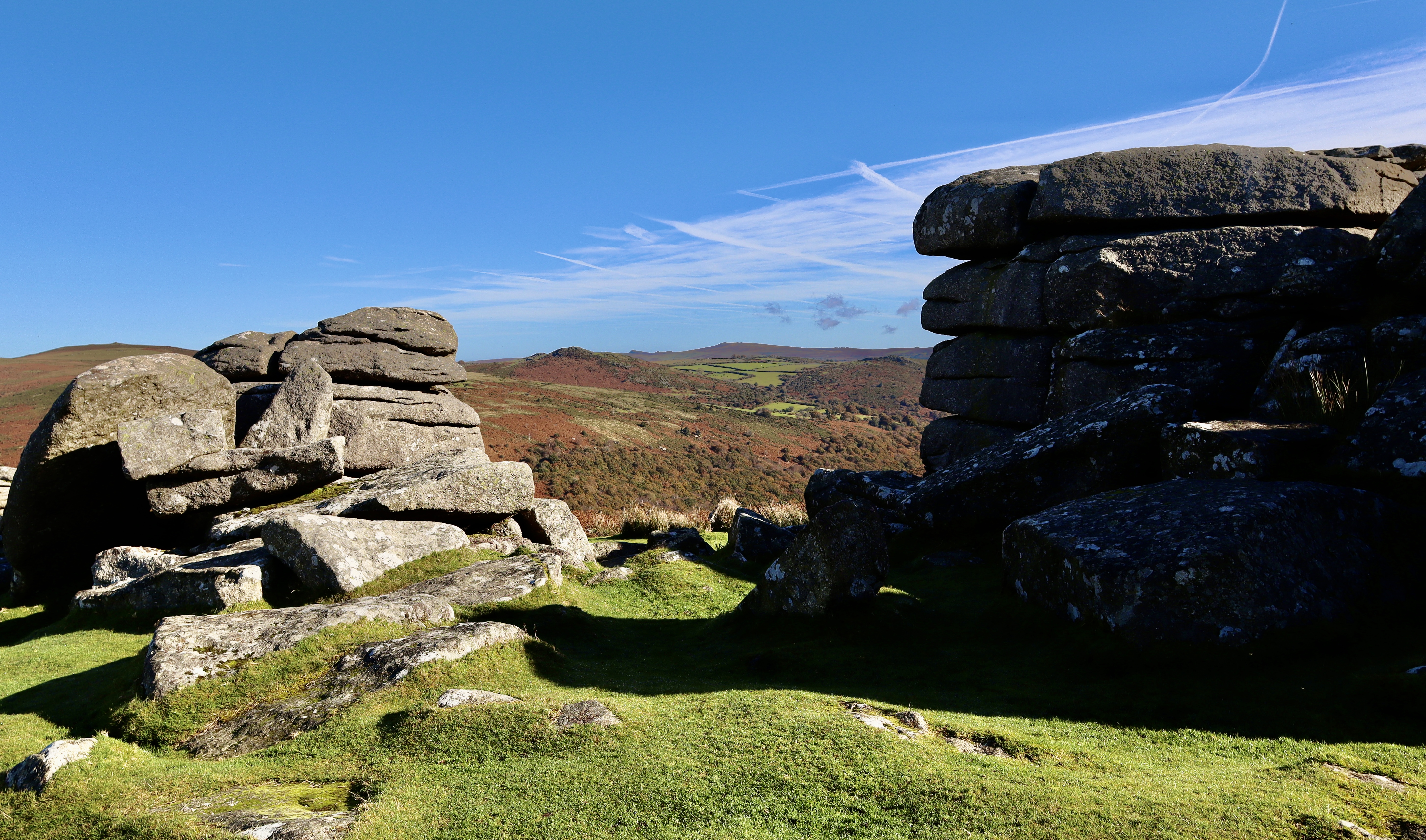
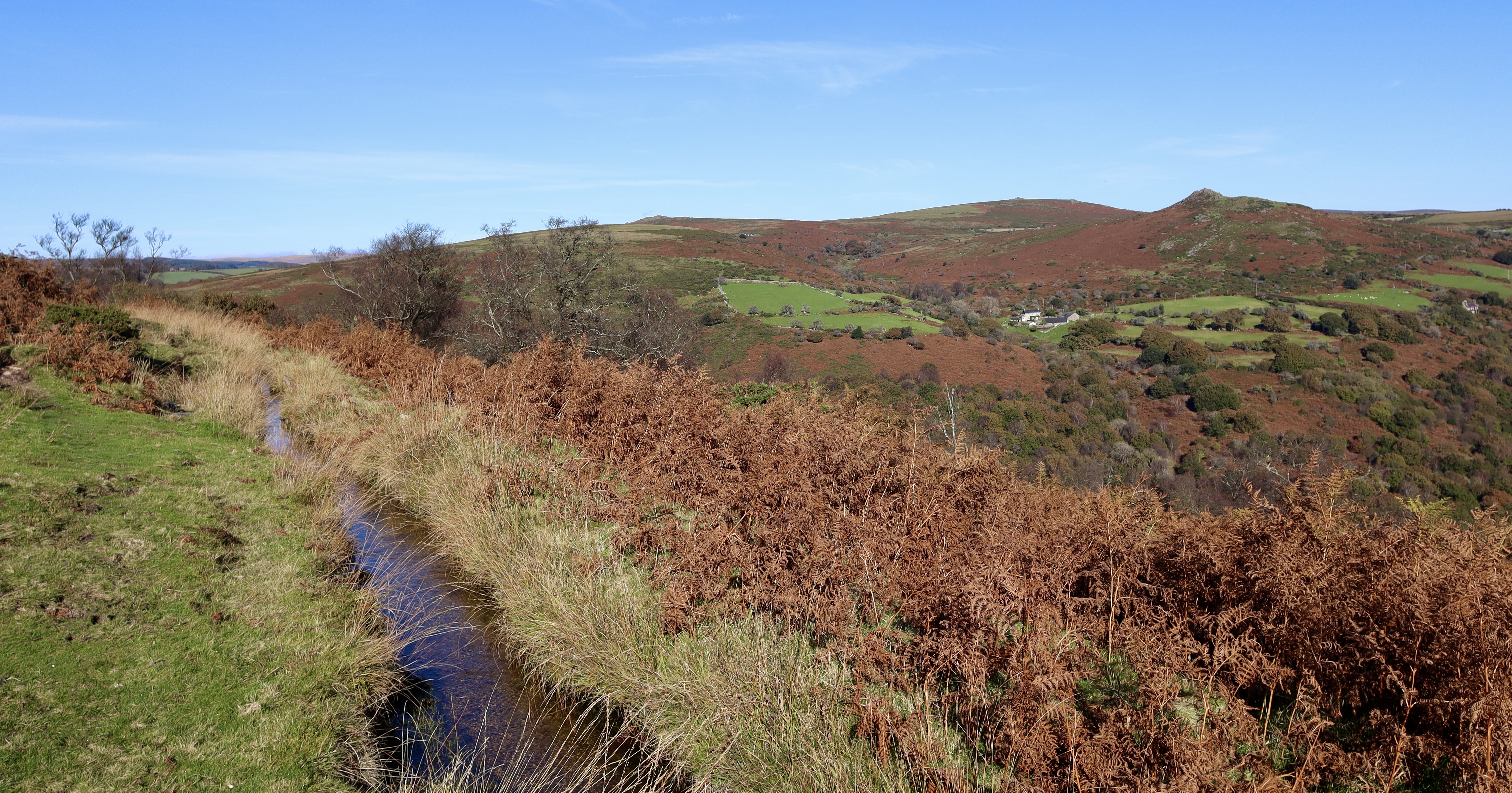
The views from the cross on a clear day like this are far reaching, overlooking the Dart Valley to the northeast, Down Ridge to the northwest and the peak of Ryder’s Hill to the South. Our next stop, Combestone Tor is also clearly visible, standing alone in the landscape, 750m downhill to the north, but before we make it there, a brief stop to check out some bronze age hut circles is needed.
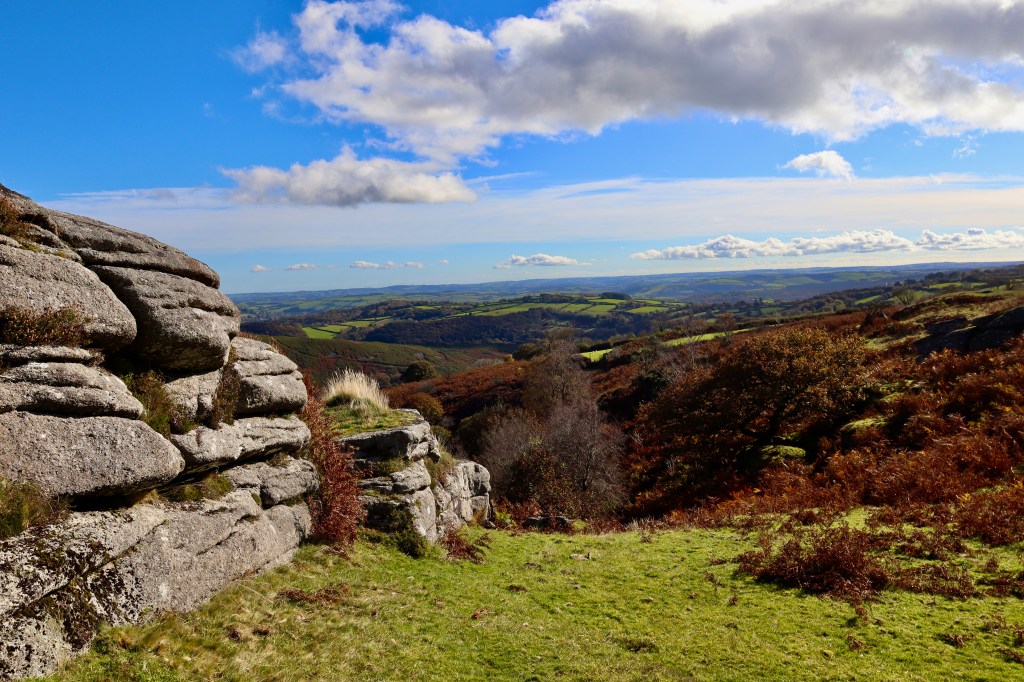
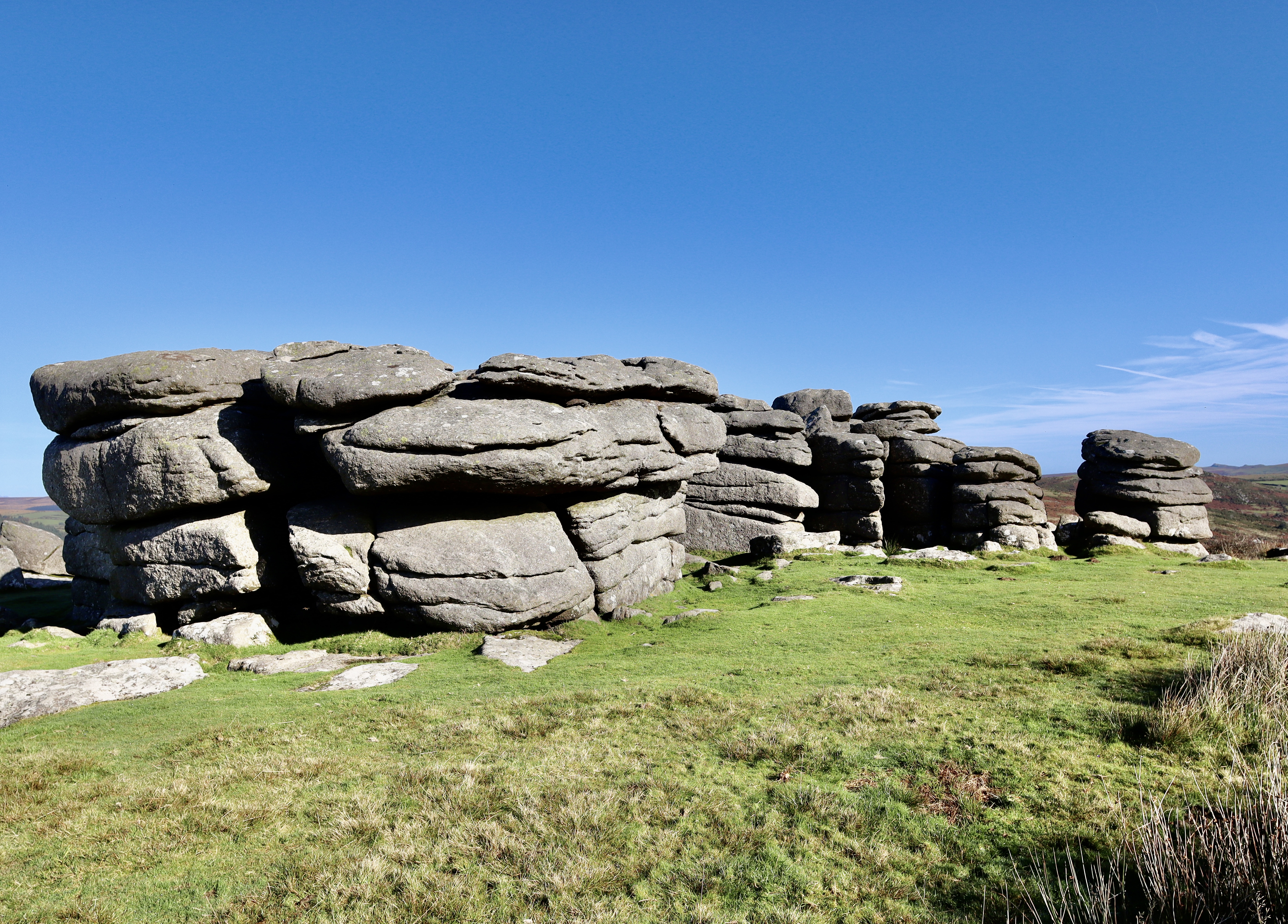
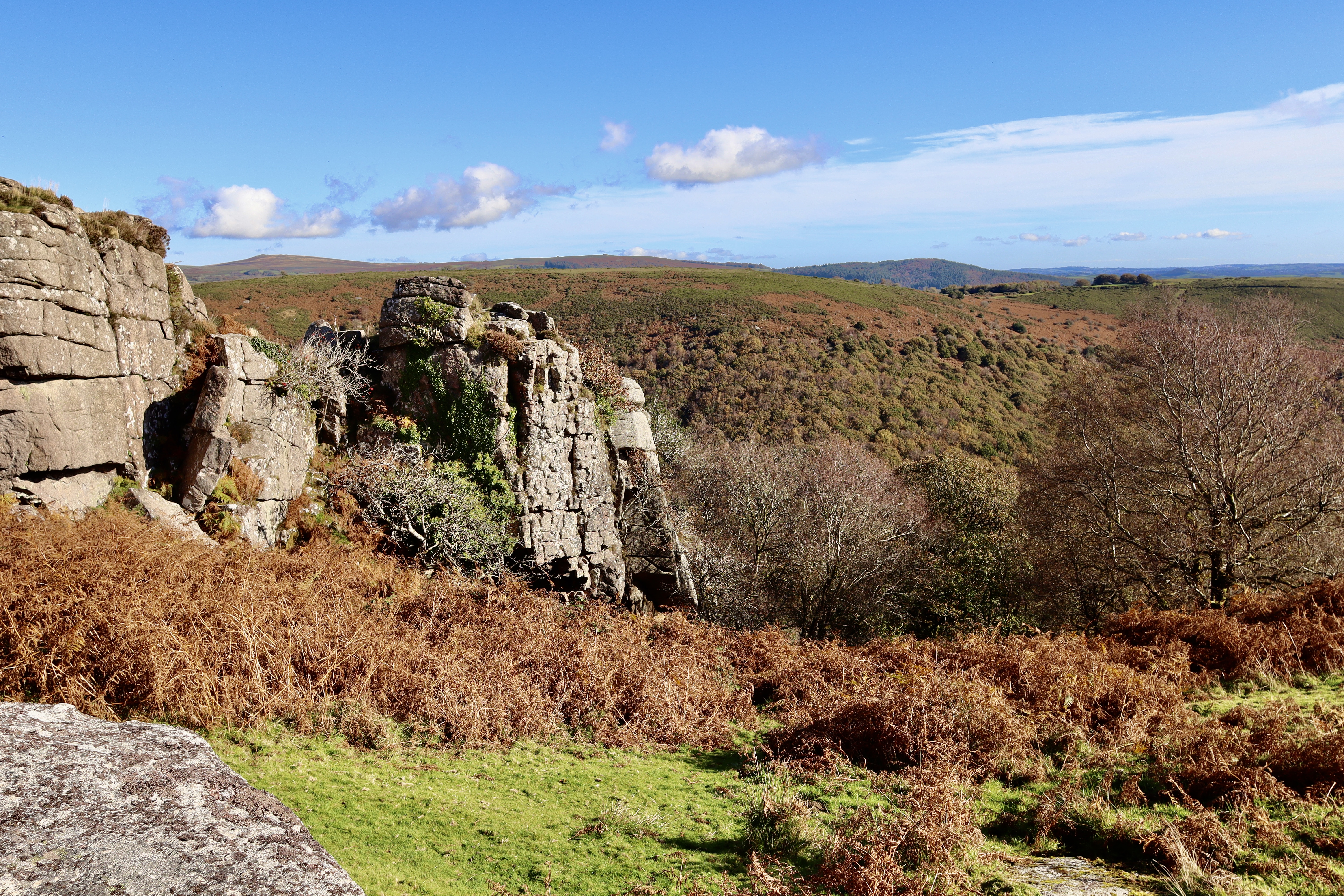
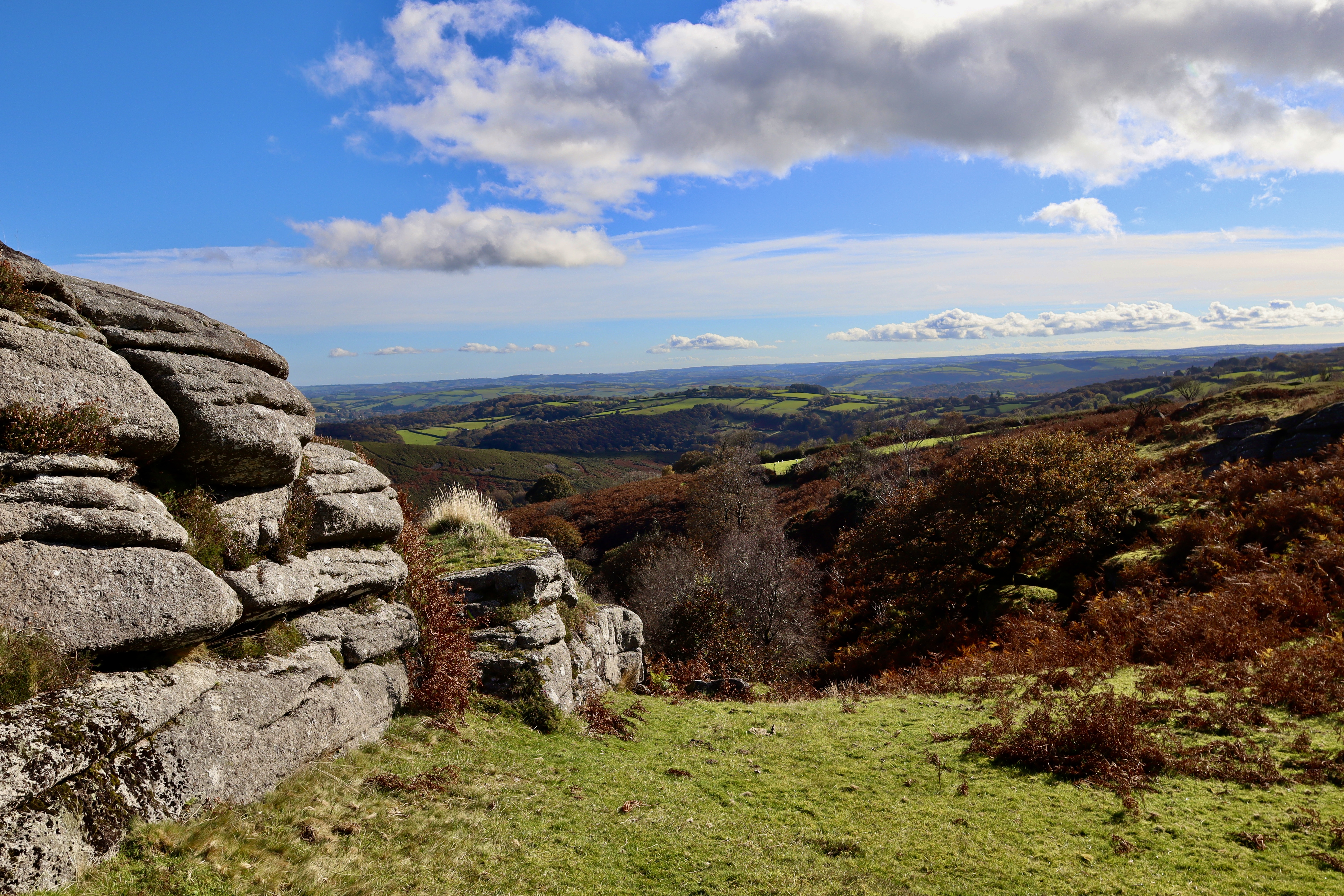
Combestone Tor
Combestone Tor is one of the most accessible on Dartmoor, with its own carpark just a few meters away. Combestone Tor is also one of the most stunning on Dartmoor, with its layered granite stacks standing in contrast to the surrounding landscape, and the avenue that the three distinct stacks creates, framing the views of the Dart Valley. Indeed, it is these views that set it apart, from many of its counterparts. The commanding granite Tor stands above the Dart Valley which drops down some 130 odd metres to the river below. Opposite Combestone Tor to the north, the view looks out over Yartor Down with its abundance of Bronze Age Settlements and to the Northwest, the majesty of Bellever Tor is apparent.
For the more geologically minded, the Combestone Tor demonstrates many of those features associated with Tor formation, jointing and erosion and the tor also hosts numerous Rock Basins. Where once thought to be the remnants of Druidic Ceremony’s (a theory particularly promoted by Mrs Eliza Bray), Rock Basins are a dish-like hollow which can occur on the top of a rock and are a product of localised weathering (or man-made for Druid ceremonies, depending on your view).
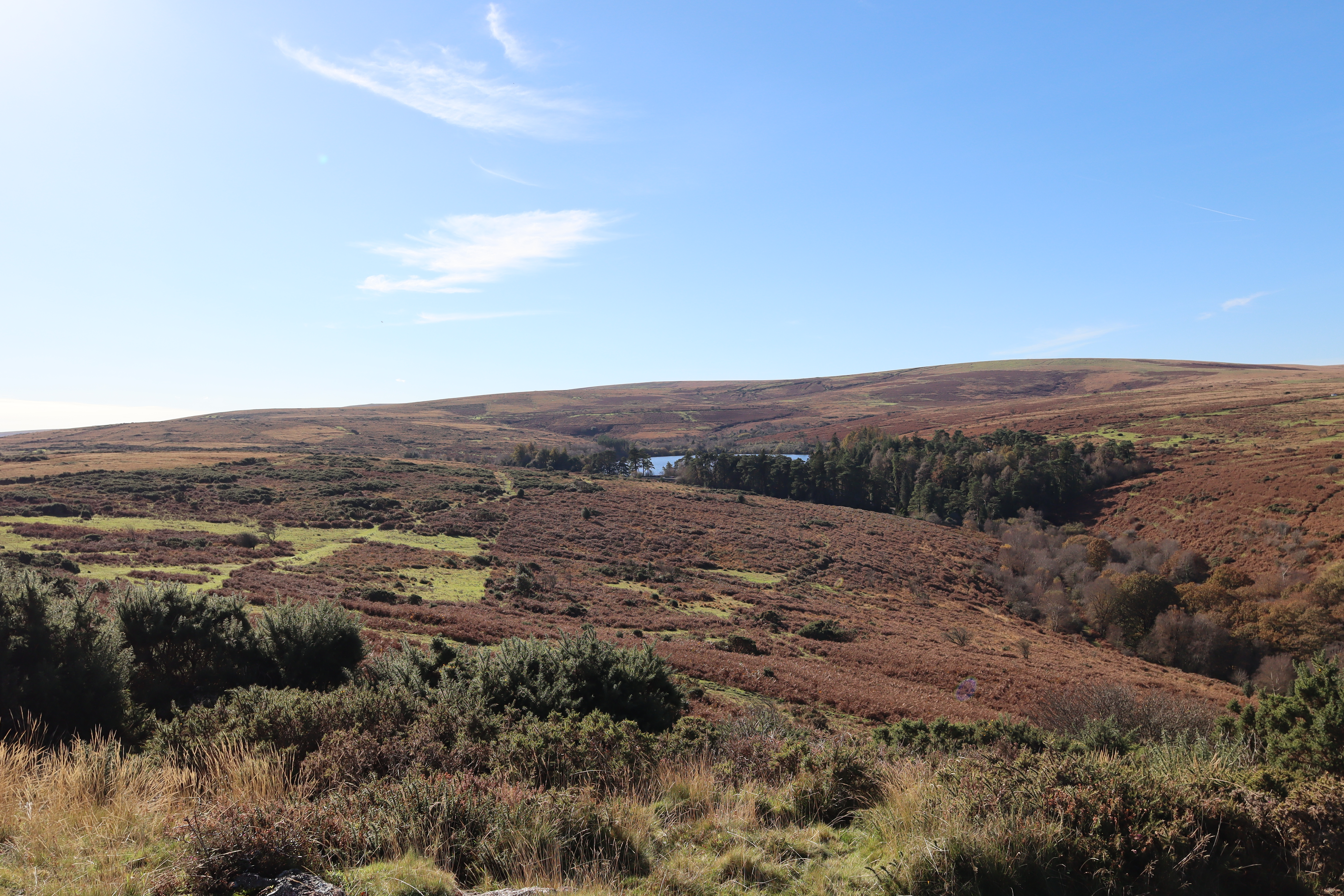
Hamlyn’s Leat
Leaving Combestone Tor behind, heading northwards downhill, we come upon Hamlyn’s Leat, which is one of the four main leats around Holne Moor which serves / served mines, farmsteads and the local communities. In particular, Hamlyn’s Leat was necessary to run a water wheel at the “Upper Mill”, a wool mill run by the Hamlyn family on the outskirts of Buckfast in the 19th century. The head of water provided by the Holy Brook wasn’t sufficient to drive the wheel, so the brook was supplemented with water from the high Moor, supplied via the Hamlyn’s Leat.
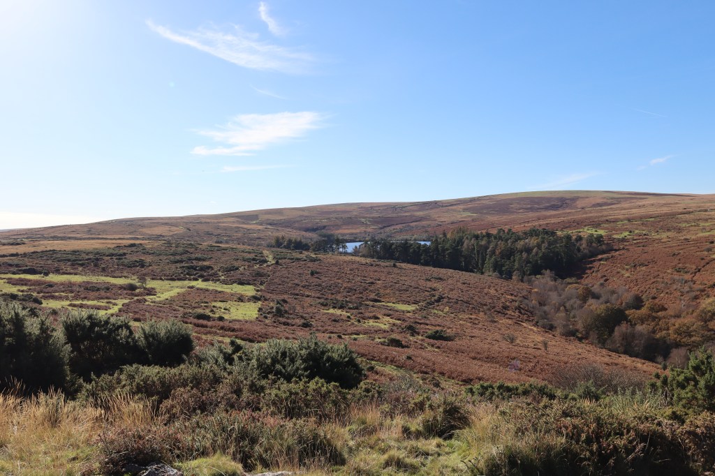
Bench Tor
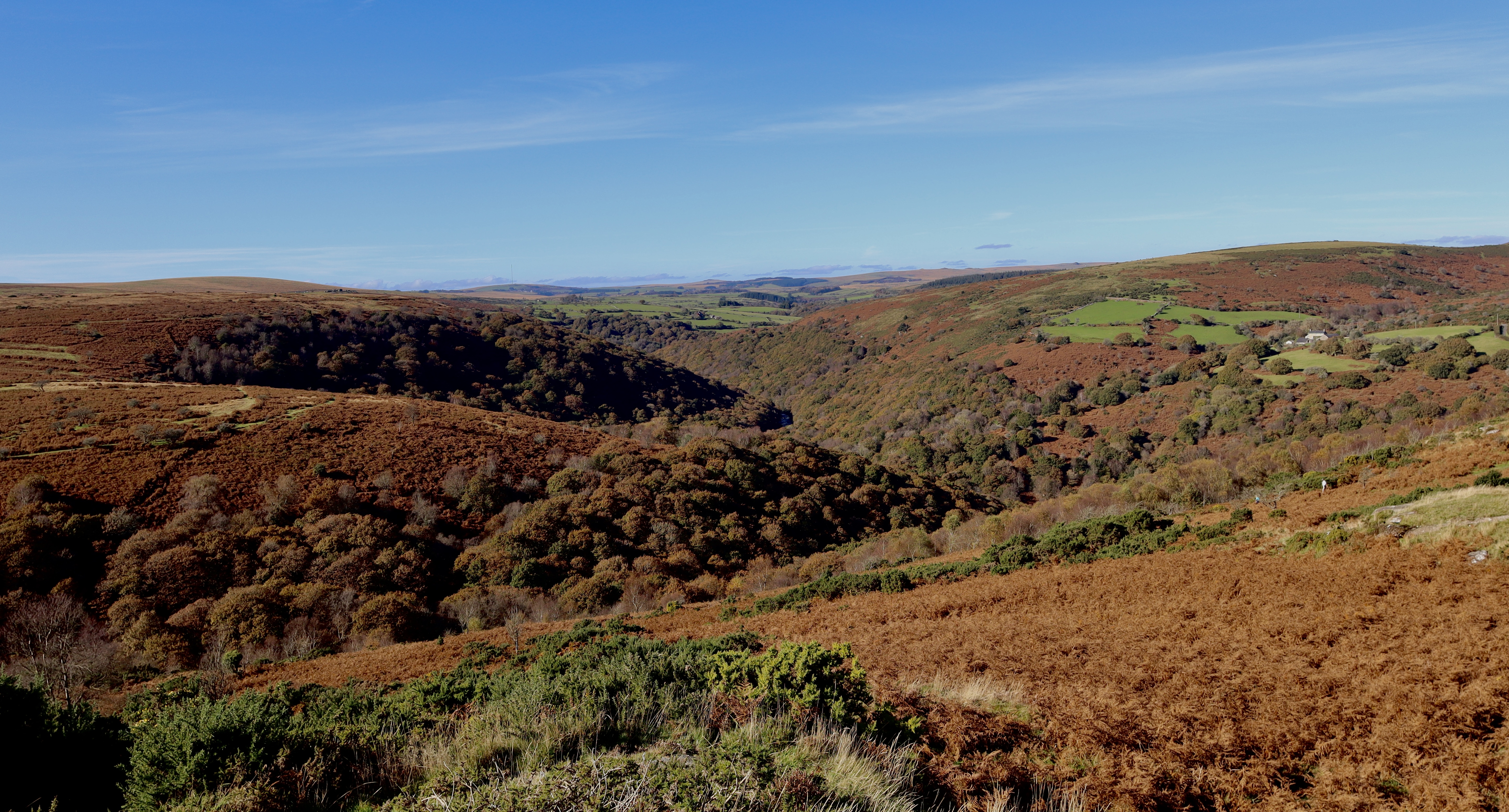
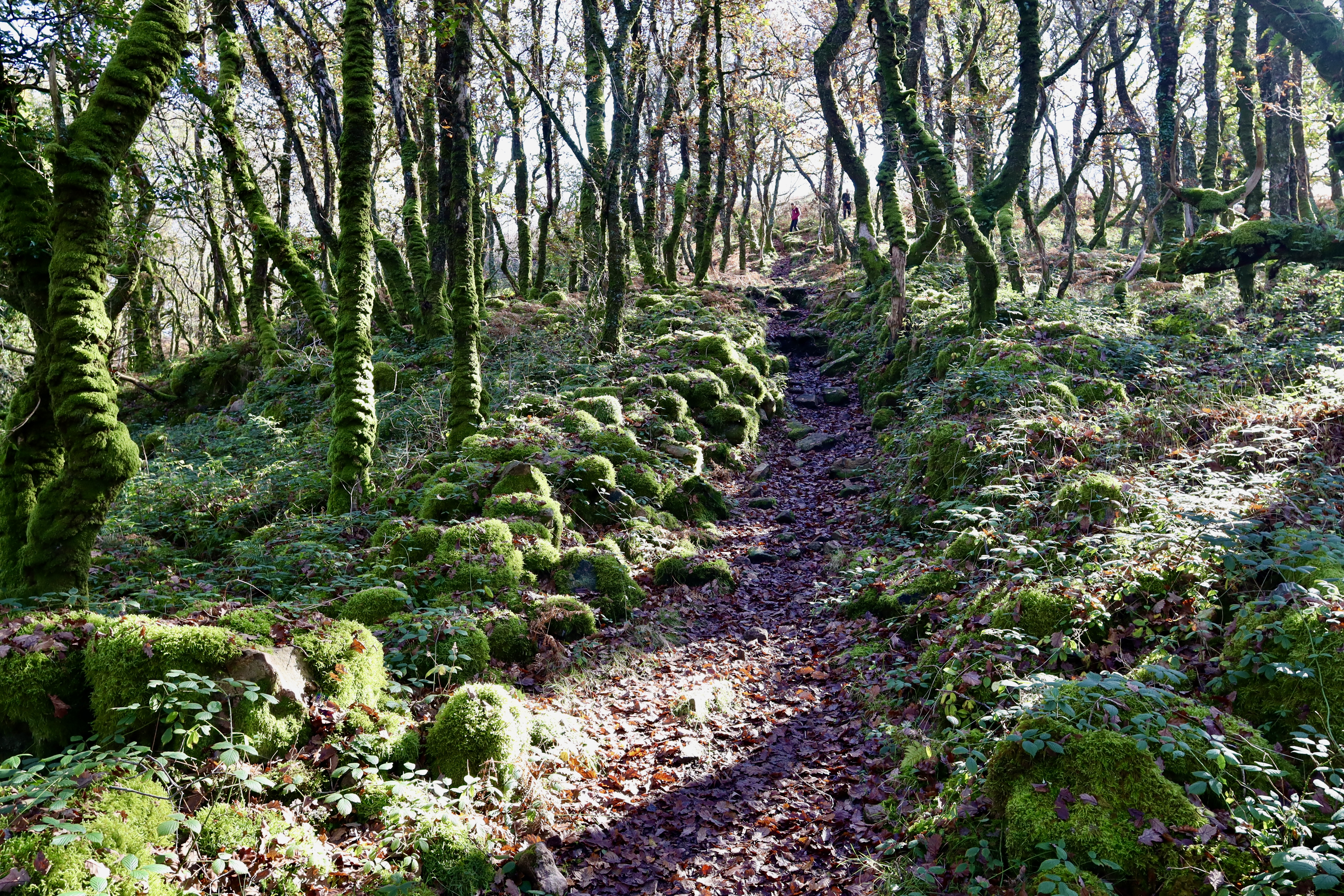
Hamlyn’s Leat is handrailed, across the variable terrain of Holne Moor, back to the carpark located on the western side of Venford Reservoir. From the car park, a trail leads north, down the steep western banks of the Venford Brook, which is crossed via some stepping stones. On the eastern side of the Brook, a path is easily picked up, which is followed for around 750m, where upon a non-descript trail leads, in between the ancient oaks and polypody ferns up the eastern slopes of Bench Tor.

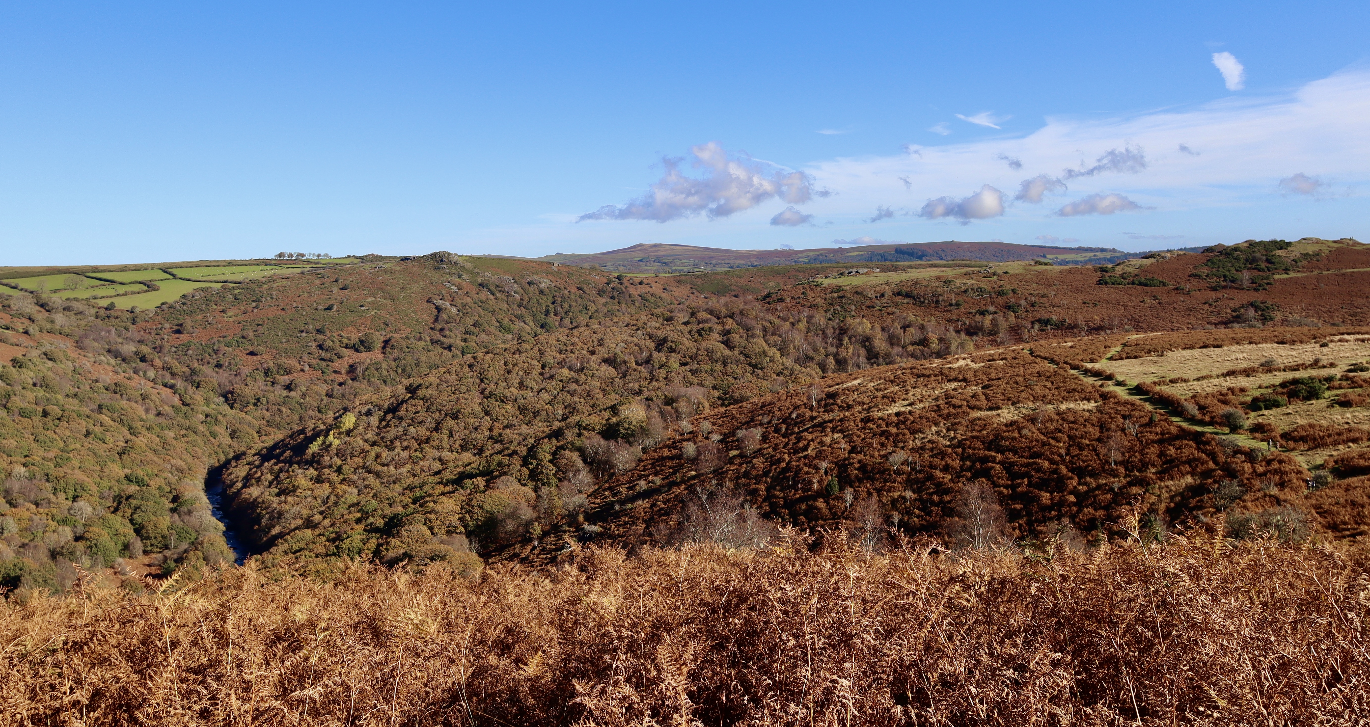
The climb is steep, but short lived and the views from the top of the Tor are more than worth it. Sitting in prime position high above the Dart Valley, Bench Tor stands sentinel above the meandering and turning River Dart. With views not just over the river, but encompassing Luckey Tor, Mel Tor, Hockingstone Tor and Aish Tor, it would be easy to sit and while away the day with these views, which is exactly what I do, cracking out the stove and brewing up a Hot Chocolate, basking in the warming winter sun and reflecting on the walk, which is nearing its end as a trail leads off Bench Tor and back to the car park.
| Difficulty | Distance | Navigation Required? |
| Moderate | 8.5km | Yes – Handrailing, Bearings, Contouring |
| Grid Reference | Safety | Footwear |
| Start / Finish SX688 708 | River and Road Crossings Poor Underfoot Conditions General Dartmoor Considerations | B1 |


Leave a comment