This is a walk I first did before I even moved to Devon about 4 years ago. And it’s one I’ve only repeated once in that time about 2 years ago.
Lakehead Hill Kistvaen and Stone Row
Having parked up at the Bellever Forest car park, located just off the B3212 and on the opposite side of the road to the national park visitor centre, the walk starts by heading south, up the hill into Bellever Forest.
Bellever Forest really is a must see for anyone visiting Dartmoor, and indeed should be a frequent stop for those of us lucky enough to live here (and I will admit to not accessing the forest as much as I should). The well-marked trails lead through corridors of spruce trees, accompanied by the smell of pine, sound of birdsong and incredible archaeology. Bellever Forest provides a perfect start, to take in the sense of calm that will accompany you on this walk.

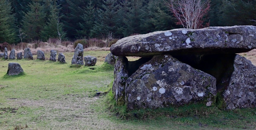
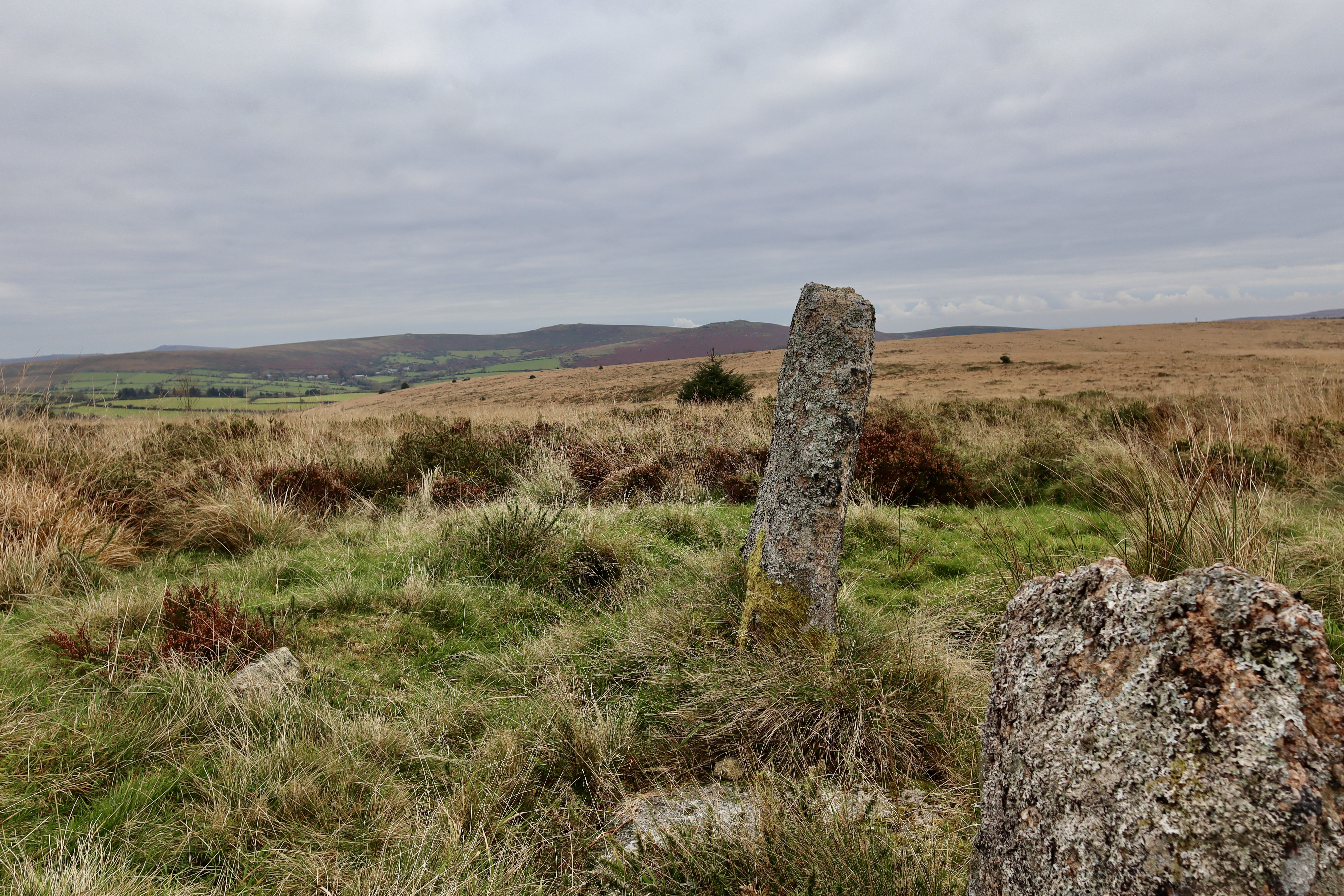
As the hill that starts the walk begins to level off at the top of Lakehead Hill, the path provides a fork. Taking the right-hand option and continuing along the path, after about 250m a grassy trail leads off the main path. Following this is highly recommended, as it takes you to one of the many ancient monuments in this area, with a bronze age Stone Row leading to a Kistvaen.


The Kist consists of five massive slabs, capped by an equally massive capstone. Leading off the kistvaen, a stone row runs downhill, with eleven stones standing in the row and evidence of space for a couple more. The Dartmoor Exploration Committee restored the kistvaen and row in 1895, after no finds were found within the burial chamber.
Although not explored on this walk, Lakehead Hill contains an abundance of ancient archaeology and so a walk around the “History Hunters Trail” (https://www.forestryengland.uk/bellever-forest/history-hunters-trail-bellever-forest) is well worth it, with an abundance of cairns, stone rows and Kraps Ring, the only settlement around Bellever that has remained relatively undisturbed by the 1921 forestation of the area.
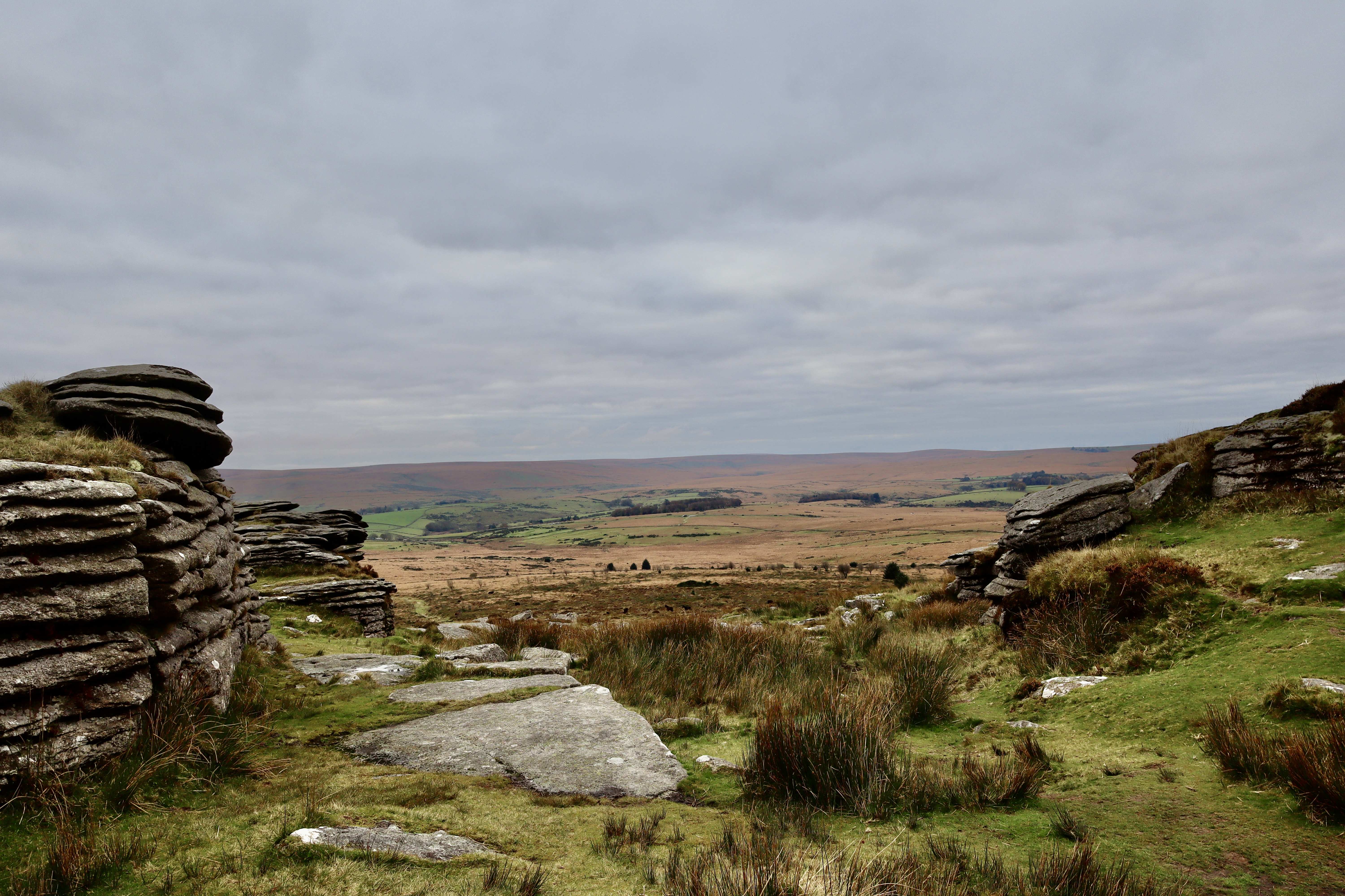
Bellever Tor
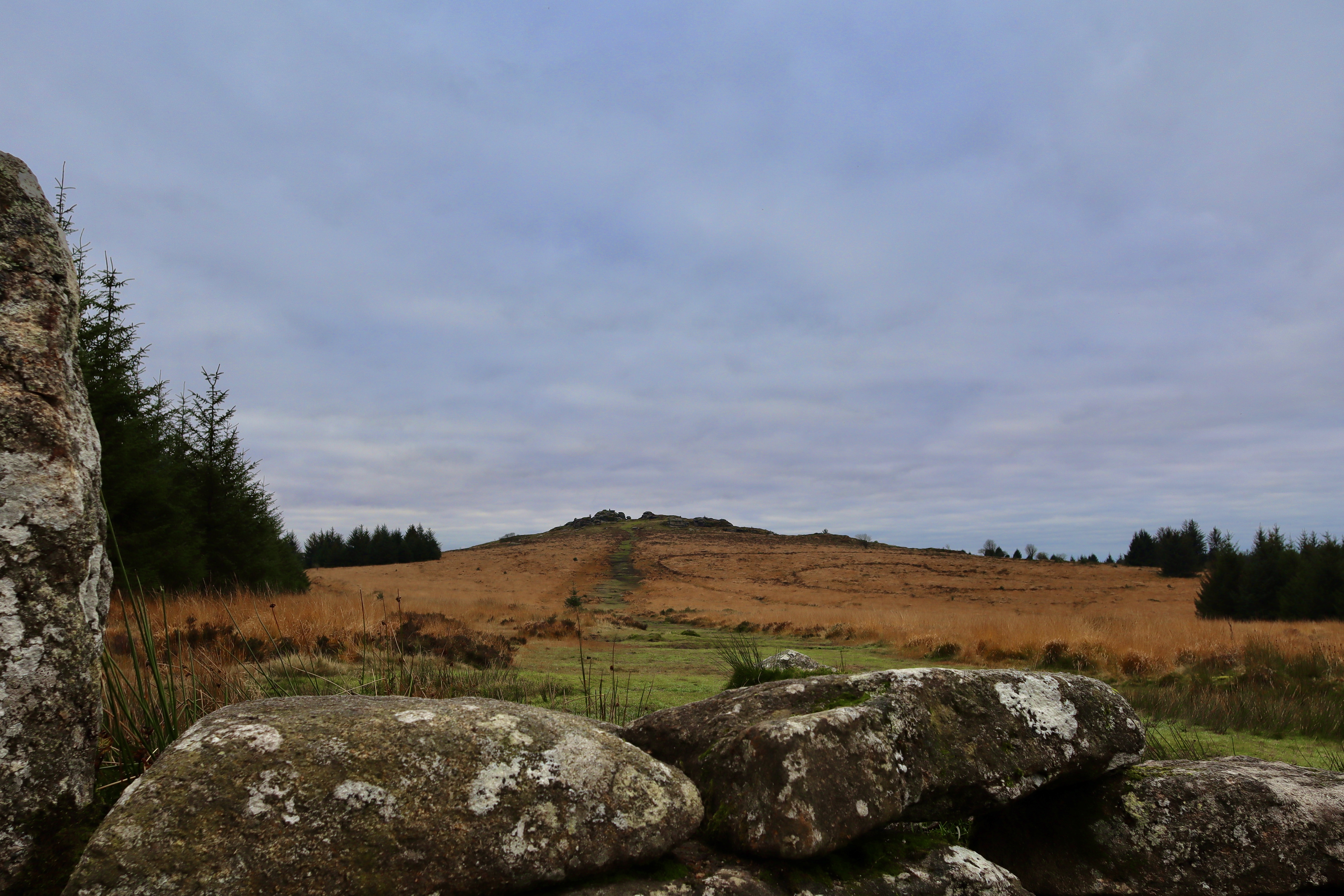
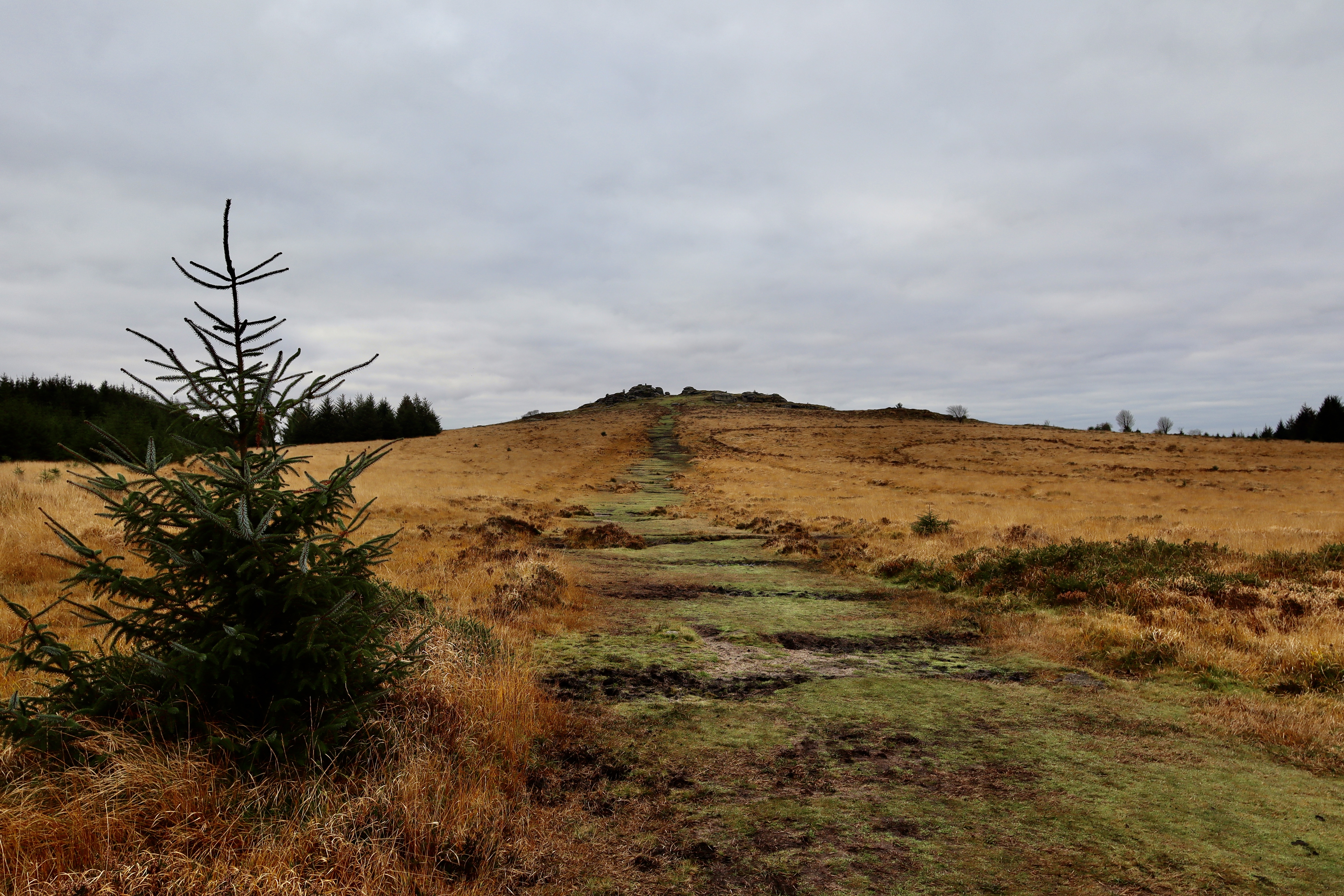
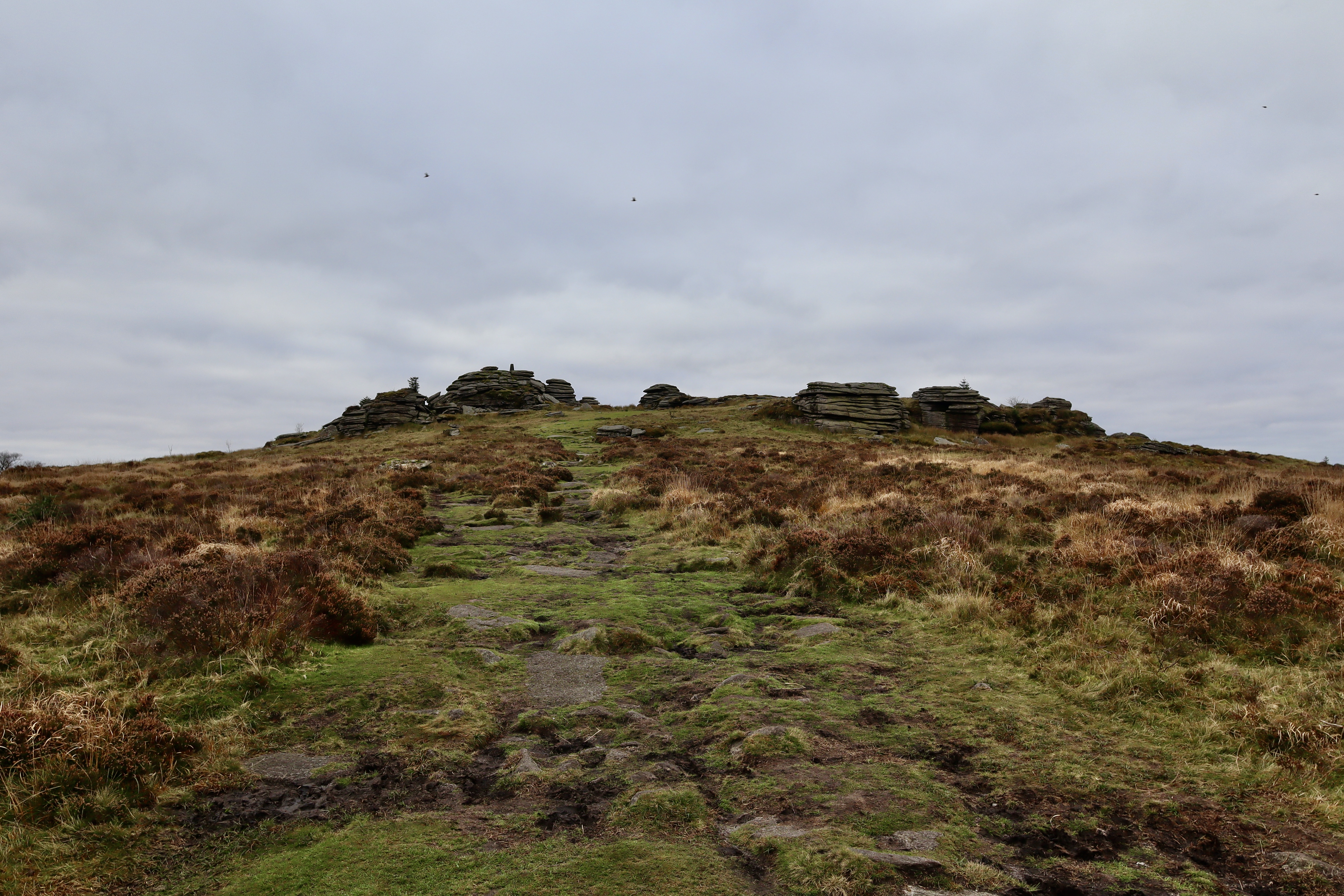
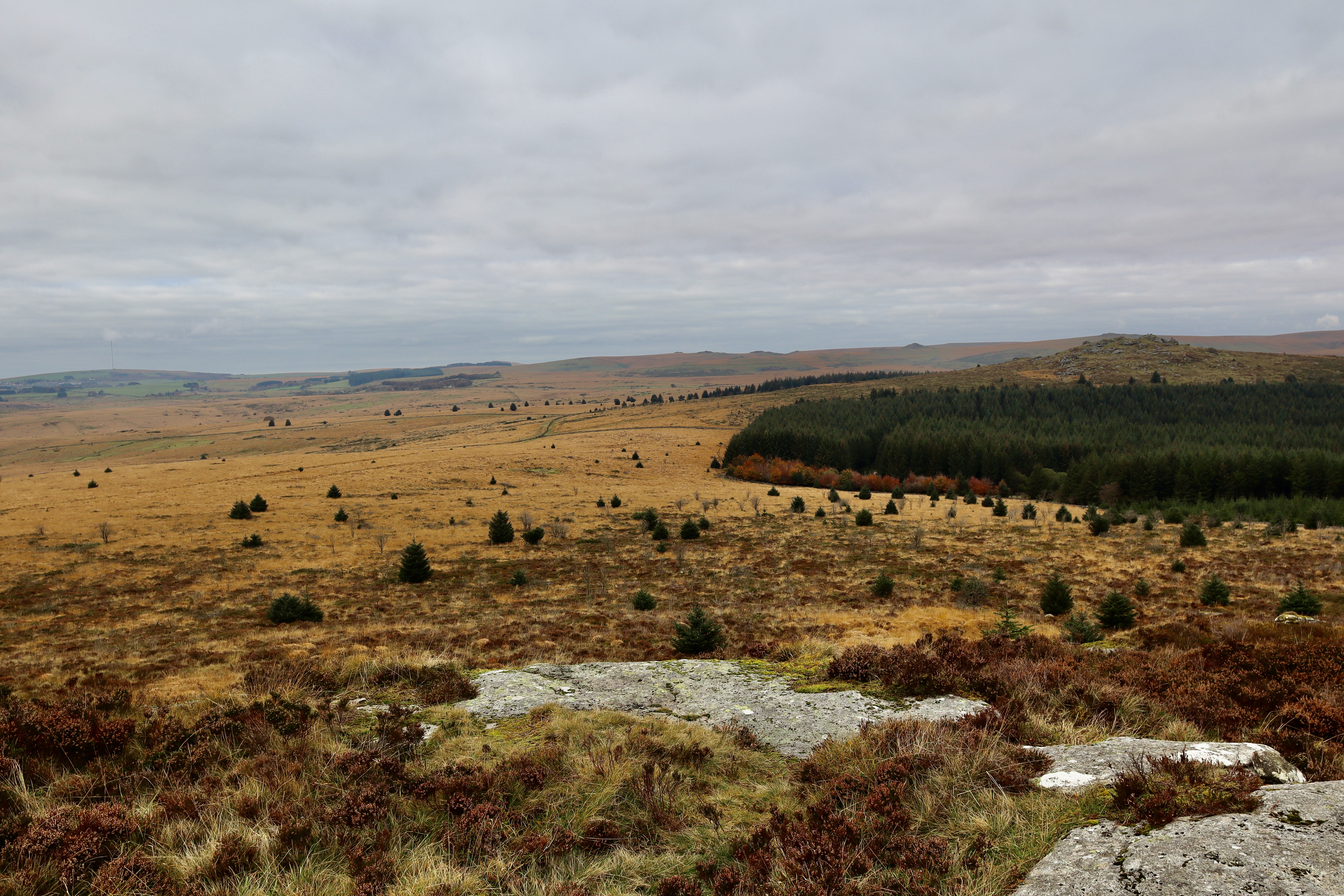
Having retraced your steps back to the main path after a brief sojourn at the ancient monument, after 500m the path again splits. Taking and following the right-hand path once more, the view opens out, away from the well managed trees and onto open moorland, Bellever Tor standing watch over it all. The route to the top of Bellever Tor from here is obvious, even when visibility is poor, as the wide green/muddy boot worn trail stands in contrast to the long, golden brown of the moor grass either side.
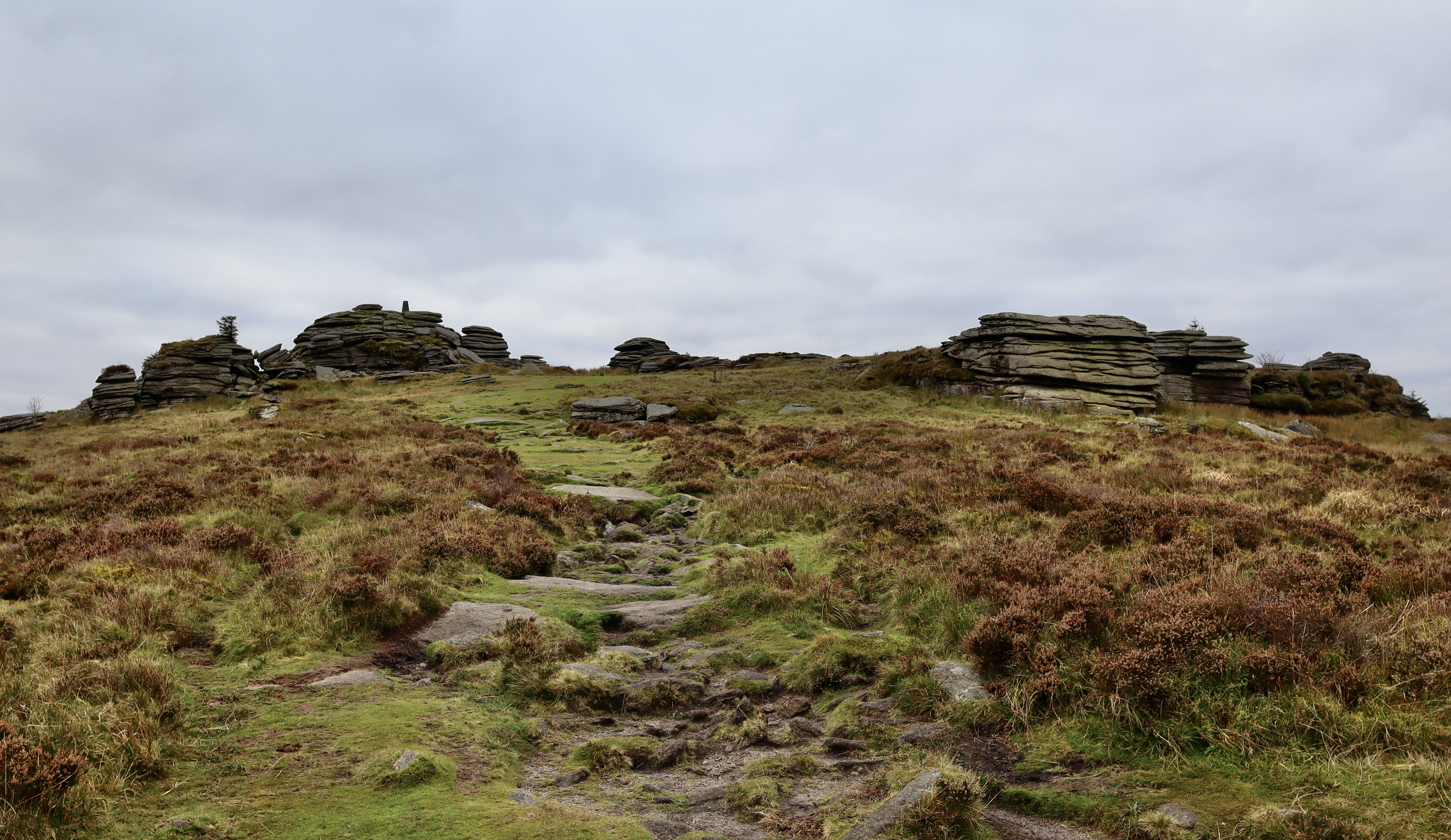
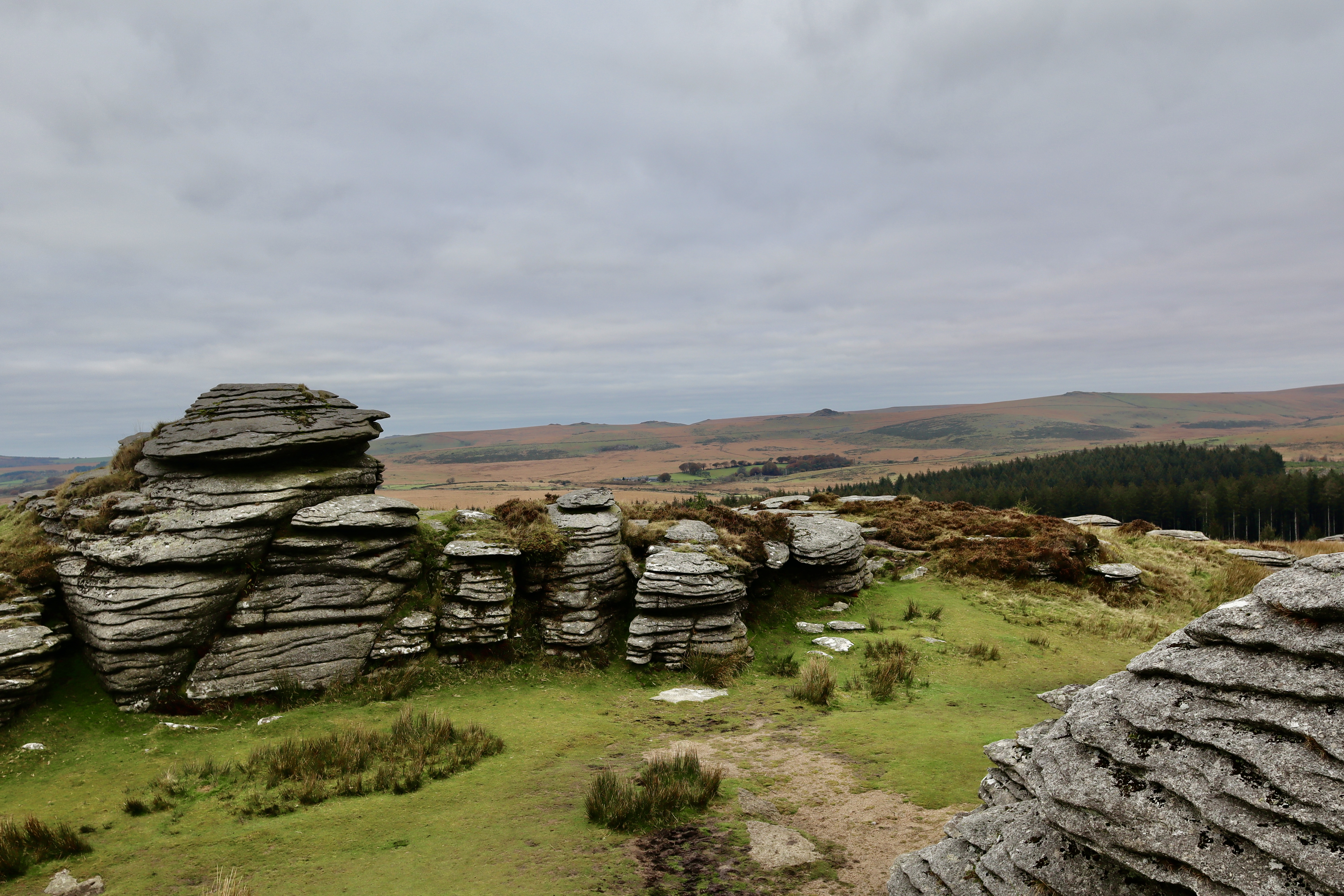
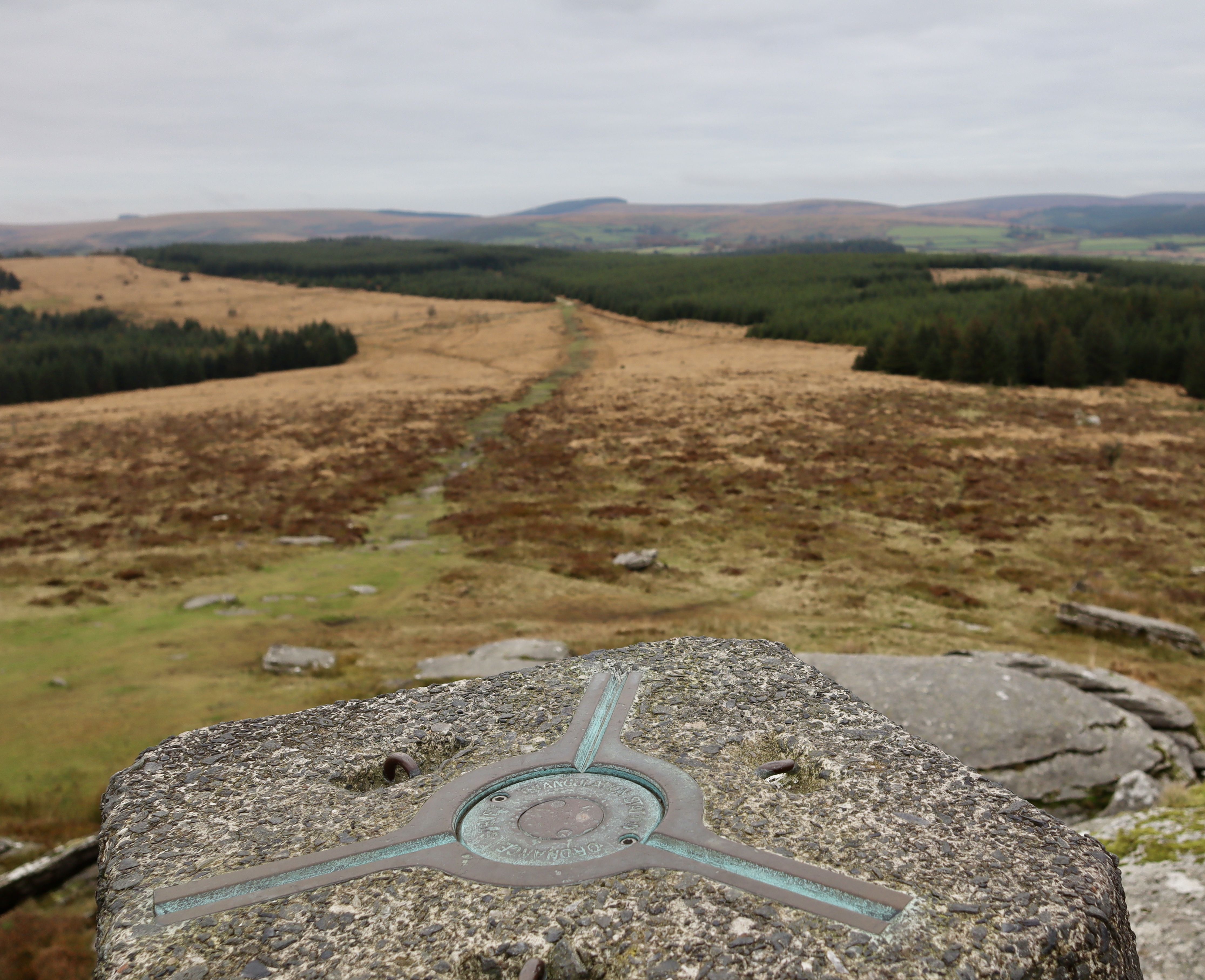
Bellever Tor is one of the best on Dartmoor. Despite it only being 443 metres above sea level, Bellever Tor is visible for miles around and offers up unrestricted, 360° panoramic views across Dartmoor and the summit is crowned by the presence of an Ordnance Survey Trig Point Pillar. Alongside the views, Bellever Tor is steeped in the piskie folklore of the Moor, and is particularly associated with the tale of the lovestruck Tom White, my retelling of which can be found here.
Having sat on the top of Bellever Tor for a good half an hour enjoying the view, peace & quiet and autumnal fresh air, whilst supping on a freshly brewed hot chocolate, I decided it was time to pull myself away from the Tor and continue my walk.
Laughter Tor Menhir and Stone Row
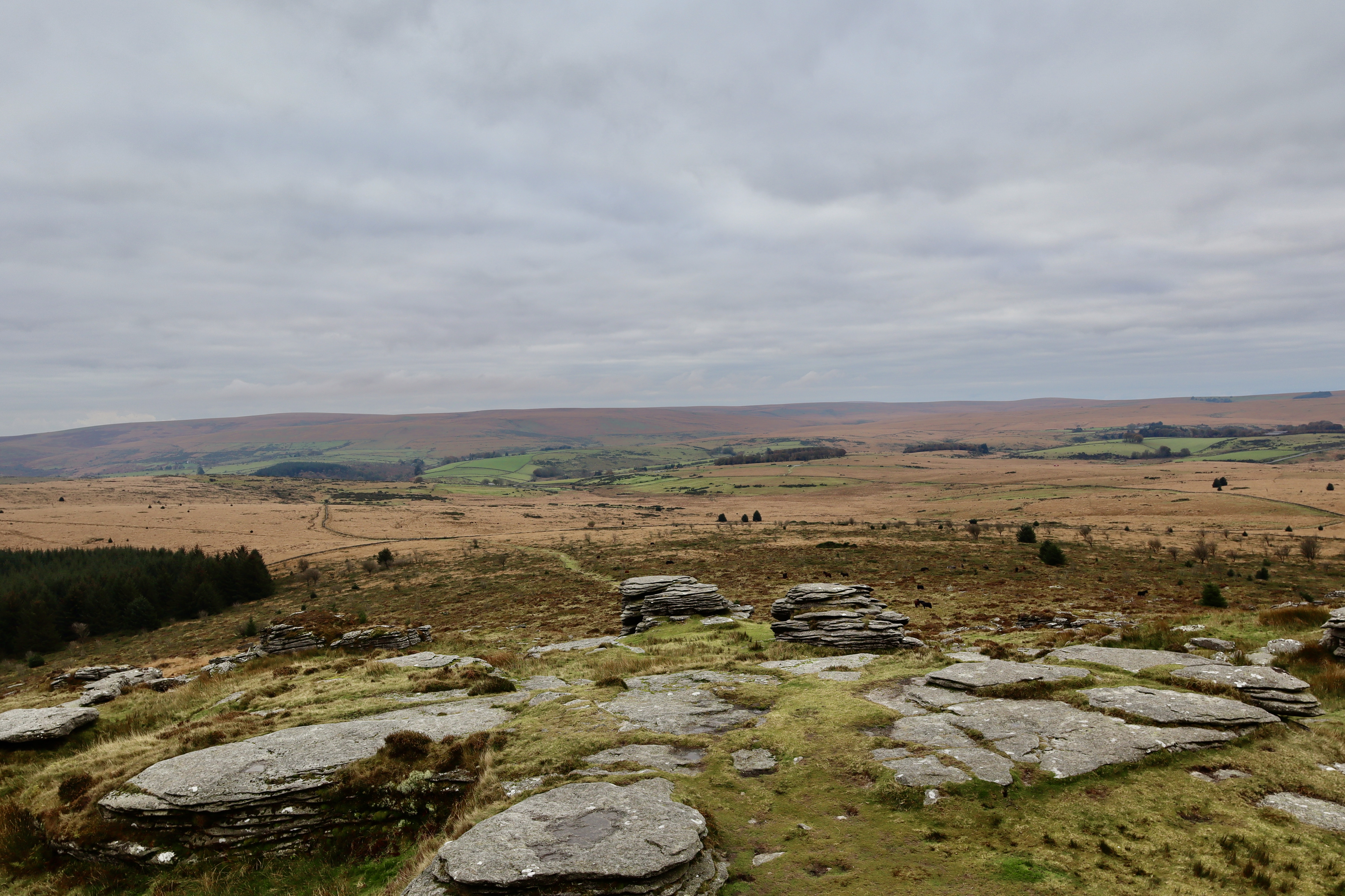
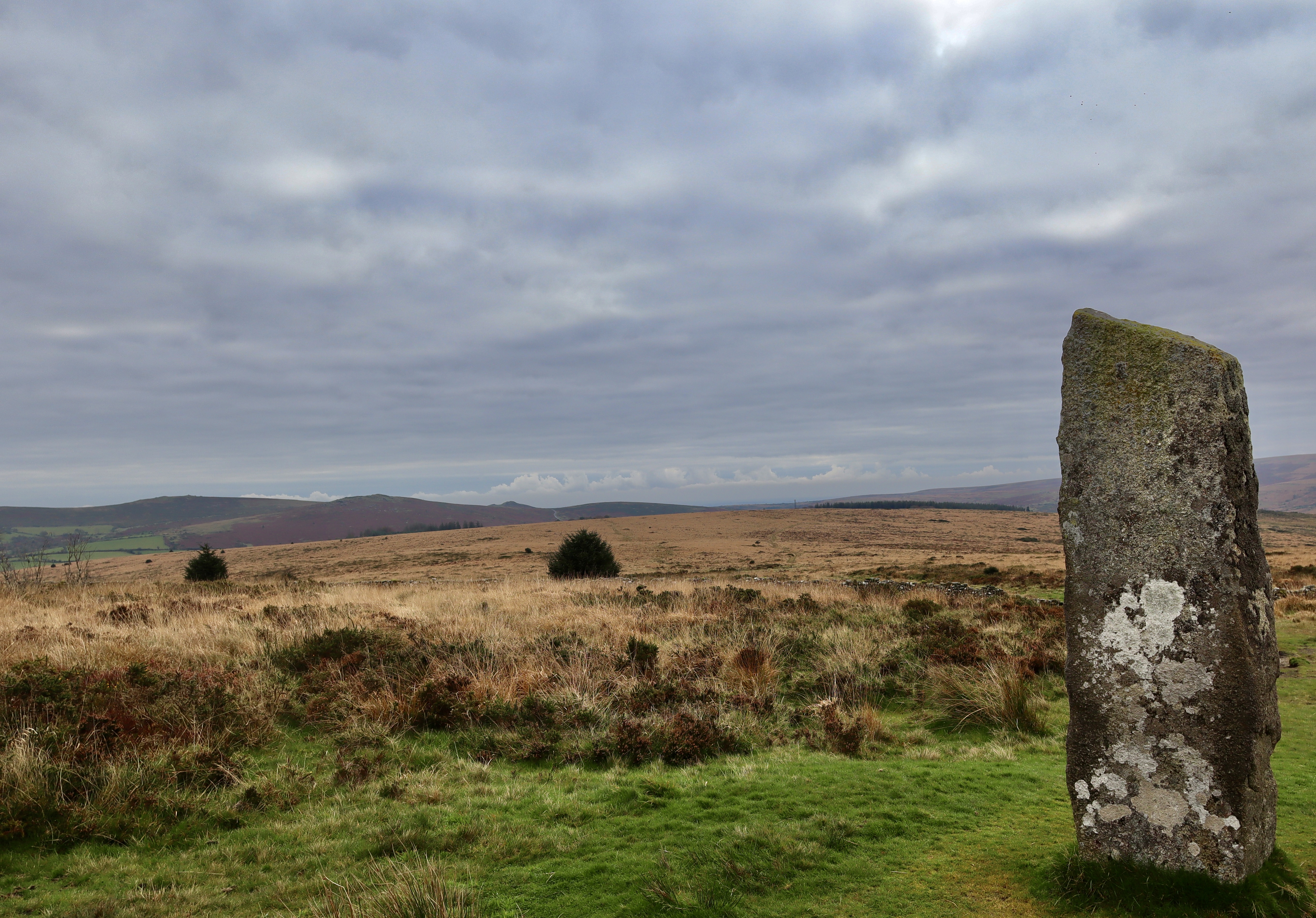
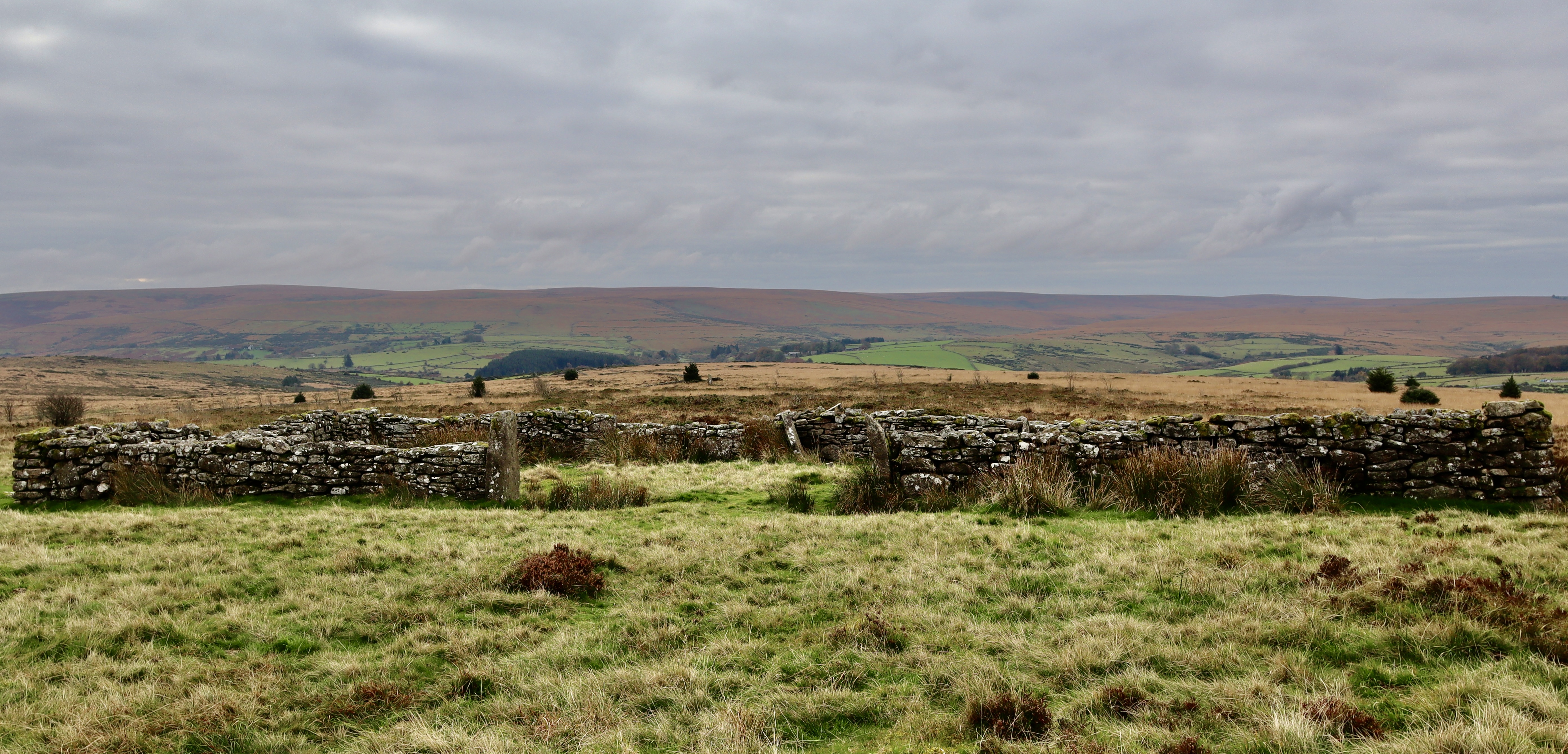
Walking off the south side face of Bellever Tor, a grassy trail meanders its way through a herd of ponies, grazing in the autumnal grass and flanked by heather, gorse and bilberry. After about 500m it reaches a wall and continues through a gate (the gate is locked so it actually requires using a stile and the then another gate to get through) and continues in a southeasterly direction. Walking this path feels much more like walking over the wilds of the moor, away from the managed beauty of Bellever forest and into the chaos of bog, tussocks and open expanse. The path gently turns away from Laughter Tor and takes you to the crest of the hill, where upon you come to a Menhir, a standing stone that is known as the Loughtor Man.
Although the Loughtor Man isn’t at the peak of a hill, it is relatively tall at around eight feet, and as such, is reasonably visible from a fair distance. The menhir is found in the centre of what was a cairn, which was excavated in 1903 by Burnard who discovered large quantities of charcoal and what appeared to be peat ash.
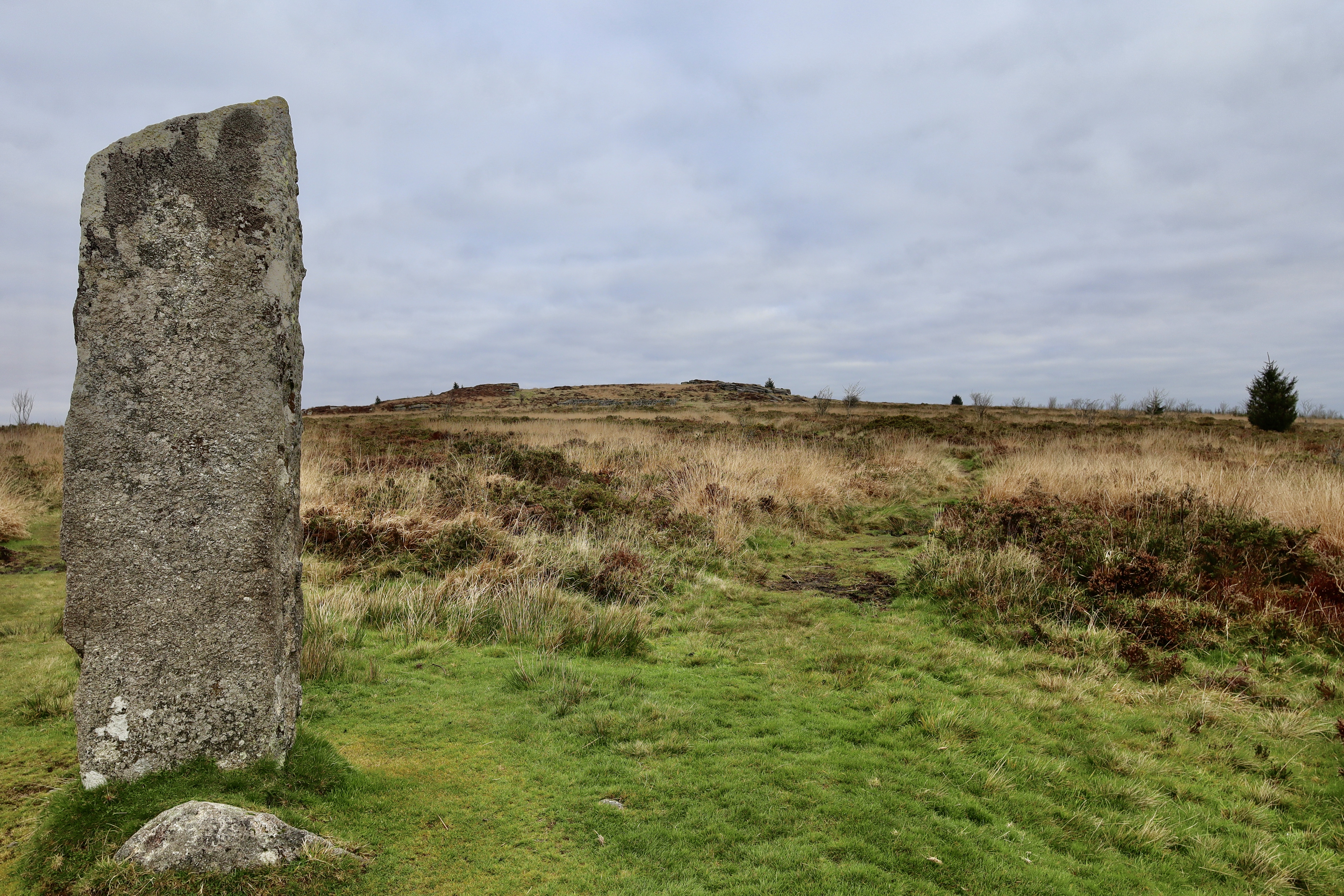
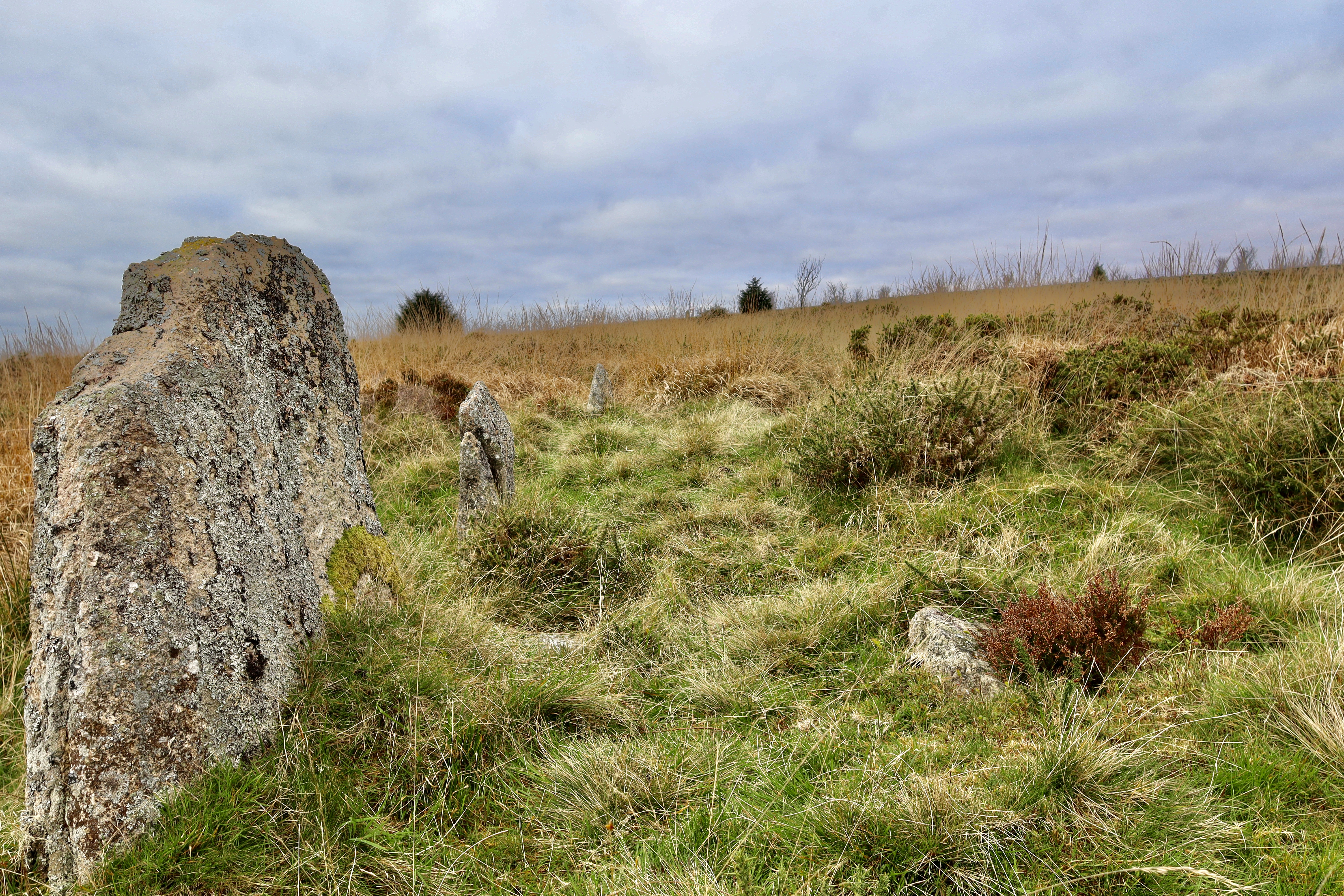
Continuing along the trail, away from the standing stone southeast, you pass through a stone wall. As soon as you do, follow a bearing of 101° (or aim behind the bulging Spruce tree – please note the path on the OS Map 1:2500 (OL28 2021/06) is not reflective of the actual trail we’re following here) 120m, hidden amongst the grass is a subtle but obvious stone row, our second of the walk. The remaining stones (I suspect a lot of the original ones can be found in the aforementioned stone wall) act as a monument to what was once a much larger feature and, through combining with nearby stones, the original construction would have been around 164m long.
When looking back along the stone row from the southeastern edge, it looks straight at the standing stone. The truth is there are more spectacular stone rows on Dartmoor, but there is something about the subtlety and unobtrusiveness of this one that appeals. Standing alone in the open moor, with nothing but birdsong for company, you really can feel a sense of connection to the ancient moor folk that called this place home.
Laughter Tor
From the stone row, I retrace my steps to the standing stone and take the trail north, past the foundations of an old building (I assume a barn but can find no info on it) and onto the top of Laughter Tor.
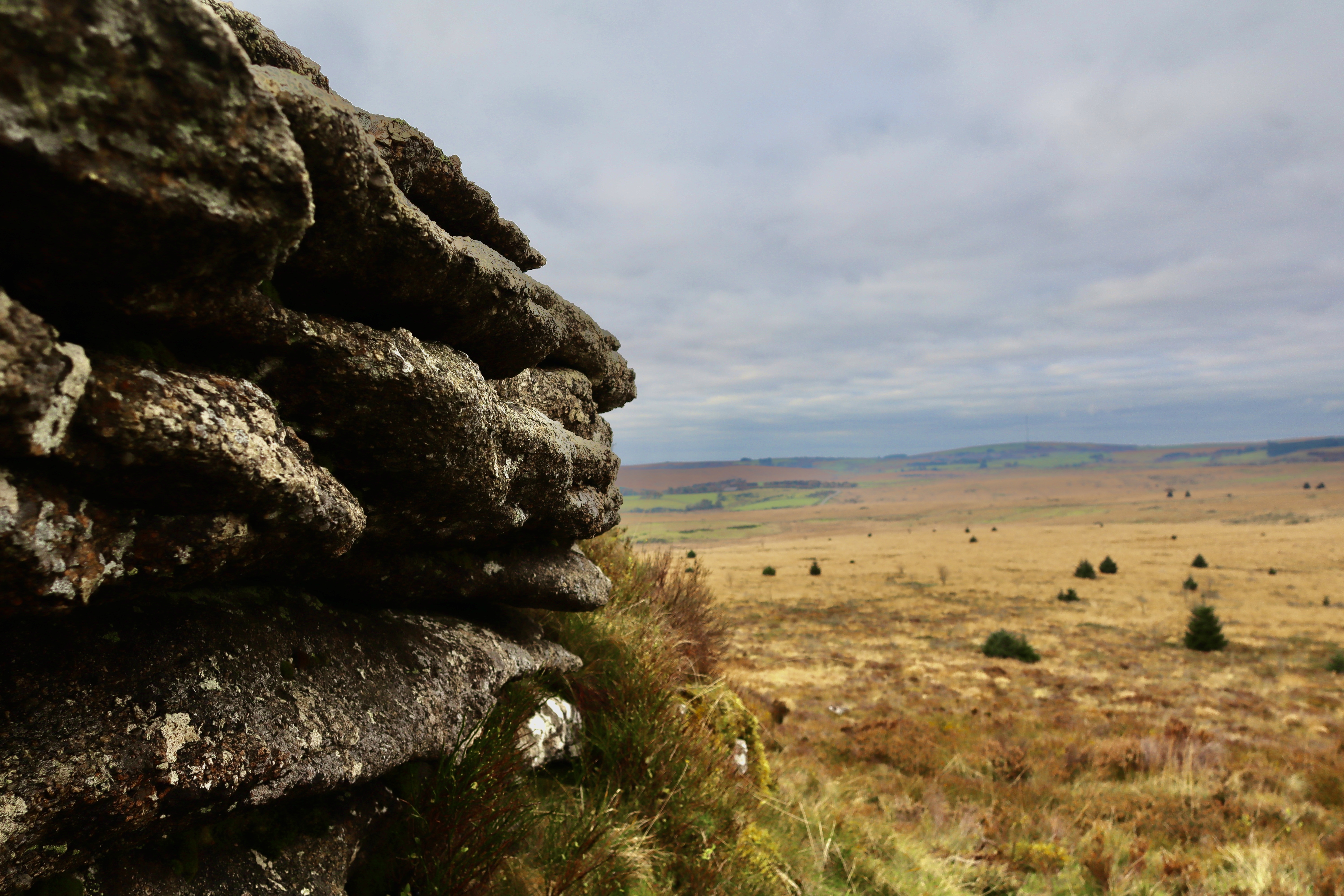
Laughter Tor itself is relatively nondescript, with the moorland flora mixing in with the granite of the Tor. I think even the most enthusiastic geologist would find the tor itself relatively uninteresting, and so the attraction of it really is the surrounding ancient archaeology (of which the Menhir and Stone Row is only a small selection), wide ranging views and sense of uninterrupted peace from the top (oh and there is a letter box too if you look around enough).
Bellever Forest Hut Circle
From Laughter Tor, I head northeast until I come upon the stone wall. I handrail this wall (so you are on the Laughter Tor side) north-westerly, and before it kinks to the southwest, a gate into the forest is available (although again, the gate is locked so a stile provides access). From here, the path leads northeast. As you continue down this path, there is a noticeable change in the trees, from the Sitka Spruce trees that make up the overwhelming majority of the forest, to European Beech trees. At this point the whole atmosphere of the forest changes, to one that feels more ancient, more natural and in a strange way, more foreboding.
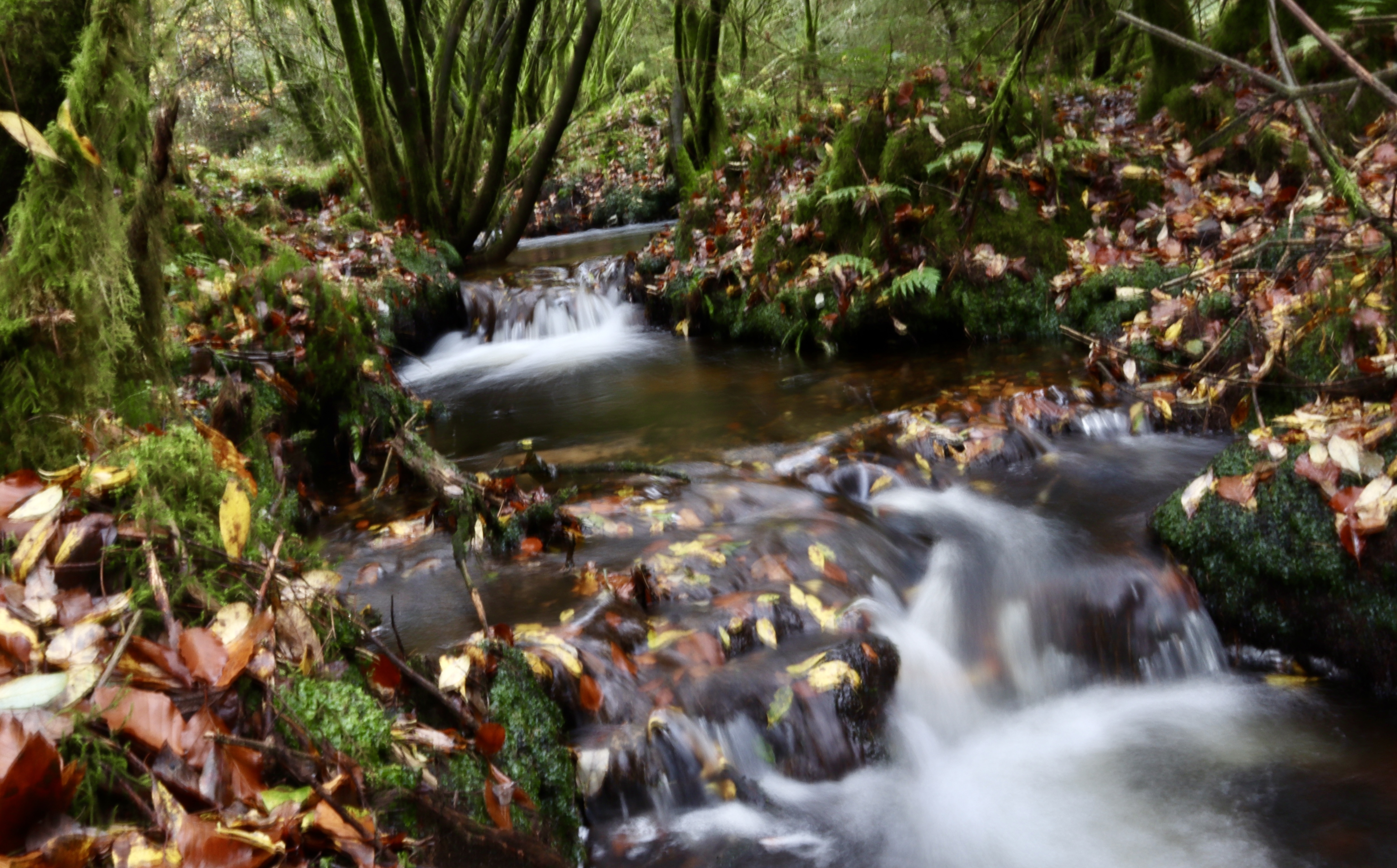
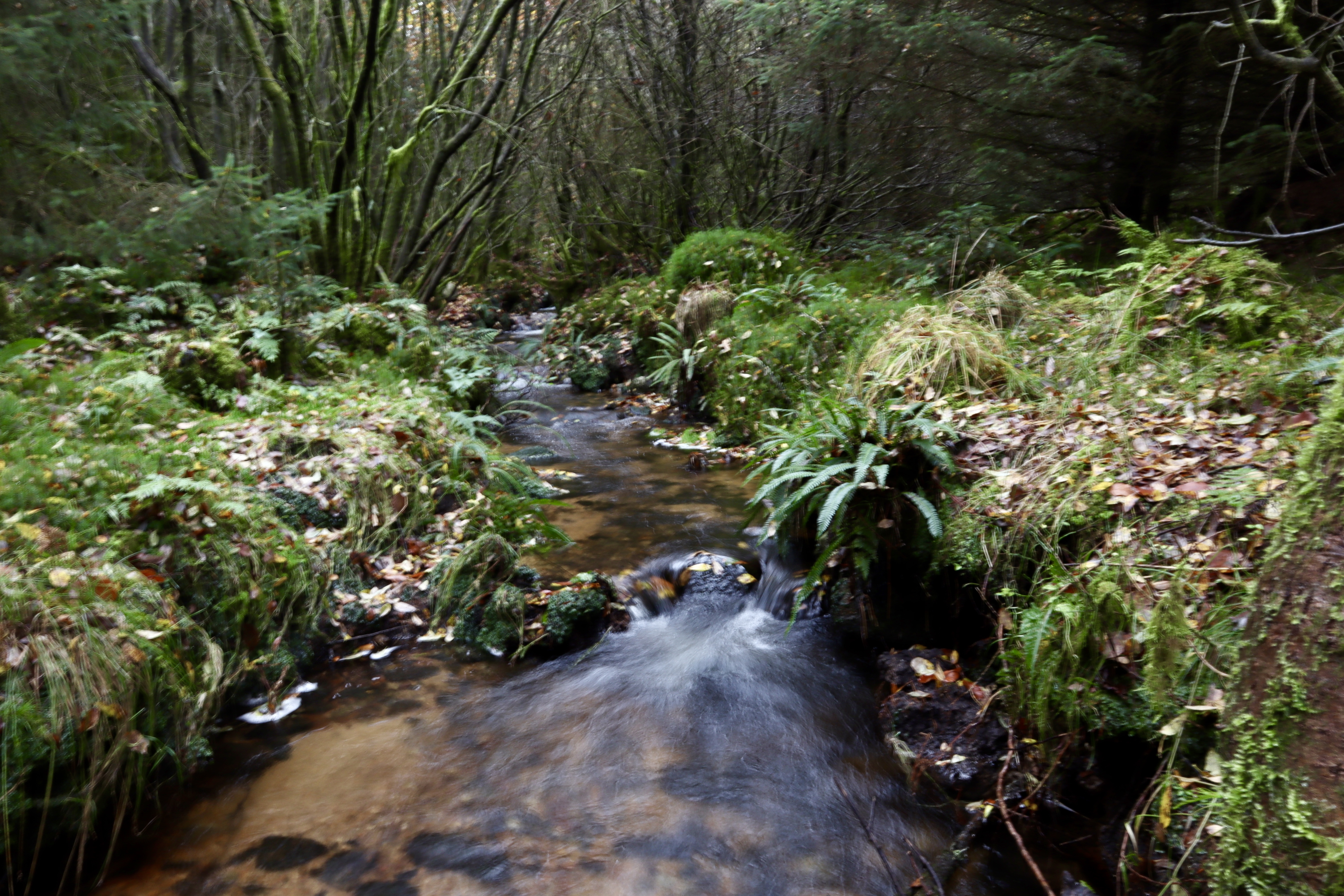
Following the now leaf littered path the trees once again turn back to Spruce after around 30 meters. At this point, I leave the path and follow a trail into the woods. Once again, I notice the atmosphere change, as the air becomes more still and sounds are dampened. Continuing to the west along a boot worn trail, I cross the flowing stream that tumbles into the East Dart River.
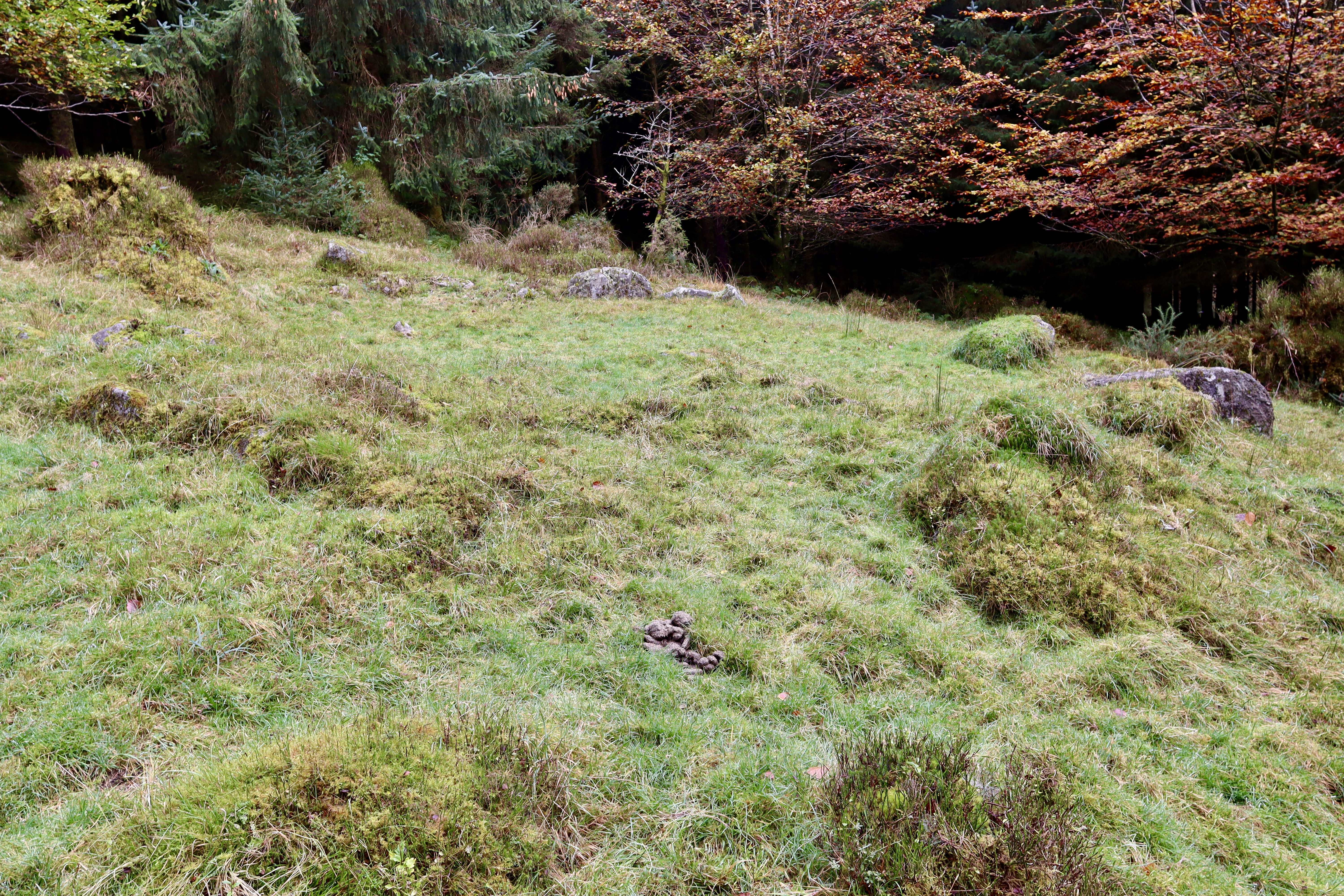
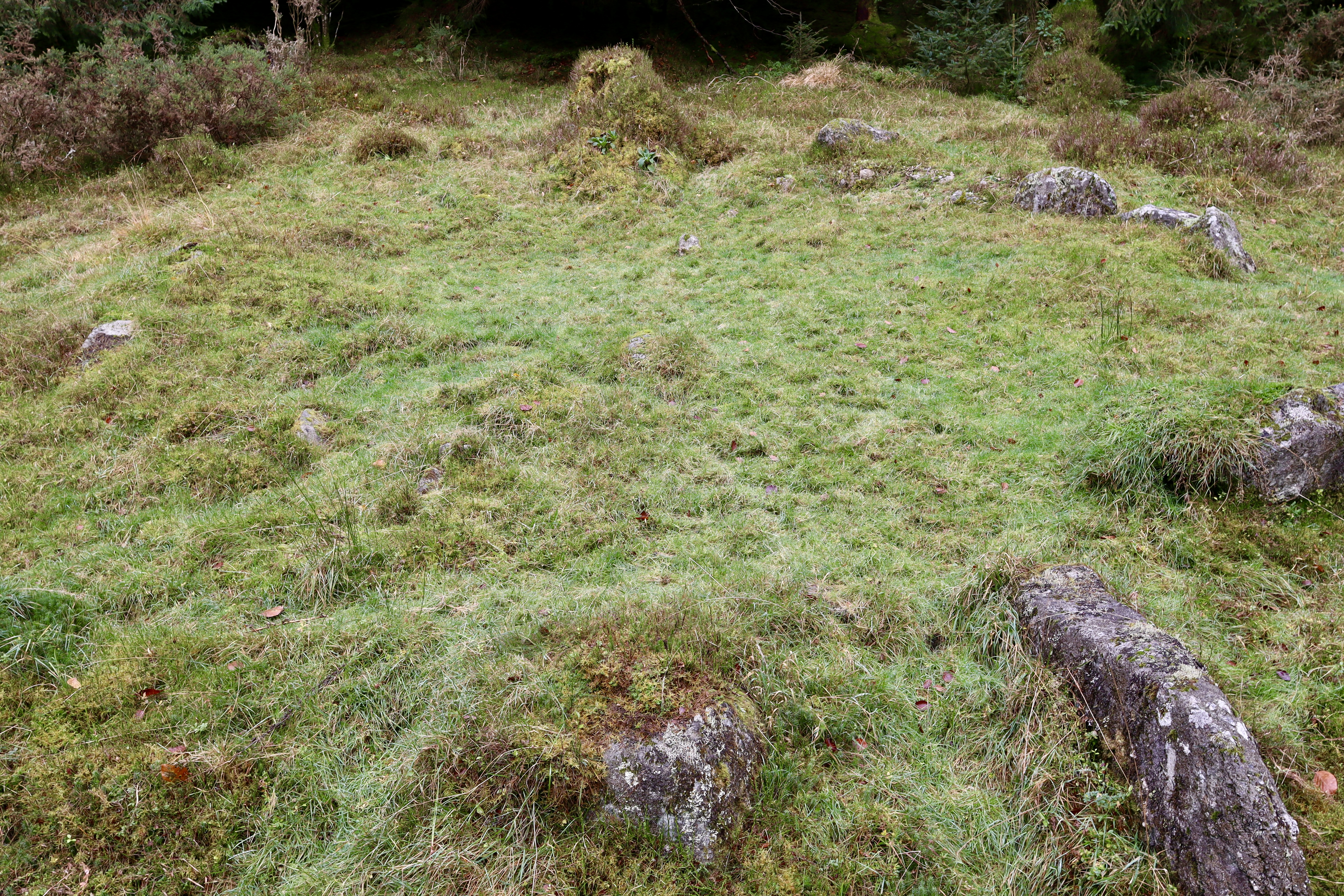
Battling on through the boggy ground (I did put myself into it just below my knee) and through the trees I emerge onto a clear path once again. Whilst much less fun, it is significantly easier to walk on so, grateful for the respite, I follow this to the southwest. After about 100m a little trail leads off the path and through the trees. As with every little diversion in Bellever forest, taking this trail is well worth it as it leads to a hut circle.
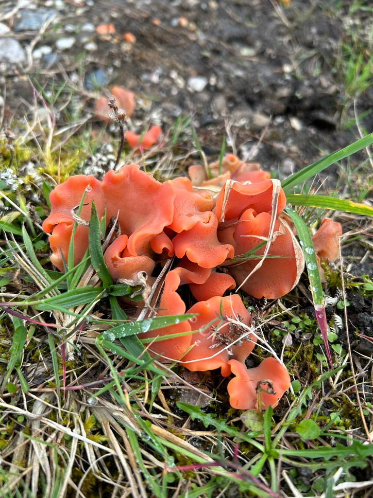
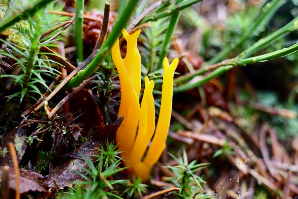
Having now completed something of an ancient trifecta of monuments of kistvaens, stone row & menhir and hut circle, my return to the main path is enhanced by spotting a flash of orange out of the corner of my eye, which turns out to be a beautiful example of Yellow Stagshorn and Apricot Jelly Fungus, growing on the decaying stump of a previously felled tree.
Once again heading southwest on the main path, eventually an option to take a joining path that leads north emerges. I take this and following it along its length, rejoin the initial path which takes me back to the car.
I think sometimes, when you spend a lot of time walking in hills and mountains and off the beaten track, you can become a bit complacent towards the more “popular” or “managed” route and for the most part, this walk certainly falls into the popular and managed routes. Doing walks like today just serves to remind me why these routes are as popular as they are. Combining ancient history, geological features, views, open moorland and contained woodland (opening up thoughts of planned forestation versus ancient woodland), where the walk is accompanied by the song of birds, rumbling of rivers and smells of pine forest, all along manageable paths (for the most part) and within an 10km radius really does just show the magic of our outdoor spaces. I won’t be leaving it over 2 years before I repeat this walk.
| Difficulty | Distance | Navigation Required? |
| Moderate | 9.5km | Yes – Handrailing, bearing and contouring |
| Grid Reference | Safety | Footwear |
| Start / Finish SX 646 786 | General Dartmoor Considerations | B1 |


Leave a comment