The Dewerstone is a rocky outcrop, over 100m high, bursting through the treelines on the sloping valleys of the River Plym between Shaugh Prior and Wigford Down. The huge crag is named after Dewer, who led his pack of fearsome wishthounds over the Moors at night. Dewer in other guises is none other than Satan himself, “Dewer” being an ancient Celtic word for the cloven hooved lord of the underworld. Local lore suggests he appears as a tall figure, dressed in black, with or without his hounds and lures the weary traveller, under the pretences of safety, to the highest crag of the rocks. Once there, he would disappear, leaving his helpless victim to wonder aimlessly around until they inevitably fell to the rolling, tumbling river, or into the crushing jaws of his spectral hounds waiting below. Anyway, this is my recalling of our trip to the Dewerstone.
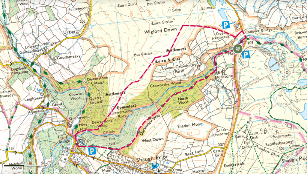
We start out early, parking up by Cadover bridge, in a pothole filled plot that sits alongside the river Plym. Potholes aside, this is a lovely spot and I can’t help but feel a pang of jealousy for the couple who were sat outside their camper van enjoying a morning watching the sun rise over the river Plym.
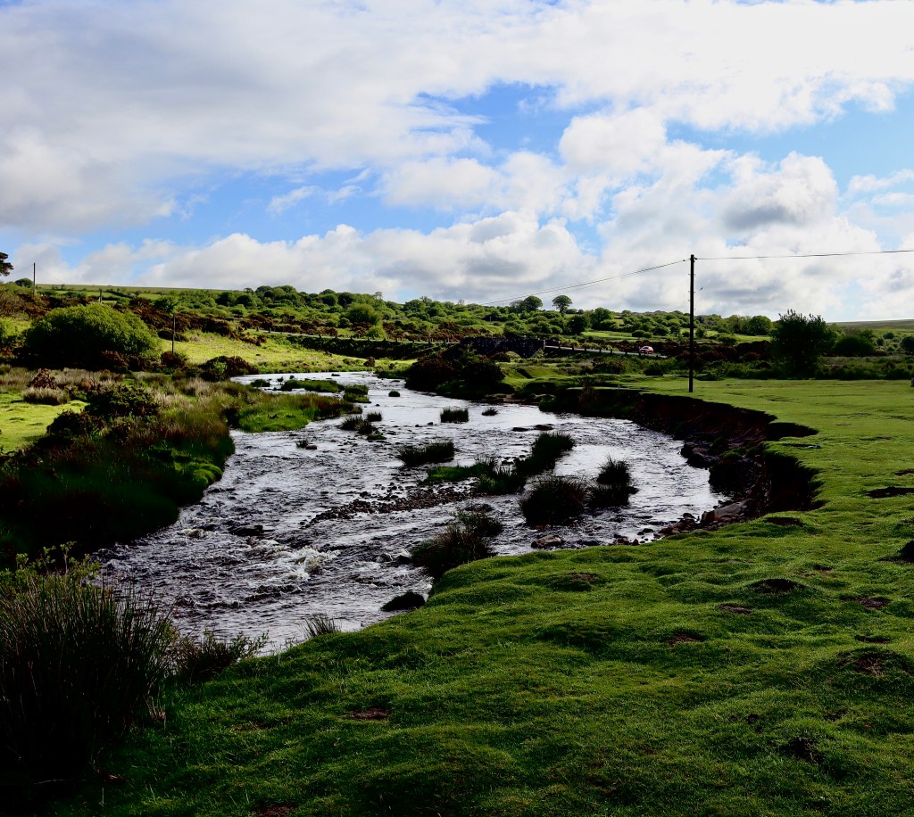
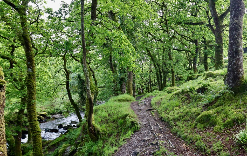
Heading west from the car park, we cross two little streams and enter through a gate into some woods. This is the start of the magic of this walk, as you walk alongside the twisting, winding River Plym carving its path inexorably through the twisting, winding, moss covered oak trees. The path on which we walk is marked by an old, broken pipe (which is all you need to follow), which, far from detracting from the beauty, adds to it, linking us to our non-too distant past and reminding us of the fragile balance we must hold between our use of natural resources and letting nature do its thing (a balance we probably have wrong).
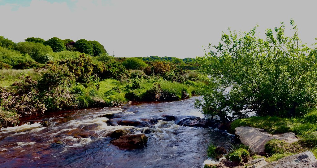
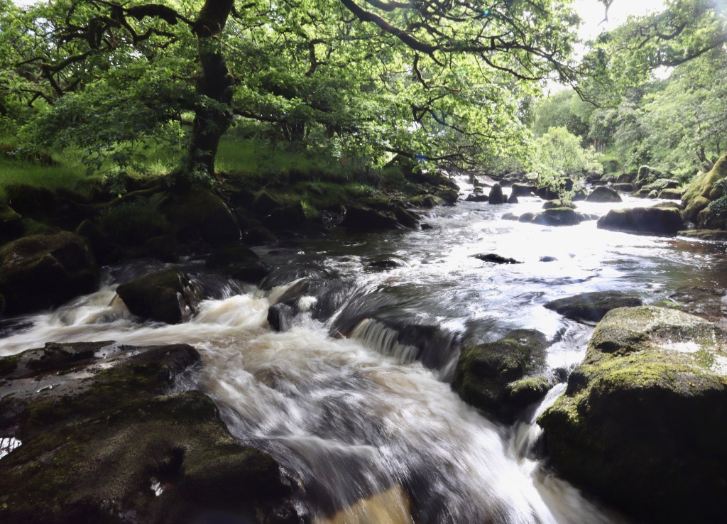
This path continues through the wood for about 1km. It offers plenty of opportunity to divert down to the riverside, to glance a steal at the birds hovering around to catch flies, or marvel at the iridescent rocks that divert the river so effortlessly. As we walk along the path, shaded by the branches of the Oaks and Hazel under which we walk, my “Temperate Rainforest Alarm” starts ringing (I will write a post about these one day) and I start look out for those keys signs that indicate we are walking in one of these vital places.
Epiphytes, or “air plants” are plants that grow from other plants. Looking around, it is easy to spot the polypody ferns, old man’s beard lichen and common haircap moss. Continuing to look around, to see what other signs I can bore my wife to death with, I shout in excitement as I see a fungus growing low on one of the sessile oaks (another sign of a temperate rainforest). As I look closer, the disconcertingly gruesome and sticky form of the Beef Steak Fungus becomes clear. Having absolutely failed to take any decent photos of any of the signs, and bored my wife half to death, we continue on our way along the track.
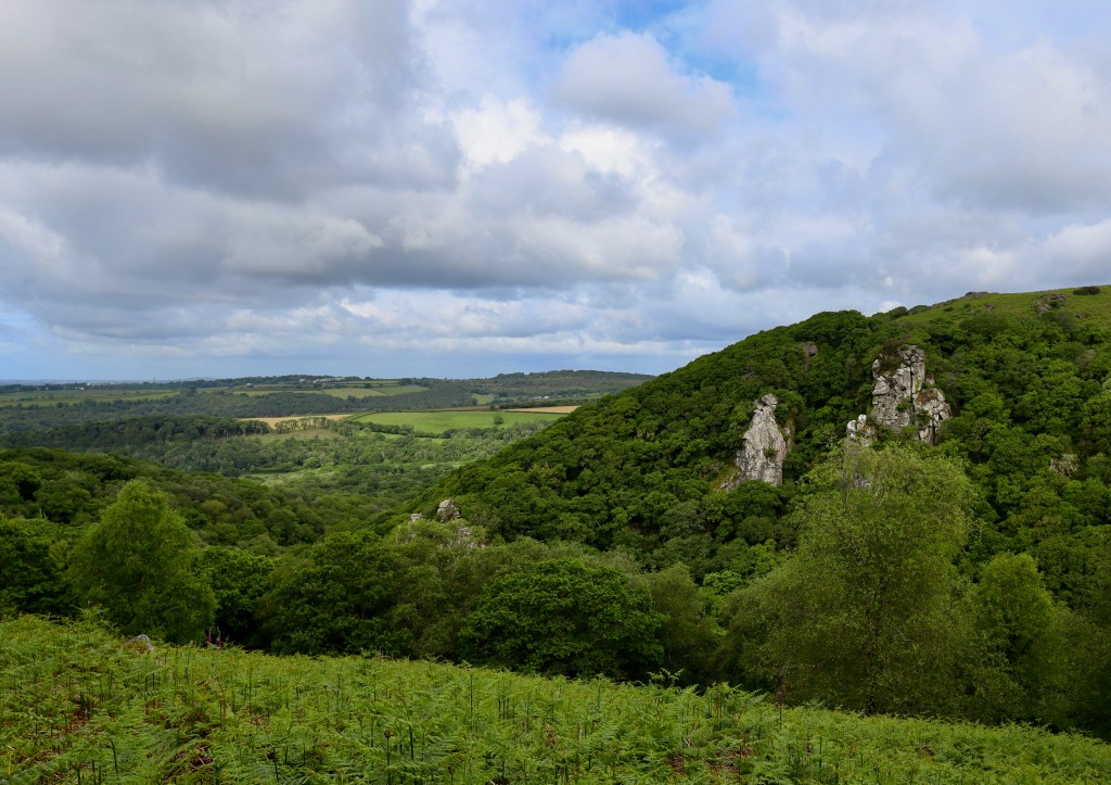
After about a kilometre, having crossed a stile, the path emerges from “North Wood” onto what feels like a more traditional Dartmoor scene, as we substitute moss laden oak trees for bracken, which is broken by bursts of hawthorn and newly flowered foxgloves. Still following the broken pipe, with the river now far below, across the valley on the right the rocky crags of Dewerstone Rocks slowly emerge with each step. The rocks stand tall, as a flash of grey emerging from the green landscape, looking settled and comfortable in their surroundings. The path continues on, ignoring the view, and takes us to an old, abandoned and ruined building. At this point, the path splits into a fork. Taking the right-hand side takes you down the side of the valley, to a small gate.

On the other side of the gate is a small track which winds through the trees, with the river remaining ever present on the right. Another stile is conquered, and the track continues down to a road, accompanied by the comforting smell of a bonfire, which was being used as a tool by the home owner, bending and shaping wood. A small track runs along the side of the ride and some steep, slippery steps take us down into Dewerstone car park. At this point, we are joined by groups of people with rope, carabiners and harnesses, as the Dewerstone, which is a popular climbing location, is tantalisingly close.

Before we reach the destination however, is a long climb up hill. Crossing the River Plym over a wooden bridge, the path turns right and flows against the river for 250m before taking a sharp left, at this point, you have a decision. You can take an immediate right, following a boot worn track upwards to the rock. I decided to take the alternative route, taking pity on my pregnant wife, and continued along the path, the route becoming more gentle, whilst still continuing uphill for another 0.5km. Heading past our first glimpse of the massiveness of these rocks, we take a right hand fork until we reach a old, tumbled down wall, the bricks now covered in moss and ferns. At this point, we take a sharp left following what looks like an animal trail (but is marked on a path – giving me the sense that my earlier decision is not one that most people take, as clearly no one has been down this path for a long time). Continuing along for about 150m, our route is bisected by a more traditional path. From here, we have no option but to take a bearing and head off the path, going straight up the hill. This is a manageable route, but is steep and does require negotiating bracken, bogs and gorse bushes. As the hill levels off and you reach its summit, we turn left and reach the top of Dewerstone Rock.
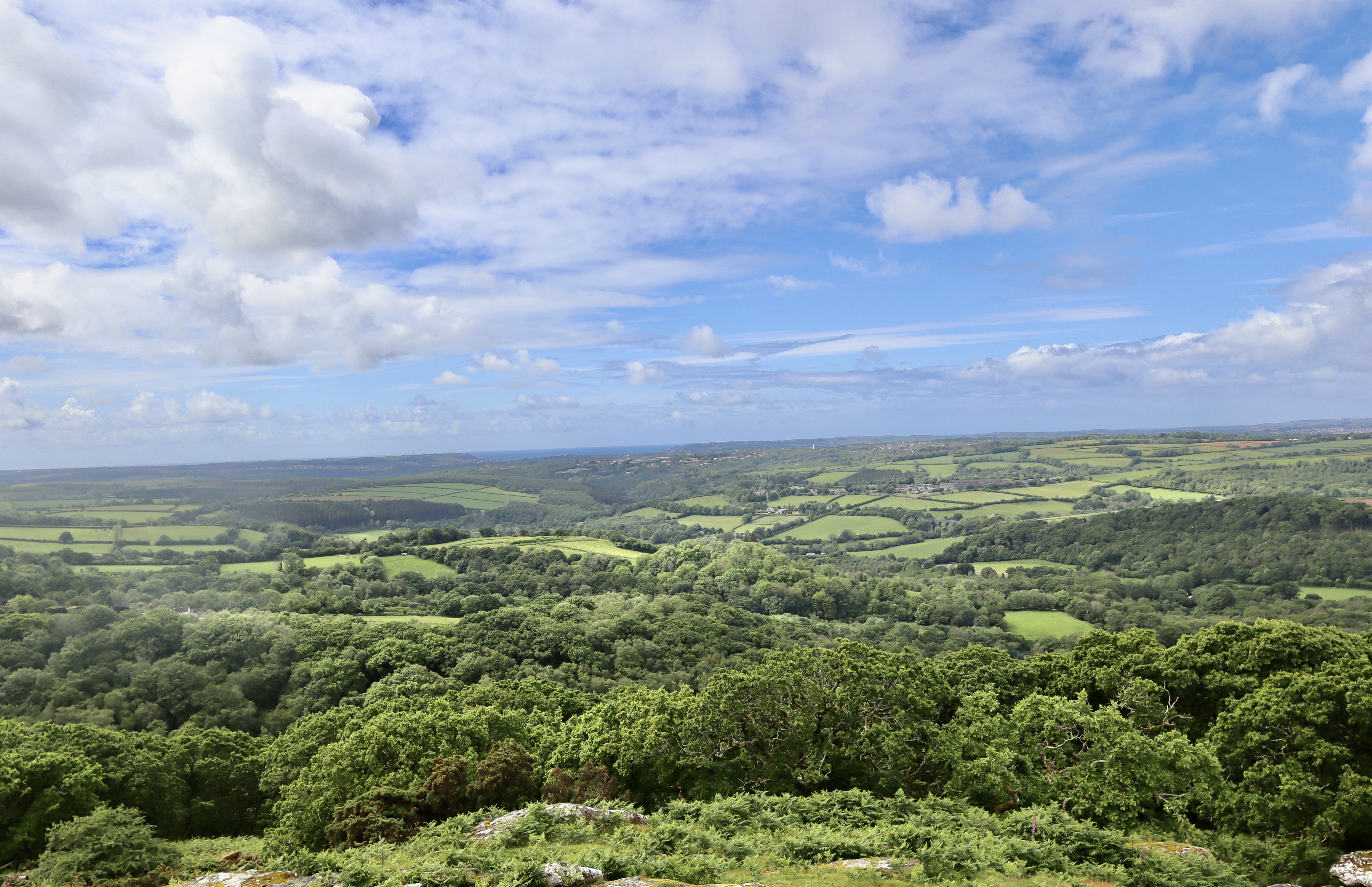
The view from the granite outcrop at the edge of Wigford Down is magnificent, looking over the Tamar and across to Dartmoor’s equally stunning sister, Bodmin Moor. Standing on these rocks however, I can’t help but think how they are utterly outshone by the massive towers that poke through the treeline of Dewerstone Wood, and which accompanied the majority of our walk out to here. The rocks on Wigford Down do contain a curiosity however. There is a faded inscription set into the rocks, which act as a monument to the poet and founder of Puffin Books, Noel Carrington.
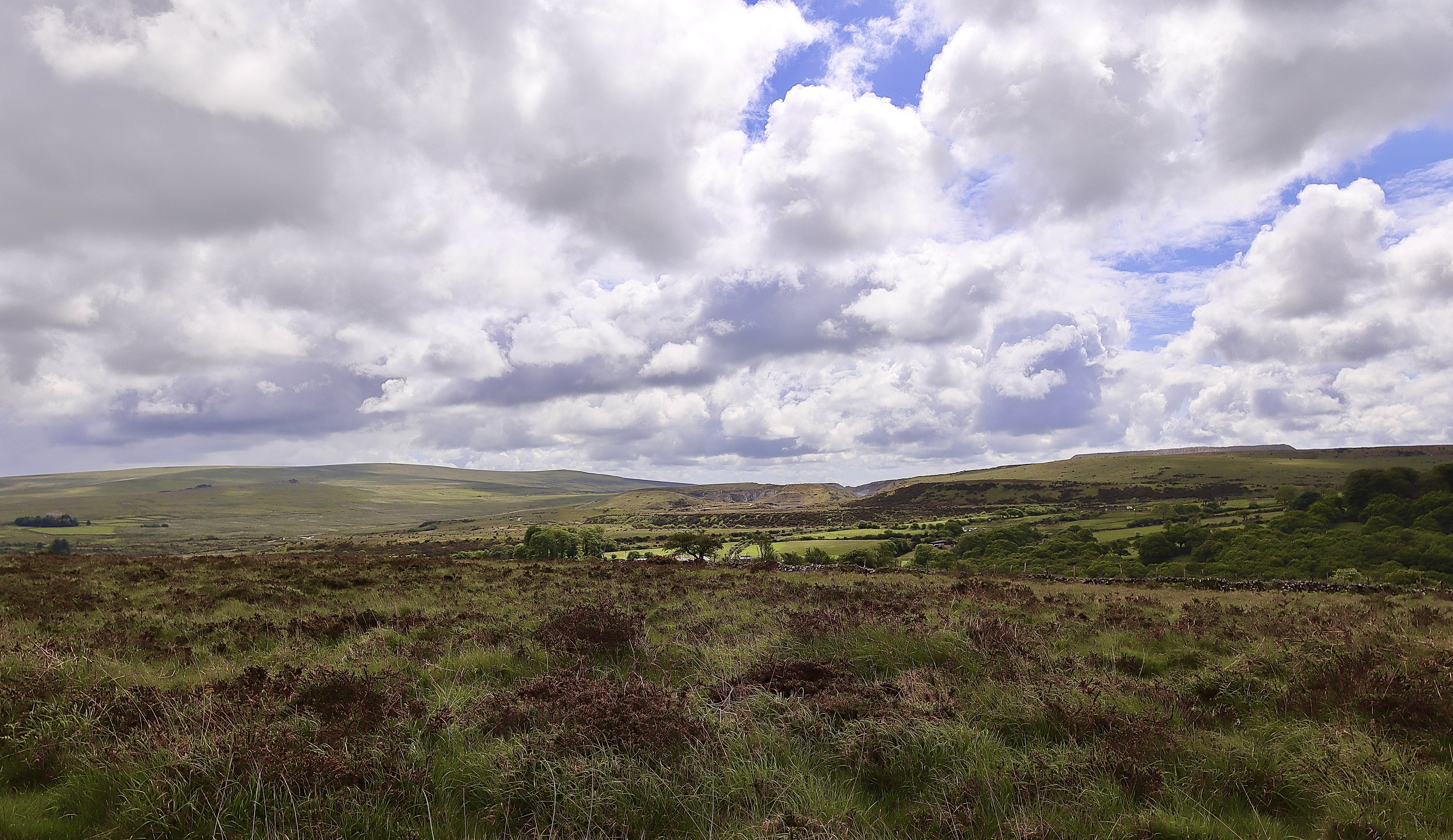


In defiance of Old Dewer, from the top of the rock, we head north-east along a grassy path which takes us across the ridge. As we go, we see a mother and young daughter excitedly celebrating as they find a plastic Tupperware hidden amongst the rocks. Letterboxing is a uniquely Dartmoor past time, and one that I promise myself I will start one day.
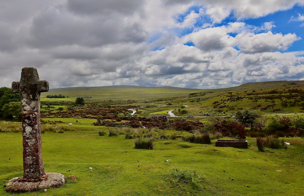
We continue along the path for about 1.5km, wary of the ominous looking, low hanging nimbostratus clouds that bring the promise of rain. Accompanied by cows, sheep, ponies and geese, we take a sharp right and heading down the hill towards toward Cadover Bridge and the start of our walk. As we do however, the dichotomy of Dartmoor is demonstrated once more as we leave a site famous for its stories of the Devil by passing a cross standing defiantly in reverence to Christ. We pass over Cadover Bridge, making our second crossing of the river Plym, and pass through a herd of cows and calves that are attracting the attention of other walkers, back to the car.
The combination of rivers, rainforest, overpowering rocks and folklore makes for a fantastic walk and a great way to spend a couple of hours.
| Difficulty | Distance | Navigation Required? |
| Easy – one section of steep hill to be wary of if poor mobility | 6km | No |
| Grid Reference | Safety | Footwear |
| Start & Finish: SX 554 645 | General considerations Steep ground and uneven underfoot | B0 (may want a boot given uneven terrain) |


Leave a comment