One of the many great things about living in Devon is being as close to the sea as you are to the moors (within reason). For the avid hiker, that means proximity to the South West coast path and the beauty that brings. This route takes in a small section of that.
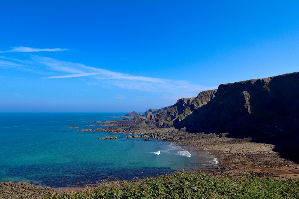
Parking in the lower car park at Hartland Quay (of note, as we left we saw that the entry road to this spot had become a Toll Road, with a £3 entry fee), next to the hotel with an eponymous name, we are immediately greeted by a stunning view, in which the sea is punctuated by black, jagged, weather beaten outcrops of rock that offer threat but invite for those will to take on the climbing challenge. Not wanting to be left behind, lines of black reef, reaching into the sea like tree roots searching for water accompany the rocks and looking to the horizon, which merges with the sea, shows the outlines of the coast, peering teasingly through a light sea haze. Knowing that we will return to this view, and that the walk ahead offers so much more, we leave to follow the steep steps from the car park and onto the coastal path.

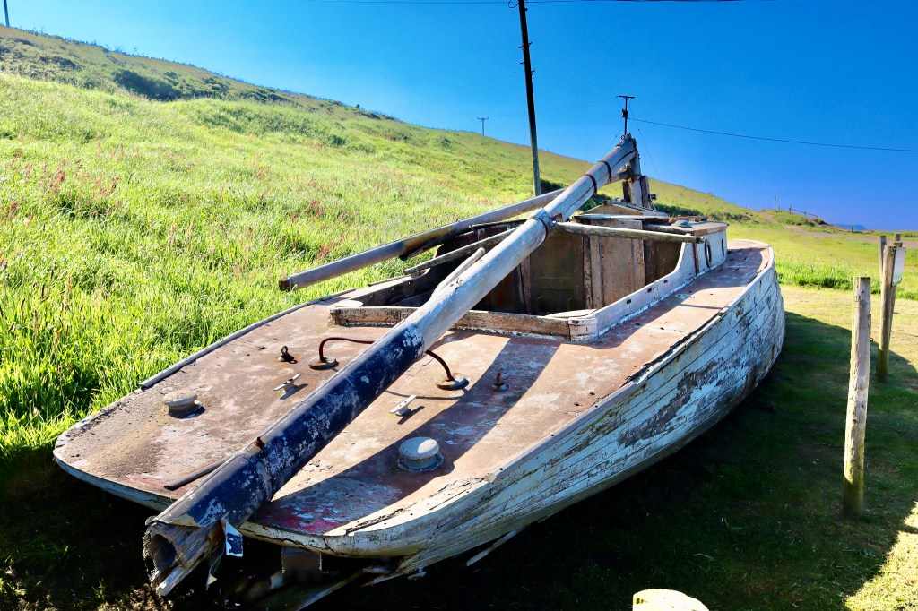
As we enter into the “upper car park”, before we start the route proper, a glance to our left shows a strange curiosity – what looks to be an old, decrepit boat sits high on the cliff with no apparent route to water. Wondering why the hell this was here, a sign near the boat answers our question, which is that the boat was used in the film ‘Rebecca’, a 2020 thriller, based on the 1938 novel by Daphne Du Maurier. Hartland Quay has been used as a location for a number of other films, including ‘Treasure Island’ and ‘Solomon’ and it is easy to see way.
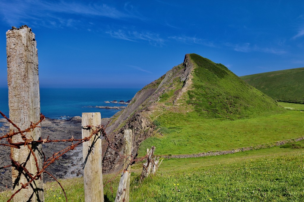
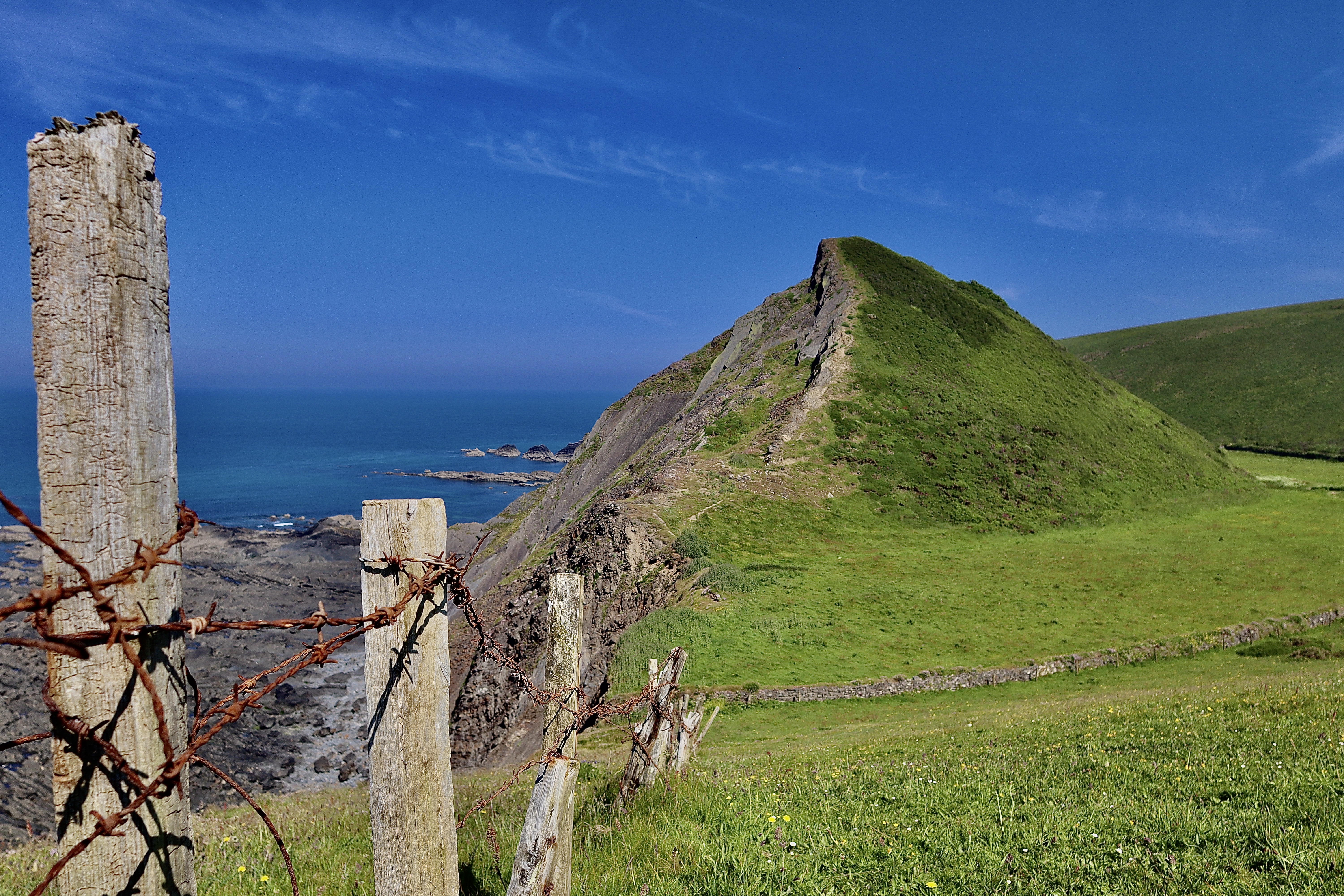
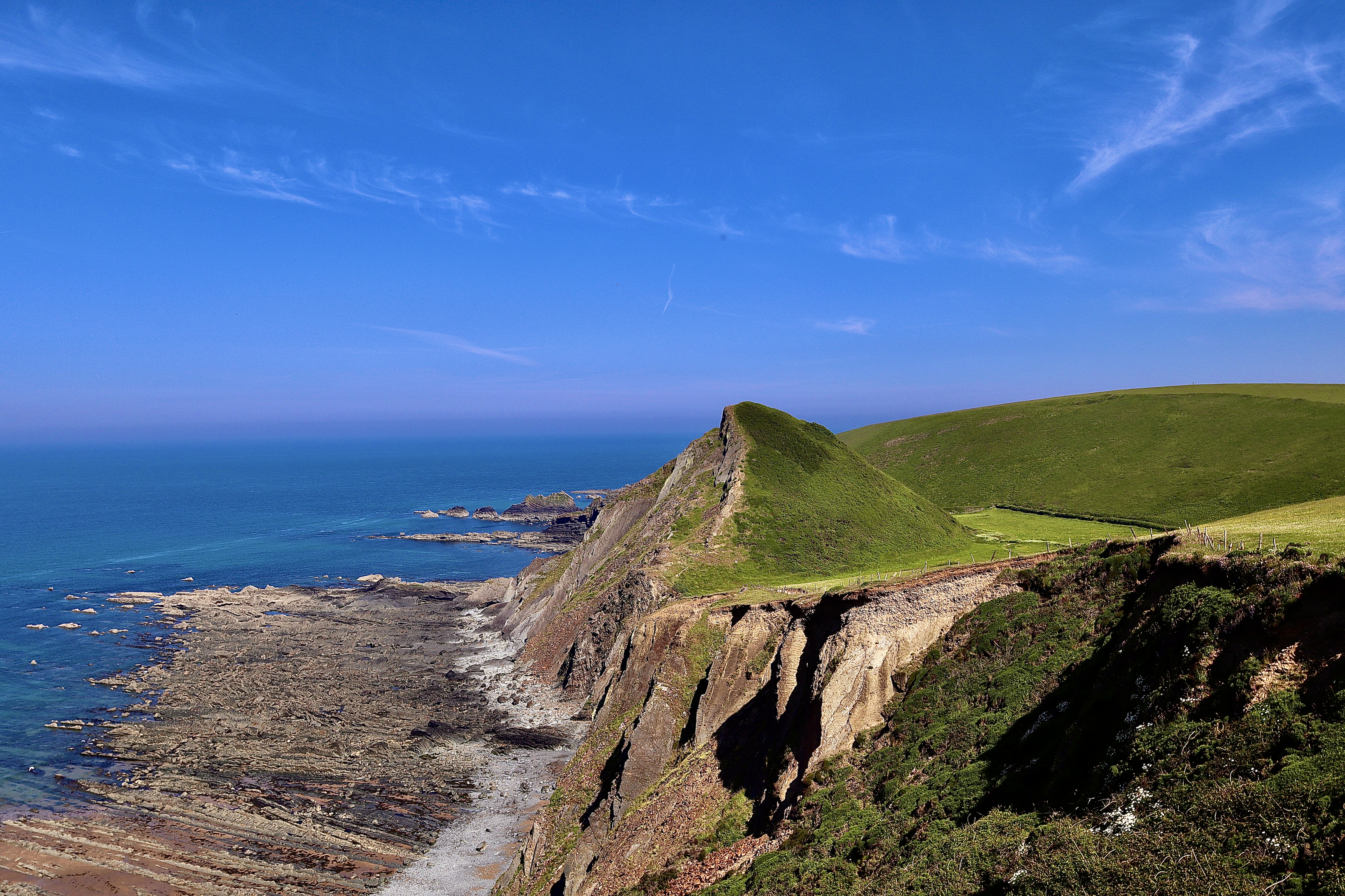
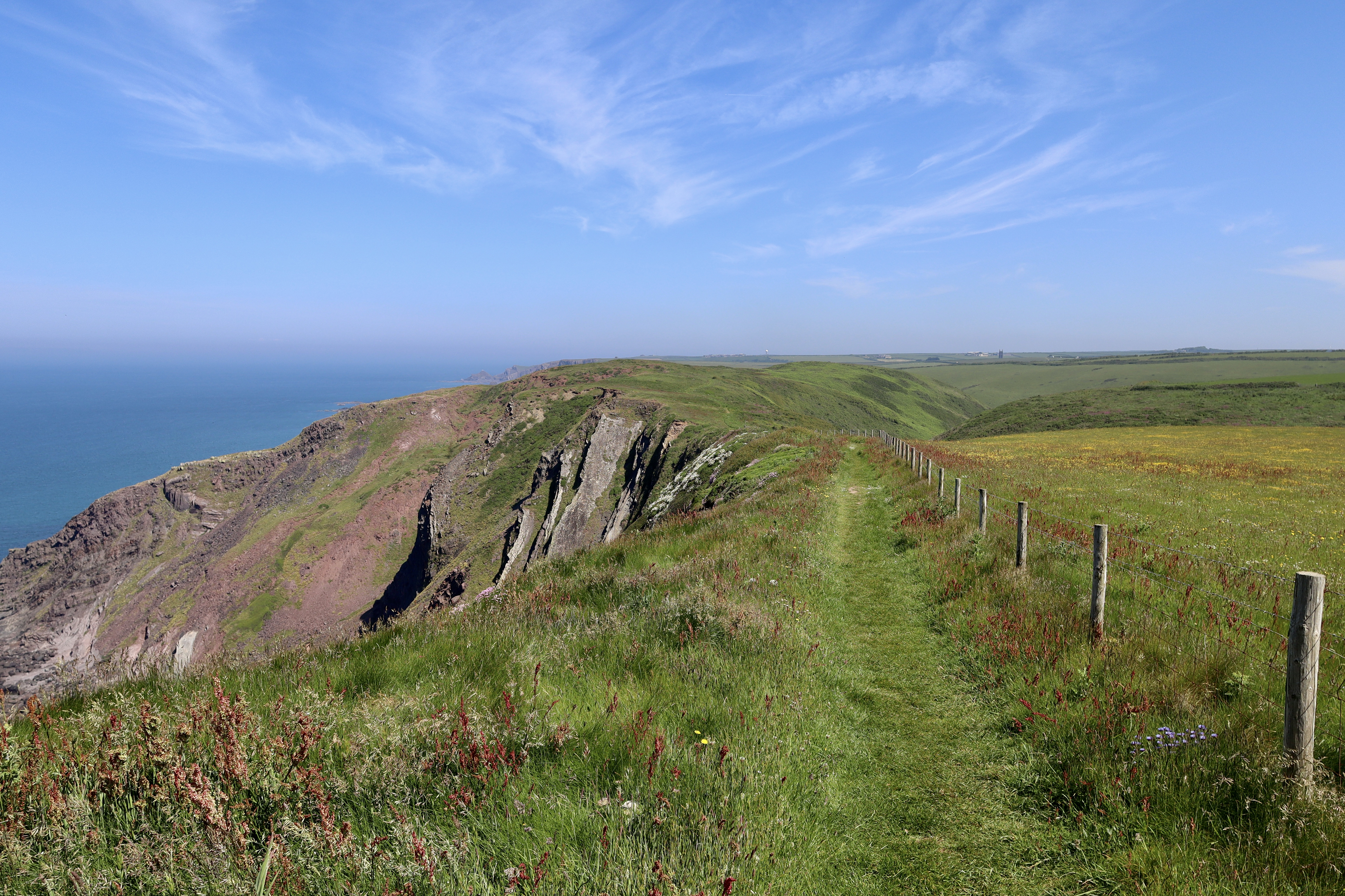
Boat related questions answered, we return to the South West Coast Path. This path, which at times runs perilously close to the edge, and the jagged rocks some 30+ feet below, meanders gently in a south westerly direction, where eventually a babbling stream replaces our view of the sea as we pass below the bottom of a sloping edge and star into a valley. This sloping edge is St Catherine’s Tor. This conically shaped outcrop of rock looks like it was dropped from above onto the otherwise flat landscape that surrounds it. This flat landscape is the former flood plain and course of Milford Water and once upon a time, the Tor was much bigger. Big enough in fact this it is believed that a Roman Villa or a chapel once stood on the summit of the tor, which is 84 metres above sea level, but these have since collapsed into sea along with much of tor itself, given the ongoing coastal erosion driven by the high wides and turbulent waves of the area.

Not entering into the valley, we turn gently right, following the course of the stream around the base of the Tor, following the long-used path, through the grassy field and across to a gate. The view of the sea returns as we begin to climb the edge of the valley we’ve been slowly edging towards, heading onwards towards Speke’s Mill Mouth. The land between the Tor and Speke’s Mill has been managed under the environmental stewardship scheme, in which the farmers have positively managed the land. The results are clear to see, as the fields through which we walk are abundant with dragonflies and butterflies which are exploring the wildflowers that carpet the ground. The insects inevitably attract birds and other animals, adding to the delicate ecosystem. This is evidenced by the mewling cry of a buzzard, which I fail to spot no matter my frantic searching of the skies.
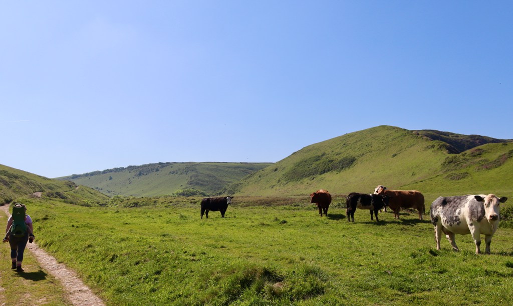
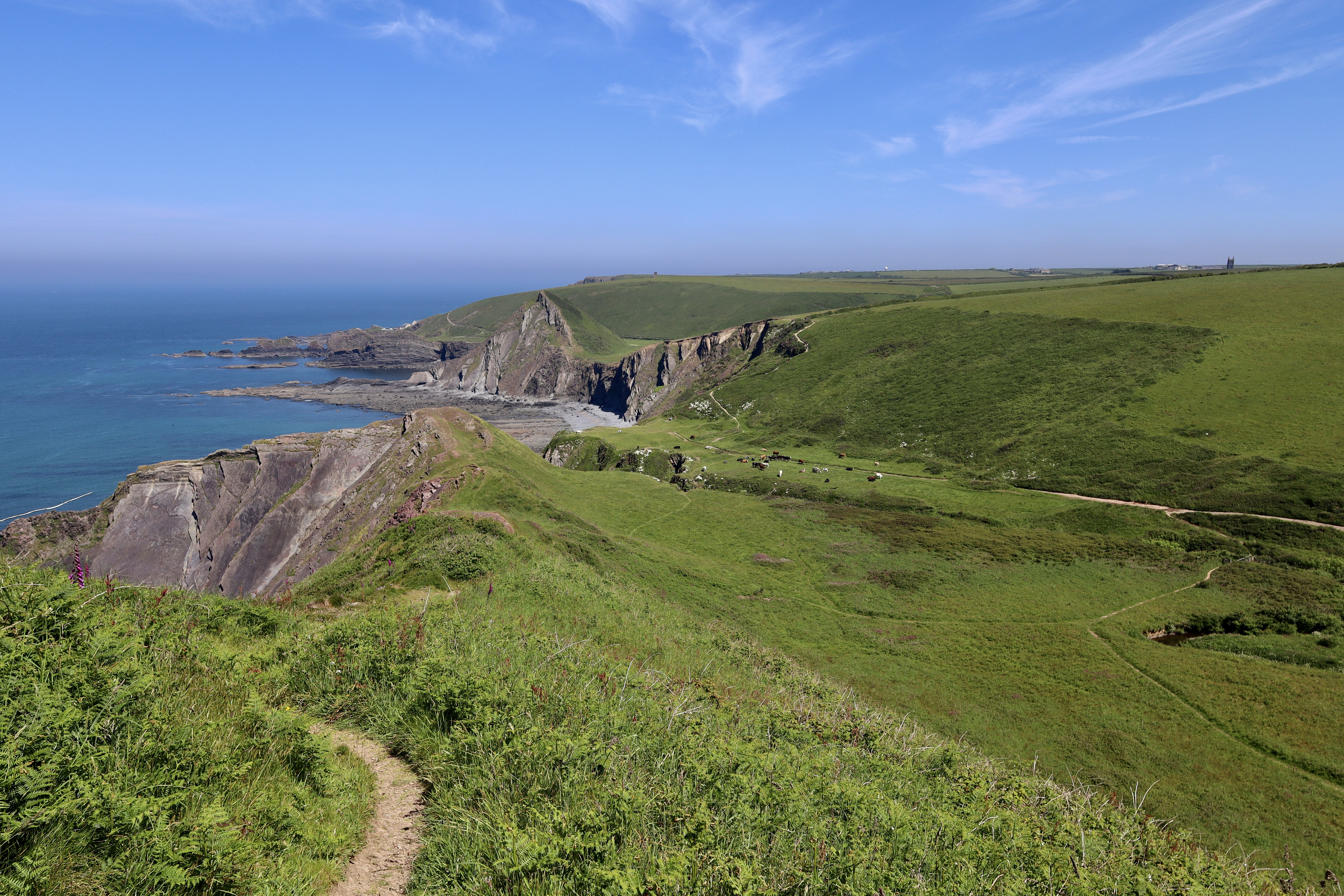
As we climb the gentle slope by St Catherine’s Tor, we look down on Speke’s Mill Mouth, a dramatic waterfall which cascades down the sheer rock face from the valley which has been shaped and managed by the ferocity of the sea, and tumbles below in a series of spectacular falls. As exciting as the waterfall, an inviting ridge also comes into view at this point. The route we are on doesn’t take us here but it is bookmarked for a future date. Instead, we get a gentle reminder that despite being high above the roaring waves, we are still in Devon, with a herd of cows gently grazing whilst overlooking the sea view and cliff edge.
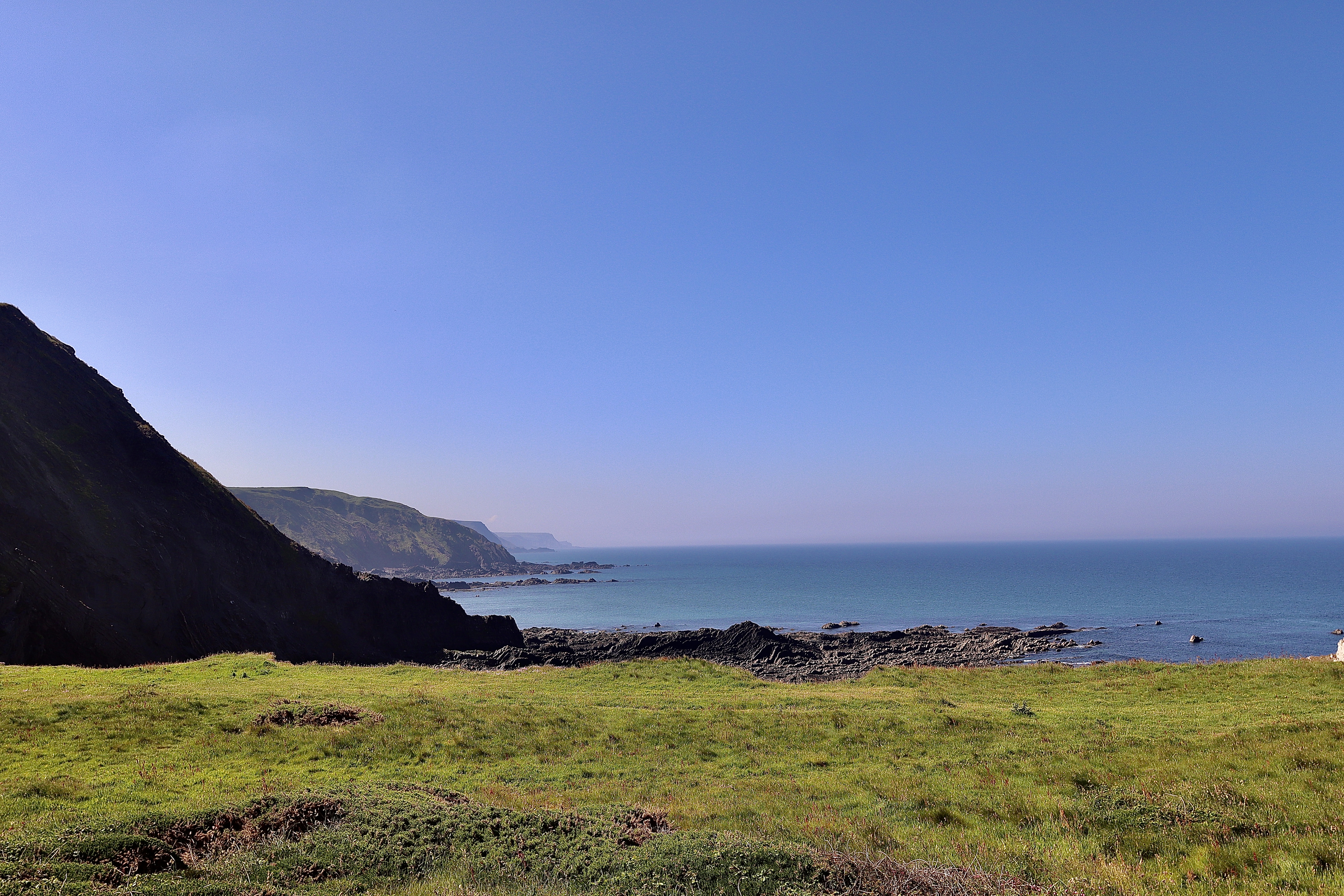
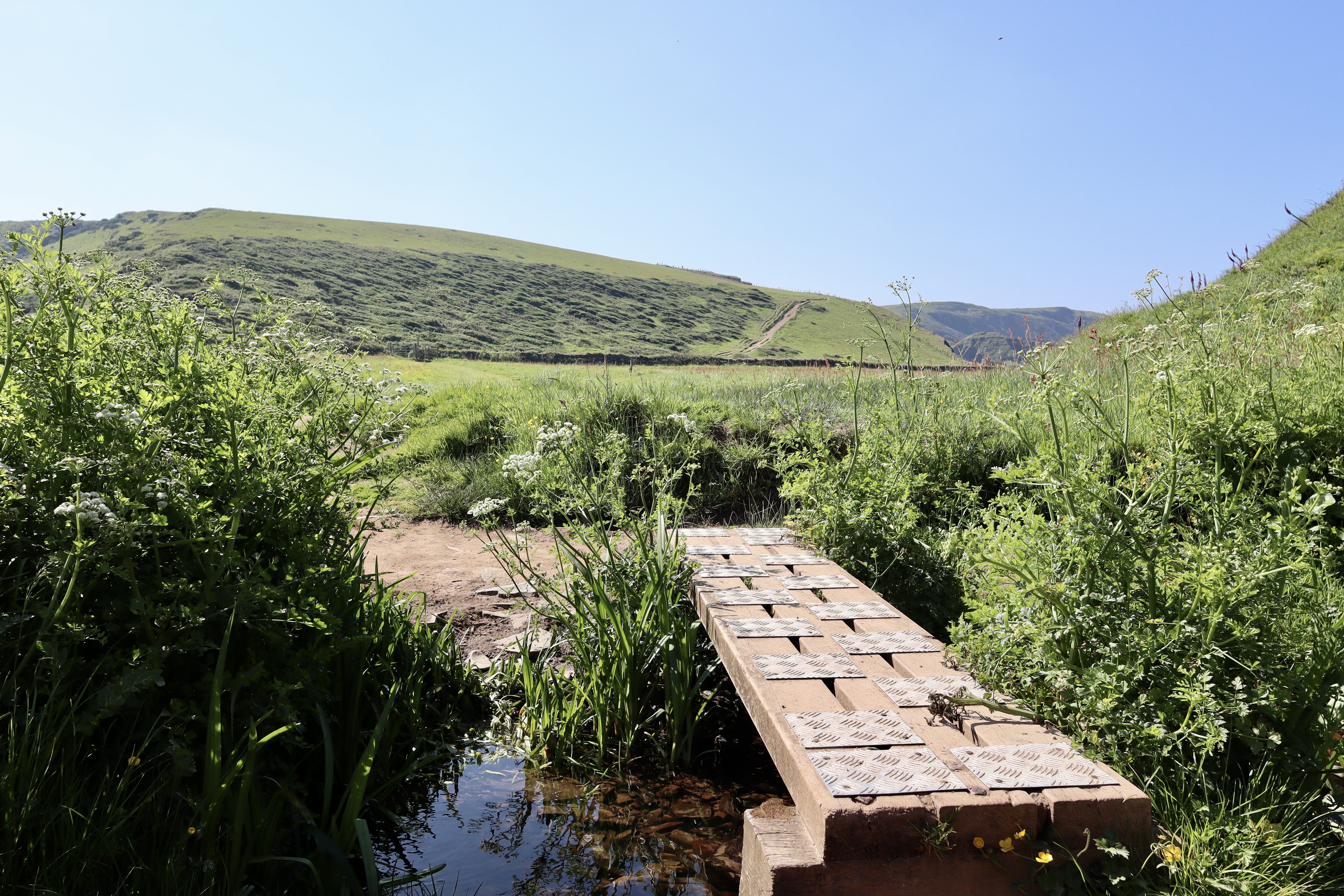
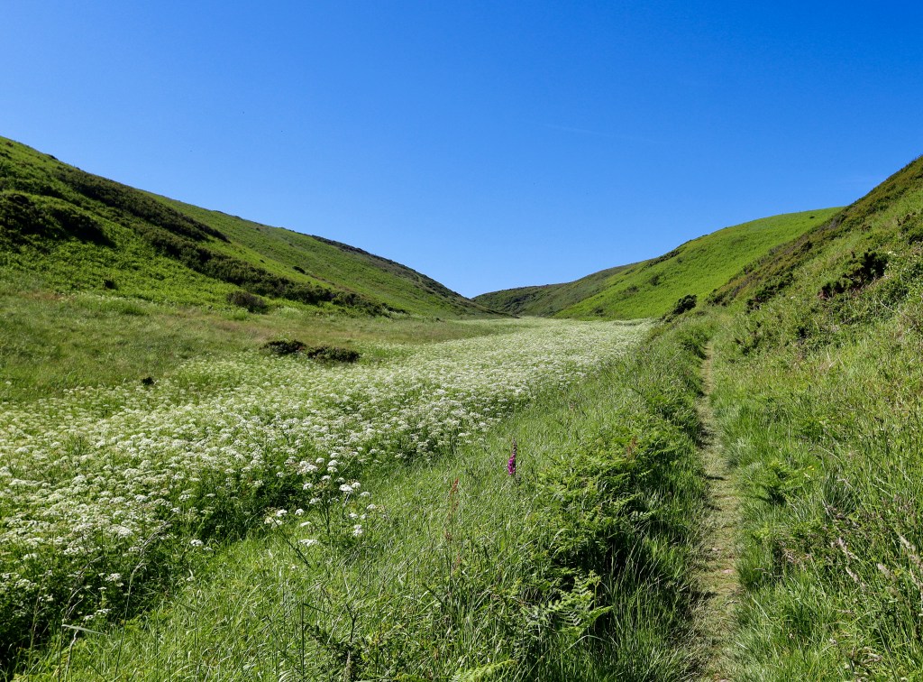
We take the path until a fork, where we turn right, crossing the stream over a wooden footbridge and entering the valley below the ridge line into a field of foxgloves, bracken and untamed grasses, bisected only by the obvious path that directs us against the course of the river. A glance behind gives a look of the sea view guarded so ably by the cows.
As the path continues, the stream disappears and its presence is only confirmed by the burbling, tinkling sounds of the water making its way easily to its dramatically cascading destination. The river view is instead replaced by a sea of hemlock which covers the valley floor and shows the twists and turns of the valley edges better than any contour map could.

Coming out the valley, we walk along the top of the cliffs with the sea to our right and a field blanketed by dandelions, daisies and buttercups to our left. At this point, with time rumbling on and a swimming lesson to get back for, we about turn and start heading back. Whilst it feels a shame to cut the walk here, and feels a shame to not do a circular walk, every cloud… I insist we take the ridge walk back. It’s a broad ridge that offers no technical challenge and as such, doing this bit shouldn’t put anyone off. What it does offer however is beautiful views of the sea down to the left and the hemlock valley to the right. As the ridge narrows, and we continue along, the sea view remains but the hemlock is replaced by the stream, the foxgloves and the stubborn cows of before. Thankfully the cows have moved on a bit so we are able to fully take in the views of the Speke’s Mill waterfall as we head back to our destination, along the path we came in on and back a well-earned ice cream, overlooking the sea.

I’ll be honest, if I have to choose between moor and coast, the moor wins. Similarly choosing between mountains and coast. What I learn from this walk, and probably never really appreciated on previous coast walks, is what they offer. Coastal walks are more refined, with a rugged flora protecting that which is more delicate, and stubborn mainstays which withstand the wind and salt. Despite this hardiness, the location and paths are more inviting, better known and less wild. They require less attention from the hiker which gives time opportunity to amble and take in the contrasting views of sea, cliff and valley. This definitely won’t be my last trip along the South West Coast Path.
| Difficulty | Distance | Navigation Required? |
| East | 6.5km | No – well marked paths |
| Start & End | Safety | Footwear |
| Postcode – EX39 6DU | General Considerations Cliff edges | Trainers fine |


Leave a comment