I’ve mentioned in a previous post that I used to live and work in Carlisle. When there, one of my favourite things to do was head to Buttermere for a stroll around the lake, then head to the Bridge Hotel for food and drink afterwards. Reminiscing and retracing old steps can be perilous for one’s state of mind, but it can also be magical. On this occasion, revisiting old ground for myself and my wife fell into the latter category and we hope it is the starts to lay the foundation of new wonders for our daughter.
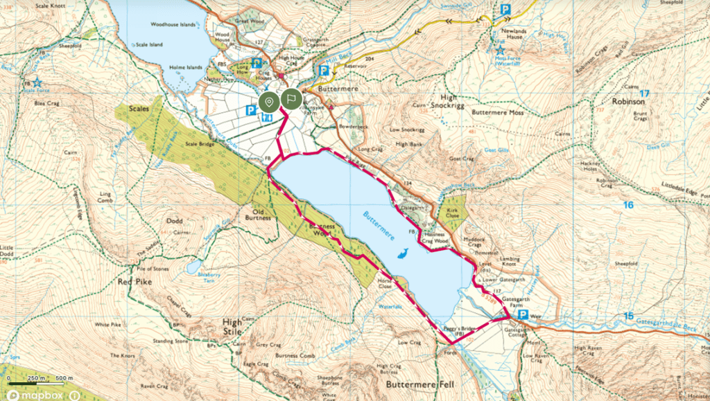
9 years on from when we first walked this route, feeling older, more tired and with a 2-year-old in tow our return journey starts all too familiarly with me searching around the car for some coins to buy a parking ticket. Having parked up in the car park that runs alongside Mill Beck, we enter through the gate that sits alongside the Fish Inn and enter onto the ever-popular path that takes us to the shores of Lake Buttermere. This path is only a few hundred metres long, framed on either side by Lakeland hedgerows, and is far from the main event. Most people therefore amble along as the anticipation of the view to come builds. It takes about half an hour to walk these few hundred meters. The recent rain has left a bounty of full, long puddles and this is a temptation that is far too great for a two-year-old. She walks through every single puddle (and believe me, there was a lot) twice (because it different going one way to the other). Previously, this delay to the purpose of the walk would frustrate me but seeing the joy on a toddler’s face as they run backwards and forwards, with a never-ending excitement and almost surprise as yet another puddle becomes available is far too great. If the walk had ended there, we would have been happy. However, the joy (for the parents this time, less so the child) was only going to grow.
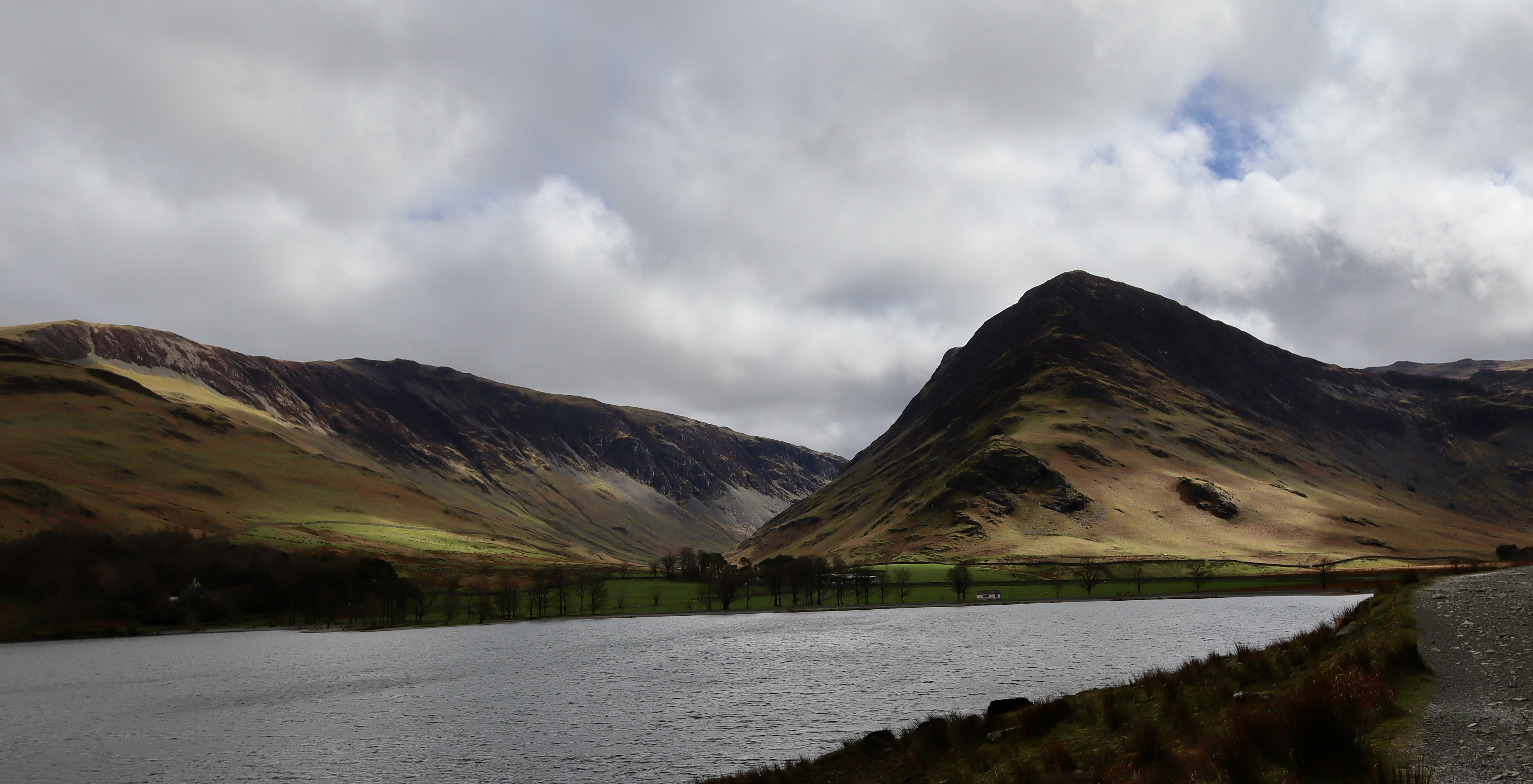
Puddle fun over, we divert early from the path to get to the lake shore itself and marvel at the all too familiar (as the majority of photos of Buttermere are this view) view of Fleetwith Pike from the Nort-Western shore. Photos taken, we head back onto the path the path which tracks the south-western shoreline, in the shadow of the slopes of Red Pike and High Stile and through Burtness Wood.

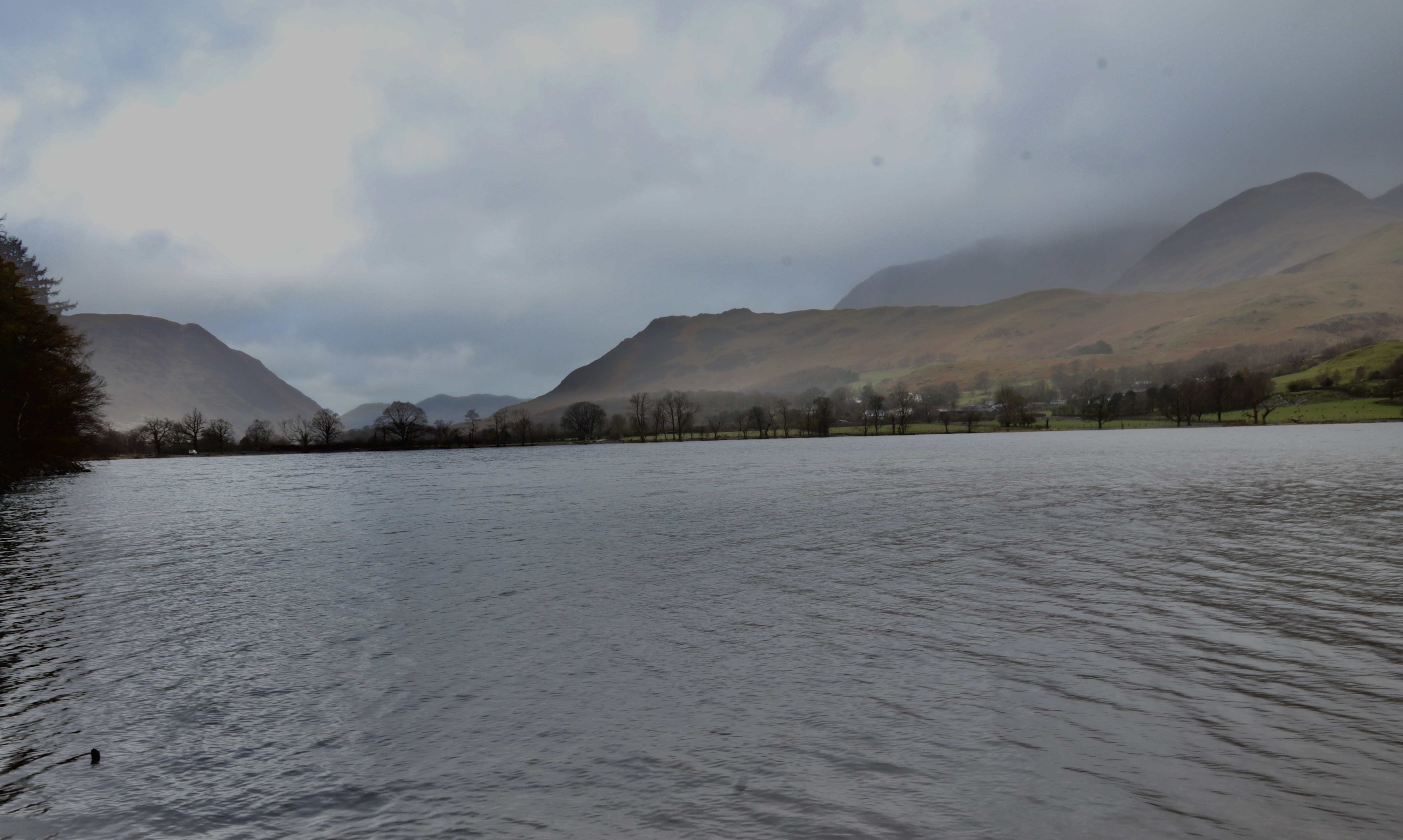
We arrived at the lake shore a matter of minutes after heavy rain but on our journey round the sun was shining. The combination of weather changes left Buttermere feeling like a tropical lake and the walk through the wood felt like a walk through the tropical rainforests, with rain dripping off the leaves, the flora revitalised to a brilliant green and the air feeling alive with the sounds of the birds, smell of nitrogen that precedes a lightning storm and the crispness of the cold front that accompanies the dissipating storm. Looking from the shore below the woods, the cloud rises above High Snockrigg on the northern side and the lake looks to calm itself in the slowly emerging sun after the excitement of the weather.
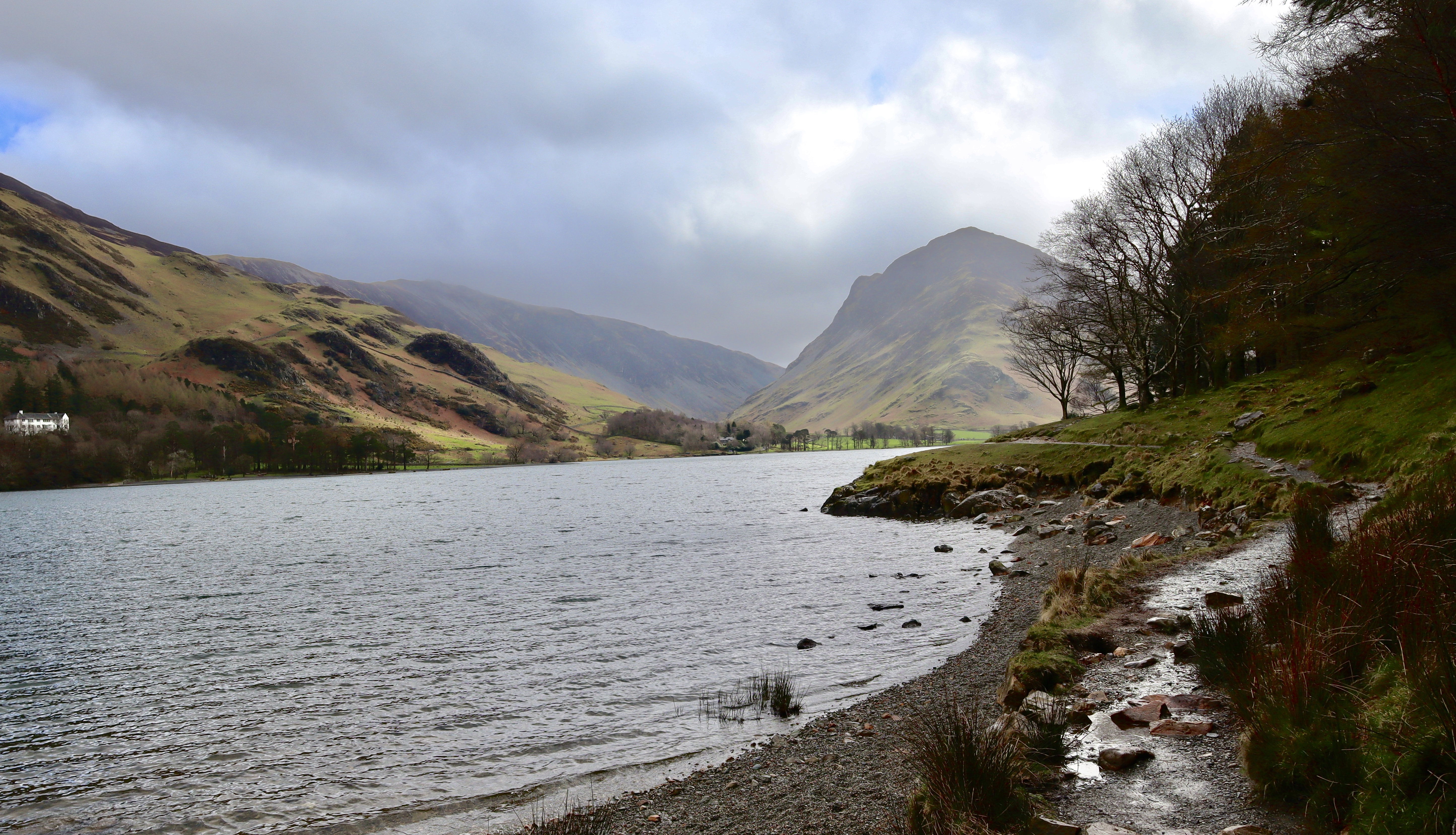
Continuing along the path, Fleetwith Edge emerges tantalisingly slowly with each step forward and as the path emerges from the woods, the view of Fleetwith is joined by that of its neighbour, the almost ethereal, and ever popular Haystacks.
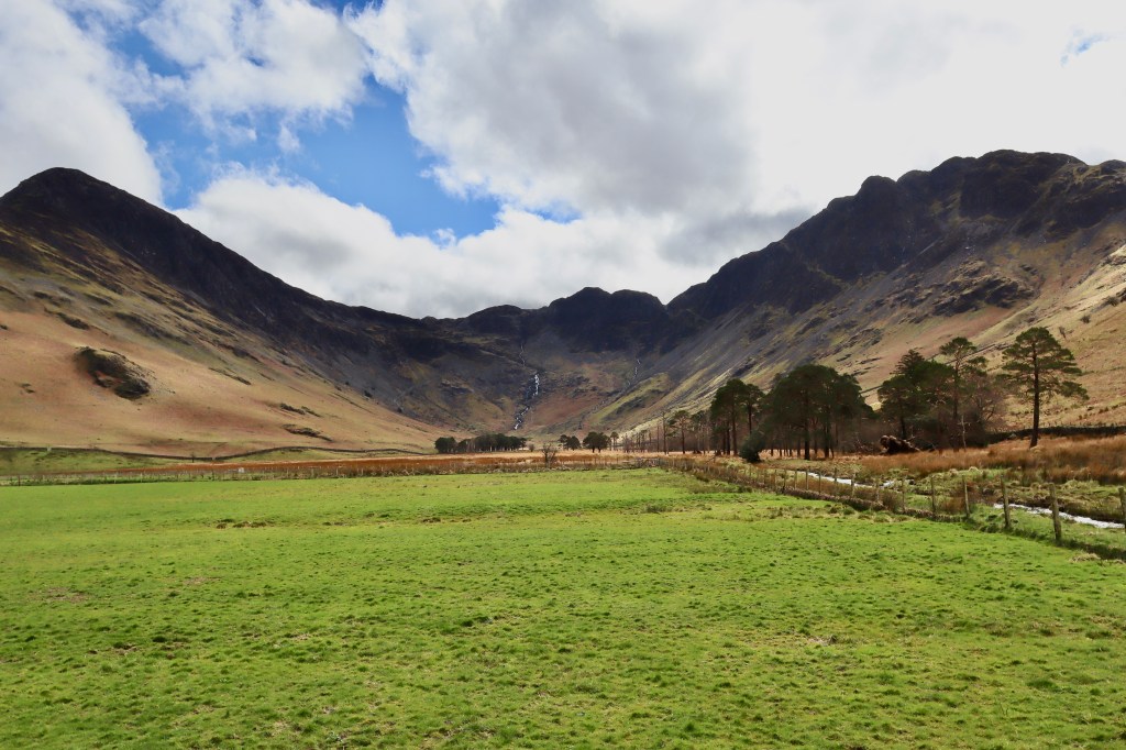
The path continues over a little footbridge and between the fields of Gatesgarth Farm, which lies in the foothills of Fleetwith and Haystacks. This natural turn affords the opportunity to look back along the lake south-east to north-west, and as ever, looking back along the lake from here provides a view as spectacular as those we had looking forwards.
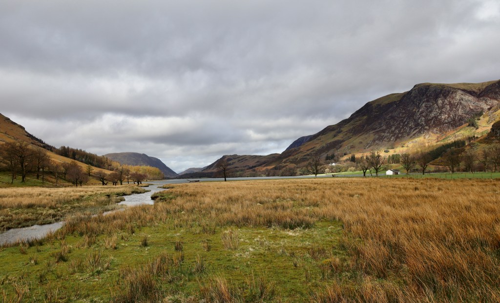
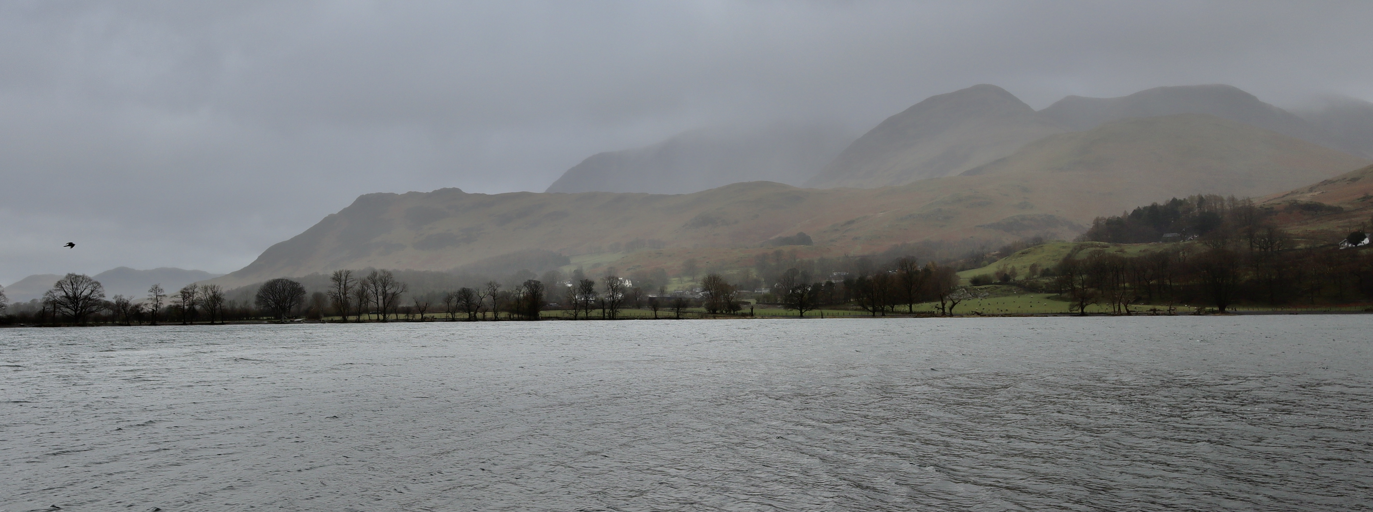
The view to the right (northern edge of the lake) takes in Muddock Crags, Goat Crag, Long Crag and in the far distance, Rannerdale Knotts. This whole valley, but Rannerdale in particular has earned its place in English History. Rannerdale, having been settled by Norseman and native Britons alike during the Viking invasions (Rannerdale means the means ‘the sheiling at the pass of the raven’ in old Norse) is the site of fabled battle, between an army formed of the native Britons and settled Norseman against the Norman invaders. 50 years following the Battle of Hastings, Rannerdale represented the last stand rebellious stronghold against the Norman invaders. One day, an army led by the Earl of Carlisle (Ranulf Meschin) advanced South from Cockermouth with the intention of ending the last vestiges of resistance. The local warriors, commanded by the Earl Boethar, lured their Norman counterparts into the Rannerdale Valley. When the Normans had passed the point of no-return, thousands of men descending the slopes of valley, ambushing the invading army and slaughtering all who were unable to escape. This humiliating defeat represented the last attempt to conquer Lakeland which remained under Briton & Norse control until it was ceded to Scotland. Between the months of April and May, the valley is covered in bluebells and local legend has it that this is because of the blood spilt there during the battle all those years before.
History lesson over, we continued our route. The path ends naturally at a road next to Gatesgarth Farm and we turn back on ourselves, north-west, and follow the road for about 0.5km. The road leads you to the start of a new path, on the northern shore of the lake. This return journey, offer up views of the route you have taken and it is here, that you really see the imposing height of Red Pike and High Stile, which is lost when you walk in their shadows.
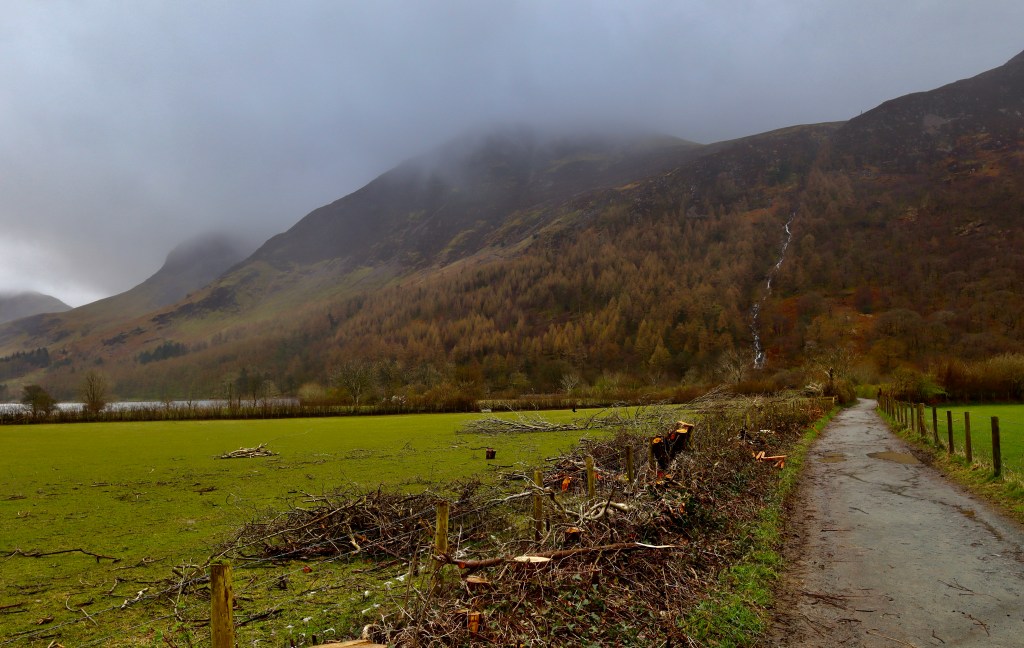
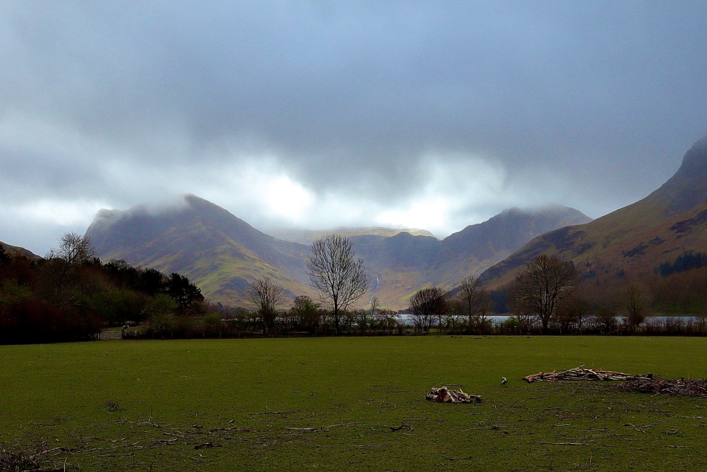
About halfway along the leg of the northern shore, we come across a tunnel cut through the crag at Dalegarth. This tunnel is said to have been created when Hassness House, which acts as an odd contrast to the natural beauty of the Lake Shore, was built. The tunnel therefore exists only because of an indifferent landowner who had no issues with significant environmental vandalism. That aside, it does make a walk around the lake possible without the need for scrambling over crag or walking along a road so it is a useful addition even if I feel slightly wrong in saying that.
Emerging through the other side of the tunnel, the path continues through to the north-western edge of the Lake which represent the end of the walk and the bar and kitchen at the Bridge Hotel calls like a siren luring a sailor to their rocky island. As we head to wards the pub, I reflect that the walk around Buttermere really is one of contrasts. From the path on the southern shore that feels almost tropical, to the manicured order of the farm in the foothills of Fleetwith Pike. From the northern edge with its manufactured beauty to northwestern shore which has been left to tourists and loggers. The walk demonstrates the beauty, history and contrast of the lakes and inspires: It inspires stories, adventures (because there’s no chance I’m going to walk in the shadows of those mountains without making a plan to walk them) and creation, but most of all, it inspired a little girl to run through puddles and begin a love of nature.
| Difficulty | Distance | Navigation Required? |
| Easy | 7.5km | No |
| Grid Reference | Safety | Footwear |
| NY 172 169 | General safety consideration | Trainers acceptable but be prepared for wet ground |


Leave a comment