I’m lucky enough to have spent a significant amount of my life in the Lake District, from holidaying there multiple times per year as a child, to working on its edges as a Junior Doctor at the Cumberland Infirmary, to marrying a girl who grew up there. The Lakes holds a very special place in my heart and as such, I continue to visit as frequently as work and my bank balance allow. Therefore, this blog will contain a number of walks from the Lake District, the first of which is my recounting of the Coledale Horseshoe.
We were visiting family in the Lakes over the easter weekend and took the opportunity to prolong our visit by taking a few extra days beforehand. We decided to stay in the village of Braithwaite, a charming little place found in the mouth of the Coledale Valley. The days we had in the lakes were planned around the weather and the walking, with one exception – we had to go on La’al Ratty, the picturesque steam train that wouldn’t be out of place in an Enid Blyton of Famous Five book (this was sold a treat for our daughter but secretly, I think this was something my wife was desperate to do).
Checking out the timings, weather and potential walks there was only one solution that would allow us to get a walk, the railway and the pub in. I would have to leave early doors, go for a walk by myself, and be back mid-morning for our journey over to the station at Dalegarth. Given the early start and need for an early finish, so we could get to the early train time and therefore the early pub dinner, I decided on a walk out from where we were staying, which fortuitously was in the shadows of Grisedale Pike and the Coledale Horseshoe.
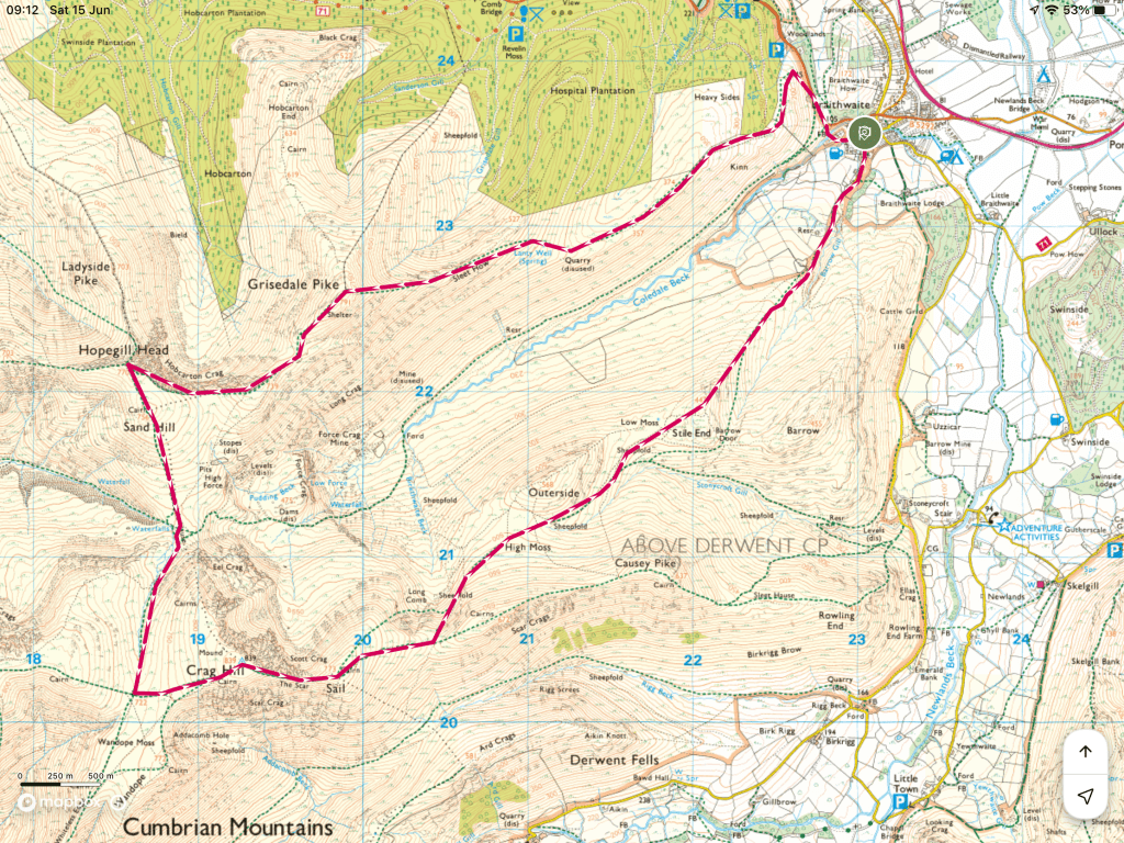
The Coledale Horseshoe is a walk that covers the Wainwright’s overhanging the glacial valley of Coledale. Trail Magazine incudes this route in their “Walks of a Lifetime” series, so even before setting off I knew I was in for something special… how special it was became clear within a few hundred metres of my start.
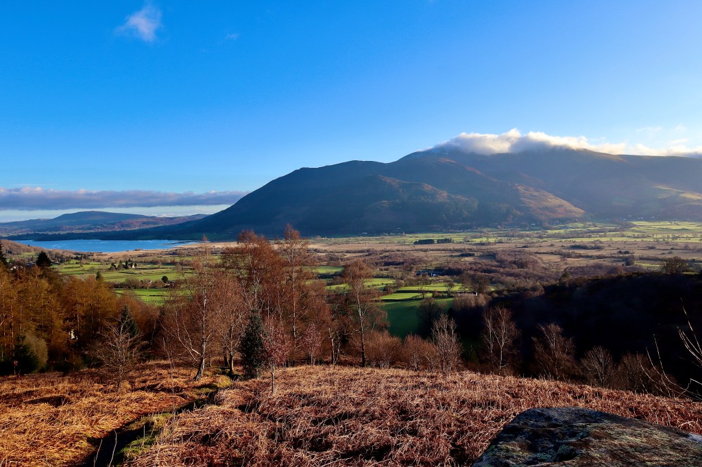
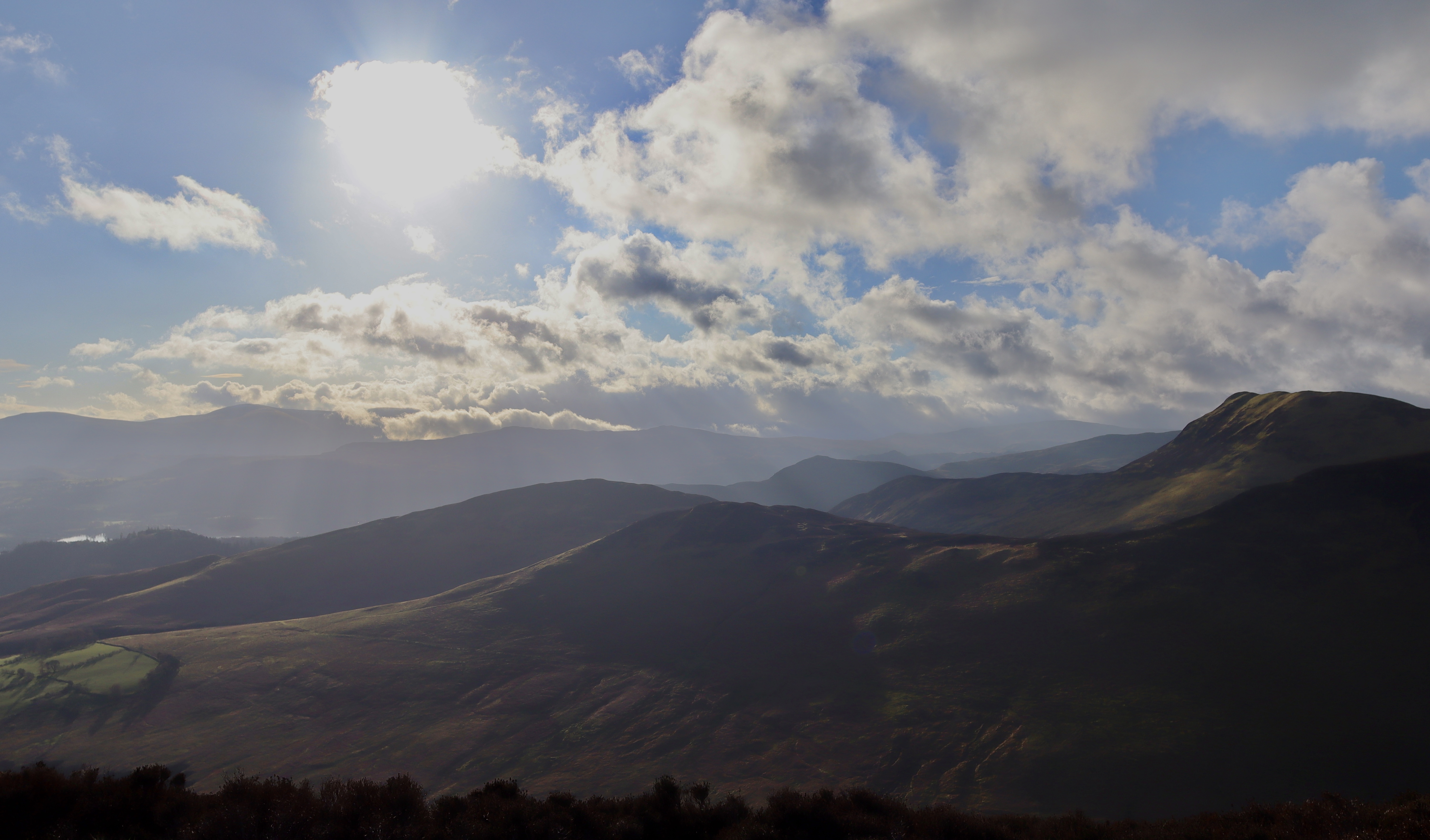
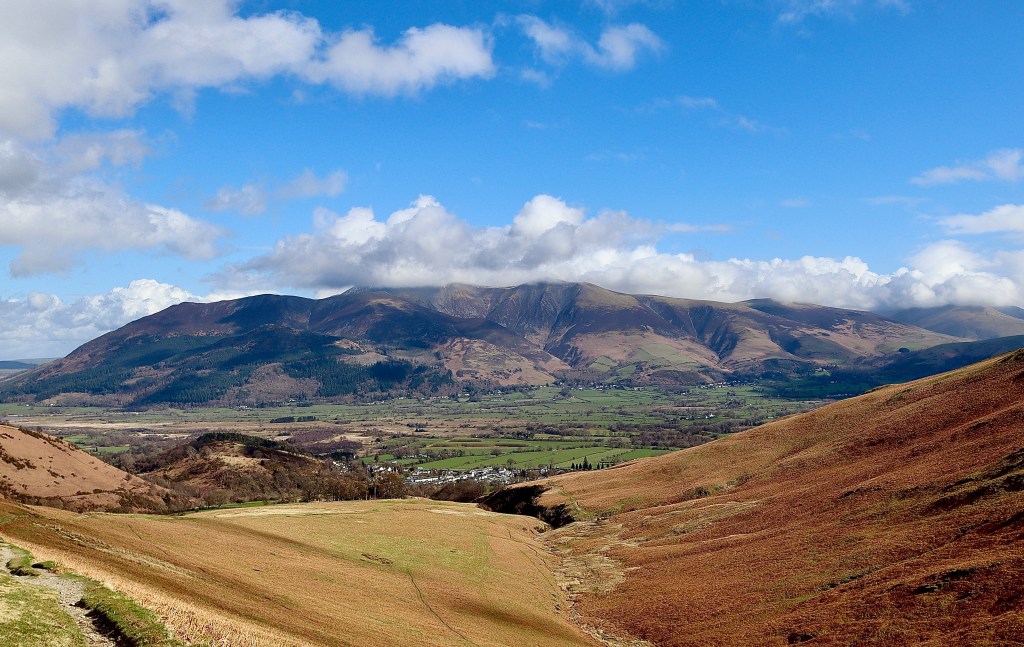
I’m going to start my journey for this blog form the carpark. In reality I started from in the village but anyone wanting to do this walk themselves will likely not be at the same Air BnB as me – that would be too weird. Starting from a little car park, just as the Whinlatter Pass enters into Braithwate, your ascent of Grisedale Pike starts immediately. Some stairs from the car park get you going, and the steepness of the steps sets the scene for the next couple of KMs The route is tough going, I am doing this walk after a period of heavy rainfall and so each step up the slope is accompanied by a slide backwards of a few inches. The energy sapping start is worth it however, as I take a break to de-layer and look behind me. The views over the village towards Skiddaw and Blencathra are nothing if not breathtaking (or is that the 500m or so up the steep hill first thing in the morning) and the promise of even better sights to come is all the motivation I need.
The path from the carpark up the eastern ascent of the mountain is clear and only needs to be followed, heading up the whole way. Googling the route and Grisedale Pike beforehand and looking on OS maps suggest that the ascent after Lanty Well is steep. Just how steep it was however, I cannot quite get into words. Now I’ll be honest, my fitness wasn’t at its peak heading into this holiday, as I was still working through the excesses of a Christmas which followed a period of tests for cancer (all fine by the way), but I still thought my fitness was to a decent standard. The burn in my legs that was to follow over the next 1km begged to differ. This is where having a camera really, really helps. Sometimes, having a camera with you forces you to take in the surroundings and appreciate what’s around. Sometimes, having a camera helps you look at things in different ways, thinking of the history and stories of a view. Sometimes however, a camera gives you a bloody good excuse for a rest, and this is an excuse I took advantage of on a number of occasions on this climb.
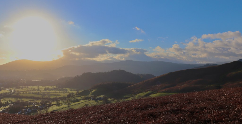
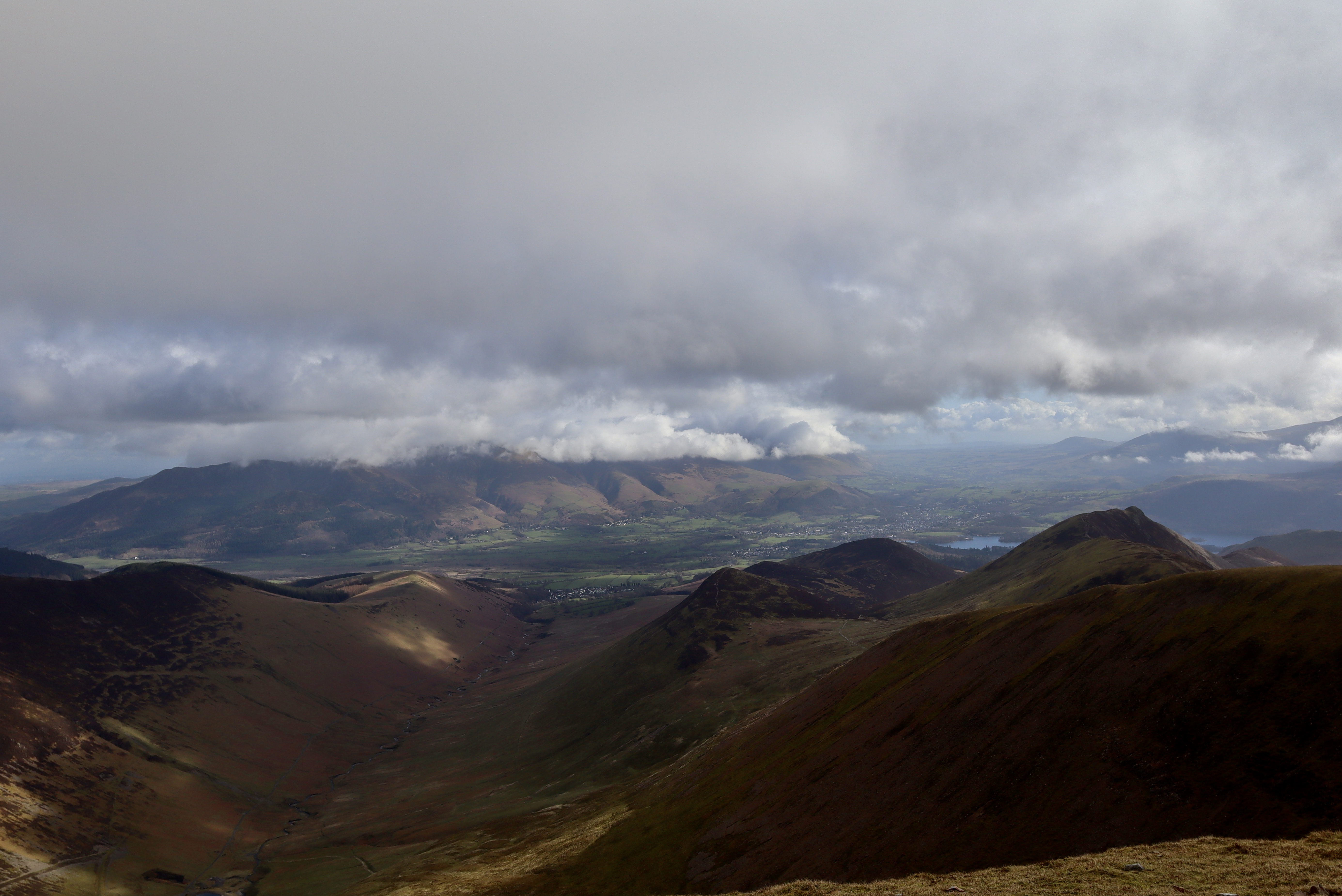
About halfway up Sleet How, with the summit in view (or at least what you think is the summit – Grisedale Pike is one of those mountains that loves to play games, and on this occasion, the game was “false summits”… about four of them) the steepness of the slope really does become secondary. Your legs move as if on autopilot, pumping you up the hill towards the summit, and the views distract you all the way up. The views at the summit are something to behold and justify the leg burning climb. In every direction is splendour, with each view offering something different. Whether it’s the foreboding of Hopegill Head, the luscious beauty of Coledale Beck and the glacial valley through which it runs, the majesty of Skiddaw overlooking all or the welcoming intrigue of Eel Crag and Sail, the views from the top of Grisedale Pike really do offer something of everything. Summitting Grisedale is the hardest part of the walk (from a fitness point of view). My whole way up, I was trailing another early riser and when we got to the top, I walked past him (oddly, given it was about 7am, eating a packet of discos), with a nod of appreciation as although not a word was spoken between us, we had both subconsciously pushed the other to the top.


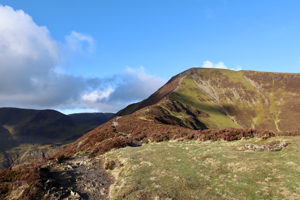
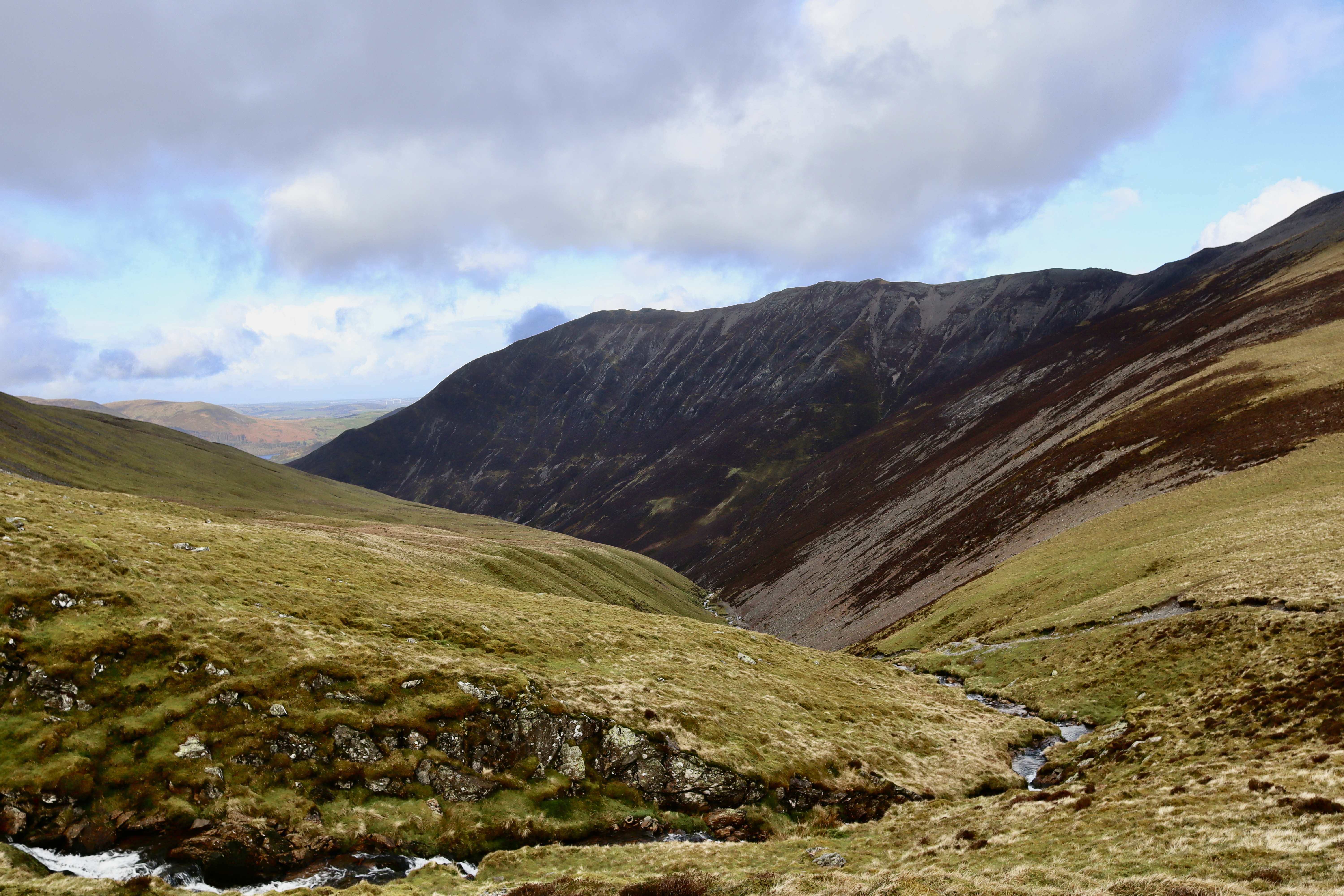
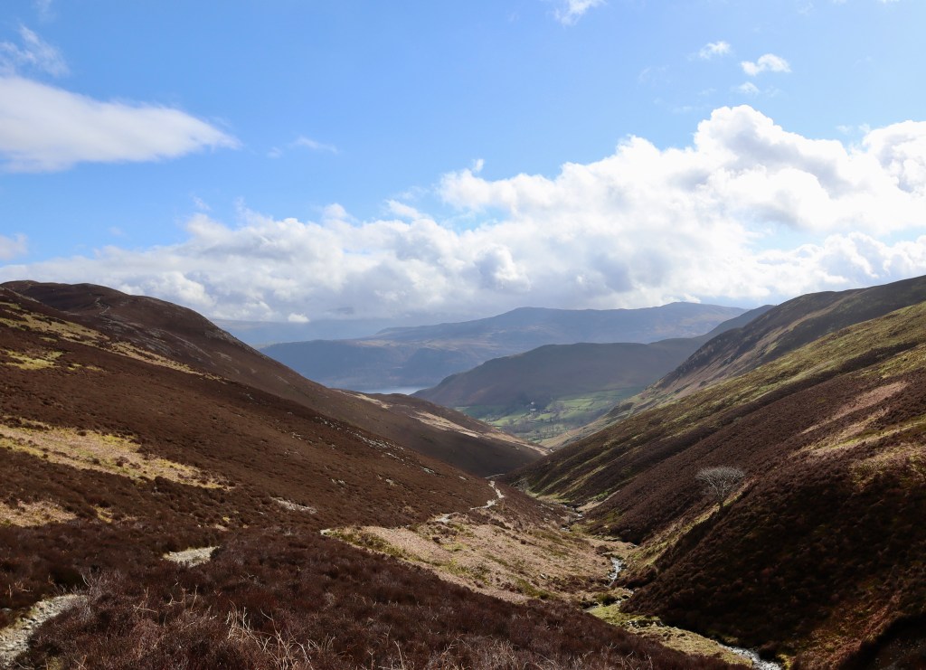
Heading off the summit in a South-westerly direction, the paths brings you to a decision. You can take the route that goes to the summit of Hopegill Head and Sand Hill, or you can take a path that cuts these out. I did the former and was so glad I did. After the playful, taunting nature of Grisedale Pike, the walk up Hopegill Head seems almost easy, tame, but the views over Hobcarton Crag and the ridge over to Ladyside Pike (a walk I will definitely come back to one day) function as a reminder of the peril which the fells can offer up. From Hopegill Head, the path turns you south over the top of Sand Hill, and a gentle descent down the other side onto Coledale Hause, brings you along waterfalls and the origins of Liza Beck. Following this path gently, stopping to drink from the beck (there is nothing better then the icy cold waters from a fell top beck when you are mid-way through a hike through the mountains) I take a sharp left towards the west, and begin the final ascent of my walk, to the top of Crag Hill. Now, you can probably guess what I’m going to say next and you’d be right… the views are amazing! The summit of Crag Hill was clinging on to the last of the winter snow, and contrasting this with the clear blue sky and rocky outcrops is a sight that I think only the Lakes can truly provide.
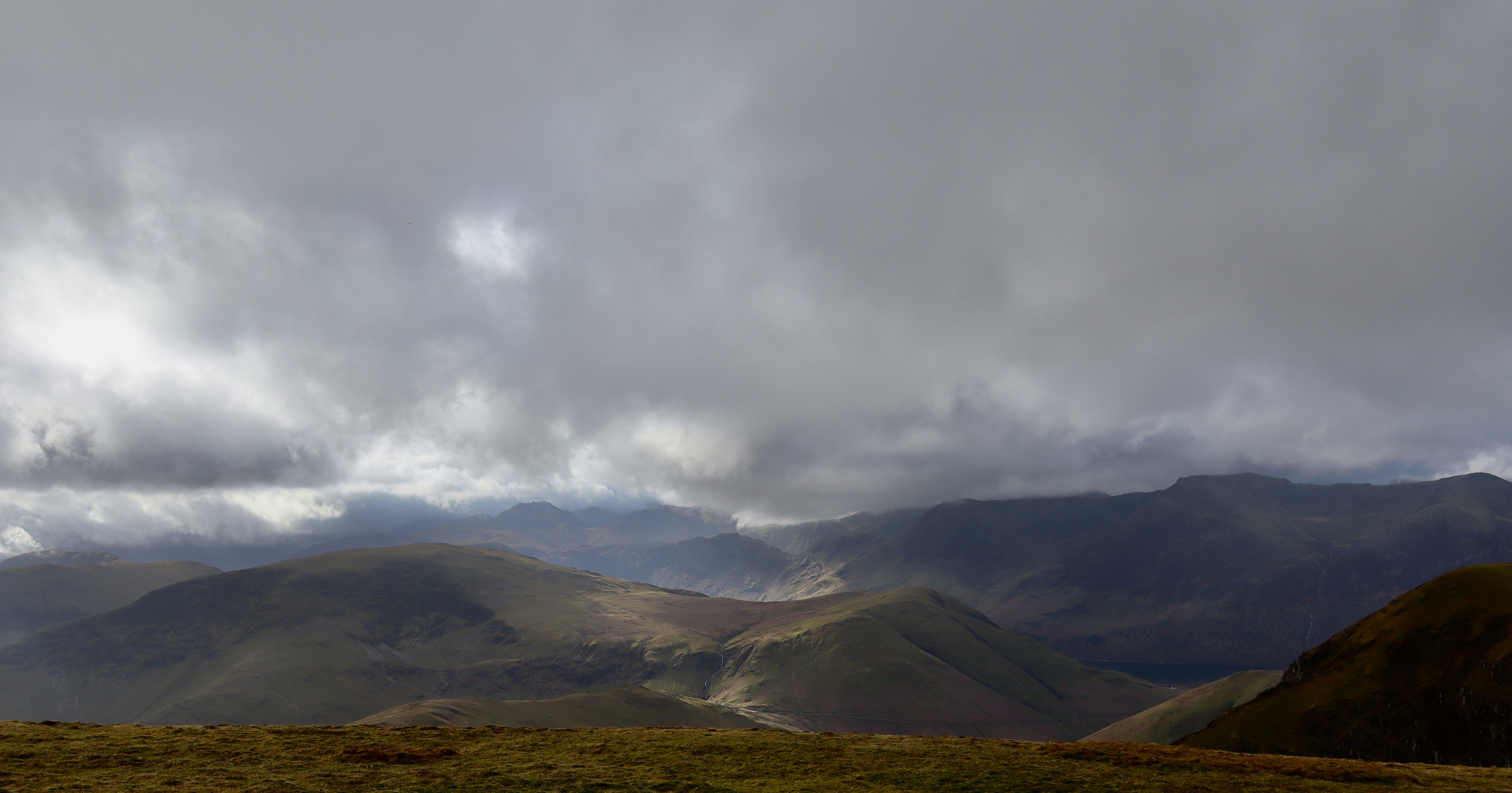

Having explored around the top of the hill (there’s a Trig point and views but that’s about it), I paused to drink a hot chocolate and eat some Kendal Mint Cake and was able to reflect on the differences between this summit and Grisedale Pike. Where Grisedale offered joviality, humour and a sense of playfulness, Crag Hill seemed overly serious, demure, like the adult amongst a group of teenagers. Hot drinks and sugary snacks finished, I continued along my journey, starting the return leg. The next step was to cross over to Sail but before that was the ridge known as The Scar.
Now, sometimes I head out on a walk and halfway round think “this would be a good blog post” and sometimes I know it will when I head out. This walk fell into the latter category and so I was taking notes as I went round. My note for The Scar simply reads… “F***king Scary”. Rewriting this does bring back the feeling and honestly, despite walking higher, more exposed ridges and undertaking harder scrambles (admittedly having done neither for a long time) this ridge had me feeling more uneasy than it should have. I don’t know if it was the photographer I saw look at the ridge and then turnaround to find an alternative route, the reading of recent mountain rescue callouts, or the fact that my responsibilities had just grown, as we found out my wife was pregnant a few days before, but something was stopping me from doing this bit of the leg. However, I had recently heard someone say, “the anticipation is harder than the participation” and this was ringing round my head. I therefore, took the steps of no return, onto the ridge and, pausing only to take a few photos of the deathly drops into the valleys the ridge bisected, made my way comfortably and easily to the top of Sail. Reaching this point marked the end of the main body of the walk.
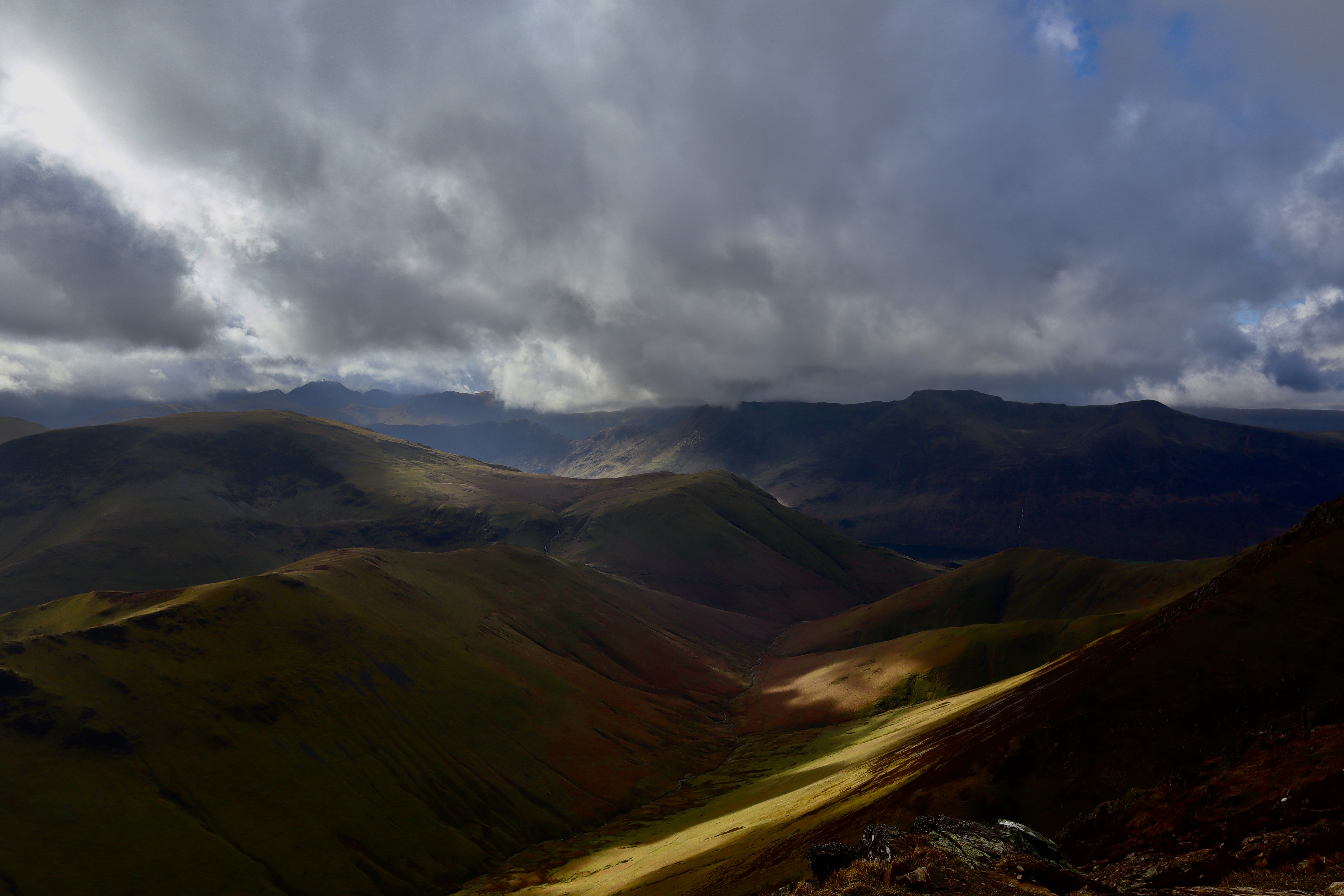

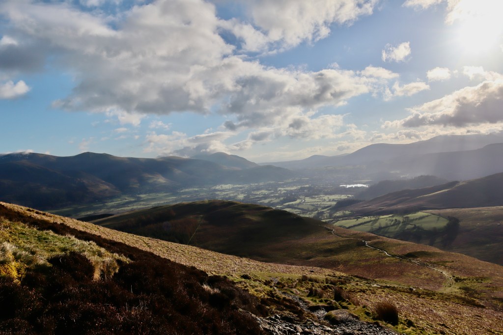
A zigzagging downhill path makes for a kind relief on tiring legs and brings you to a fork. To truly do the Coledale Horseshoe, you need to take the right-hand fork and head over Causey Pike, I however, had got my timings wrong and therefore needed to shave about half an hour off my walk and so I reluctantly took the decision to take the left fork, heading northeasterly down into the Coledale Valley. The regret of missing out on Causey Pike soon dissipates however, as I get my first real views of the Force Crag Mine (which mined lead and zinc for around 130 years before its closure in 1991) and feel the imperious size of the valley I’ve been walking around.
The path I’m on, flows gently downhill, following the course of the Stonycroft Gill along the foot of Outerside Fell. At this point, I decide to go straight over the top of Stile End but it is more than possible to avoid the additional height and take a path round its base, should you rather. The descent down keeps Coledale Beck on your left, and Barrow Gill on the right, and gives the last glimpses of the views that have accompanied the walk, offering one last look at the ever imposing Skiddaw. As you lose height along this path, the village of Braithwaite comes into view. Taking the gate off the fellside and onto the road, marks the start of the end and brings you back to the road. From here, I make my way back to the Air BnB, and start a stretching and rehydration routine that I hope will see me through to the train journey (it does and was well worth it).
| Difficulty | Distance | Navigation Required? |
| Medium – good hill fitness required with (if you want) some small scrambles and a ridge walk | 15km | Yes. Mostly follows path but good to have a map and compass to hand |
| Grid Reference | Safety | Footwear |
| NY 227 237 | Steep climbs, loose boulders and scree in places | B0/1 should be fine. |

Leave a comment